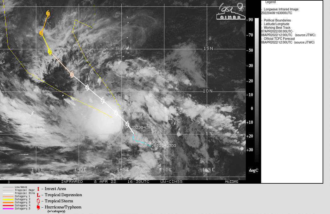
Tropical Cyclone Malakas in the western Pacific
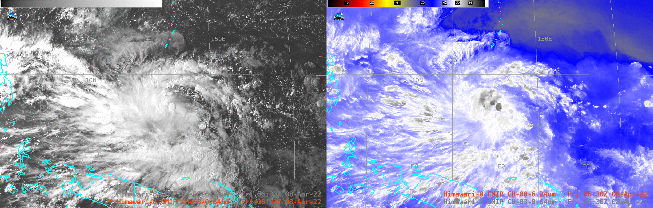
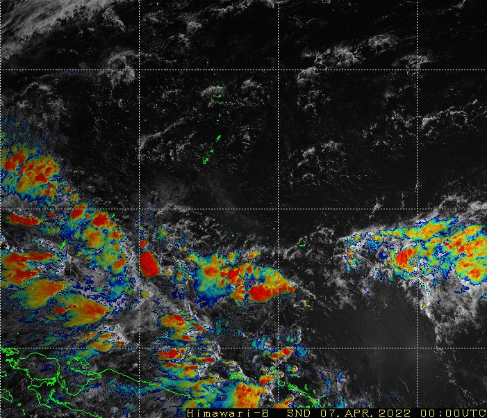
The tropical disturbance (formerly 95W) in the western Pacific south of Guam (discussed here) has strengthened and become the second western Pacific named storm of the year: Malakas. The storm is about halfway between the islands of Guam and New Guinea. The side-by-side imagery above, showing Himawari Band 3 and Band 8 imagery (courtesy JMA), shows deep convection near the center of the storm that was at fairly low latitudes: around 6o N at 0600 UTC on 8 April, the times of the imagery above. In addition, the storm is far from dry air. A 24-hour animation of the Band 3 (0.64 µm)/Band 13 (10.41 µm) sandwich product on 7 April 2022 below, taken from this site (see this blog post), shows the rotation of the system and the abundance of convection at the center.
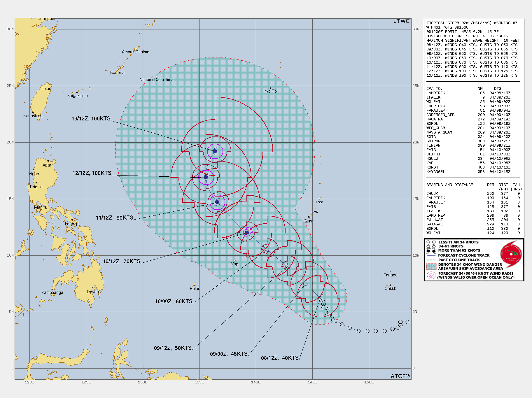
The forecast at 1200 UTC on 8 April from the Joint Typhoon Warning Center take this strengthening storm northwest, between Guam and Yap.
Imagery from the SSEC/CIMSS Tropical Weather website, below, shows the storm in a region of low shear. An excellent ASCAT overpass at 1126 UTC on 8 April 2022 showed a closed-off center.