Hurricane Ian makes landfall in South Carolina
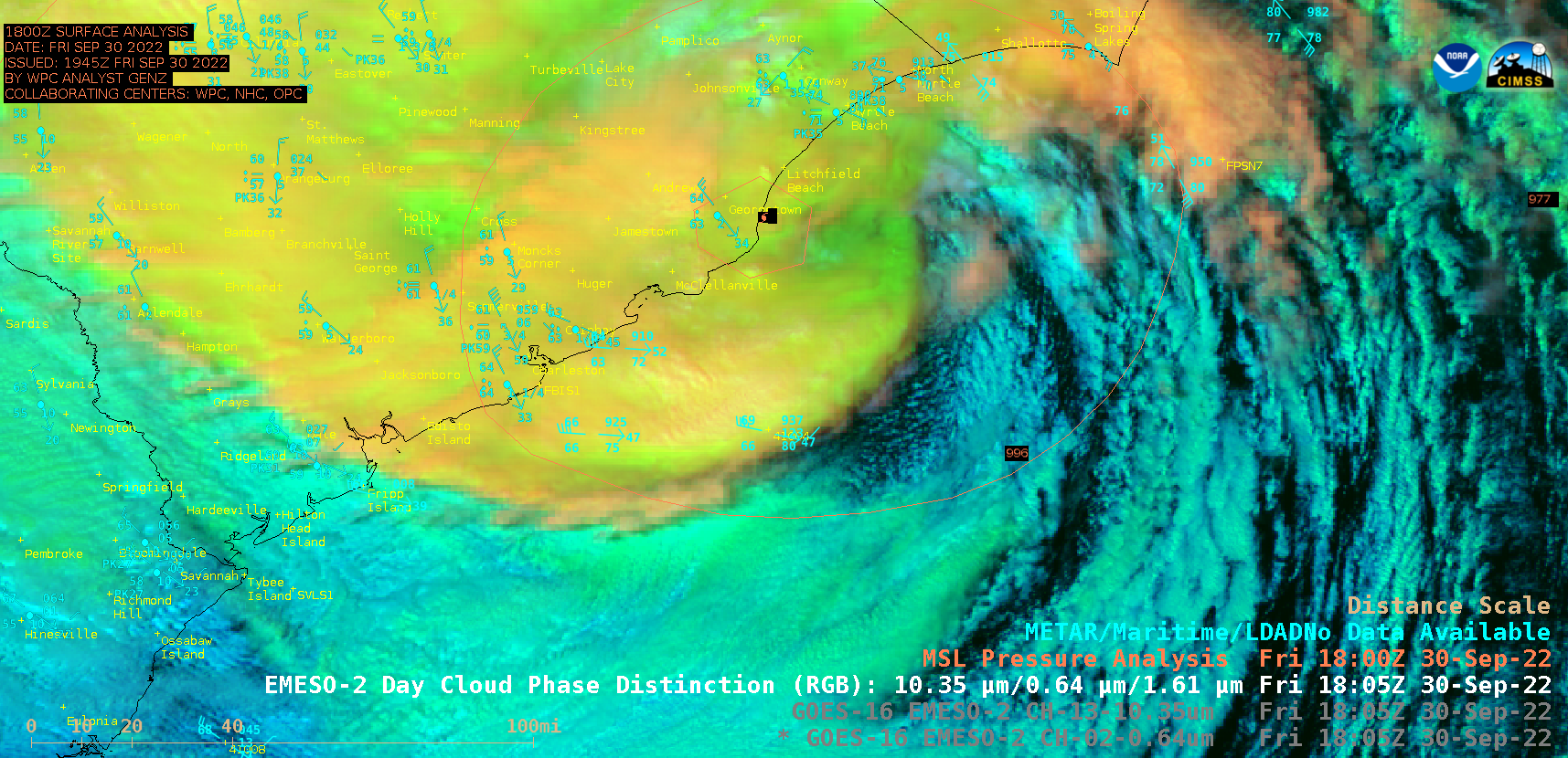
1-minute Mesoscale Domain Sector GOES-16 (GOES-East) “Red” Visible (0.64 µm) images (above) showed Hurricane Ian as it made landfall as a Category 1 storm near Georgetown, South Carolina at 1805 UTC on 30 September 2022 — producing wind gusts as high as 92 mph and rainfall totals exceeding 5 inches. The low-level circulation center was mostly obscured by... Read More

