Tropical Storm Karl in the Gulf of Mexico

GOES-16 “Clean” Infrared Window (10.3 µm) images [click to play animated GIF | MP4]
The center of Karl passed very close to Buoy 42055 around 12 UTC — as shown in a plot of wind speed and air pressure (below).

Plot of Buoy 42055 Wind Speed (blue), Wind Gust (red) and Air Pressure (green)

GOES-16 “Red” Visible (0.64 µm) iages [click to play animated GIF | MP4]
GOES-16 Infrared Window (11.2 µm) images (below) include contours of deep-layer wind shear valid at 2200 UTC from the CIMSS Tropical Cyclones site — which displayed the shear that was affecting Karl and helping to partially expose its low-level circulation.
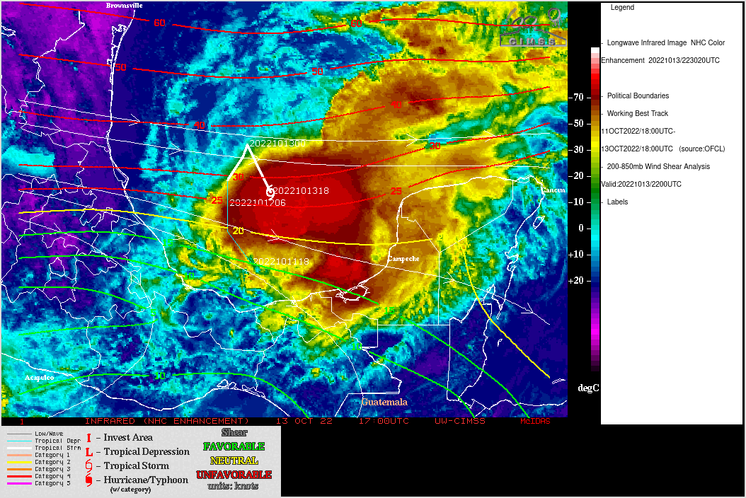
GOES-16 Infrared Window (11.2 µm) images, with contours of deep-layer wind shear valid at 2200 UTC [click to enlarge]