More results from a numerical model input with Polar Hyperspectral Soundings fused with ABI data (Convective Weather edition)
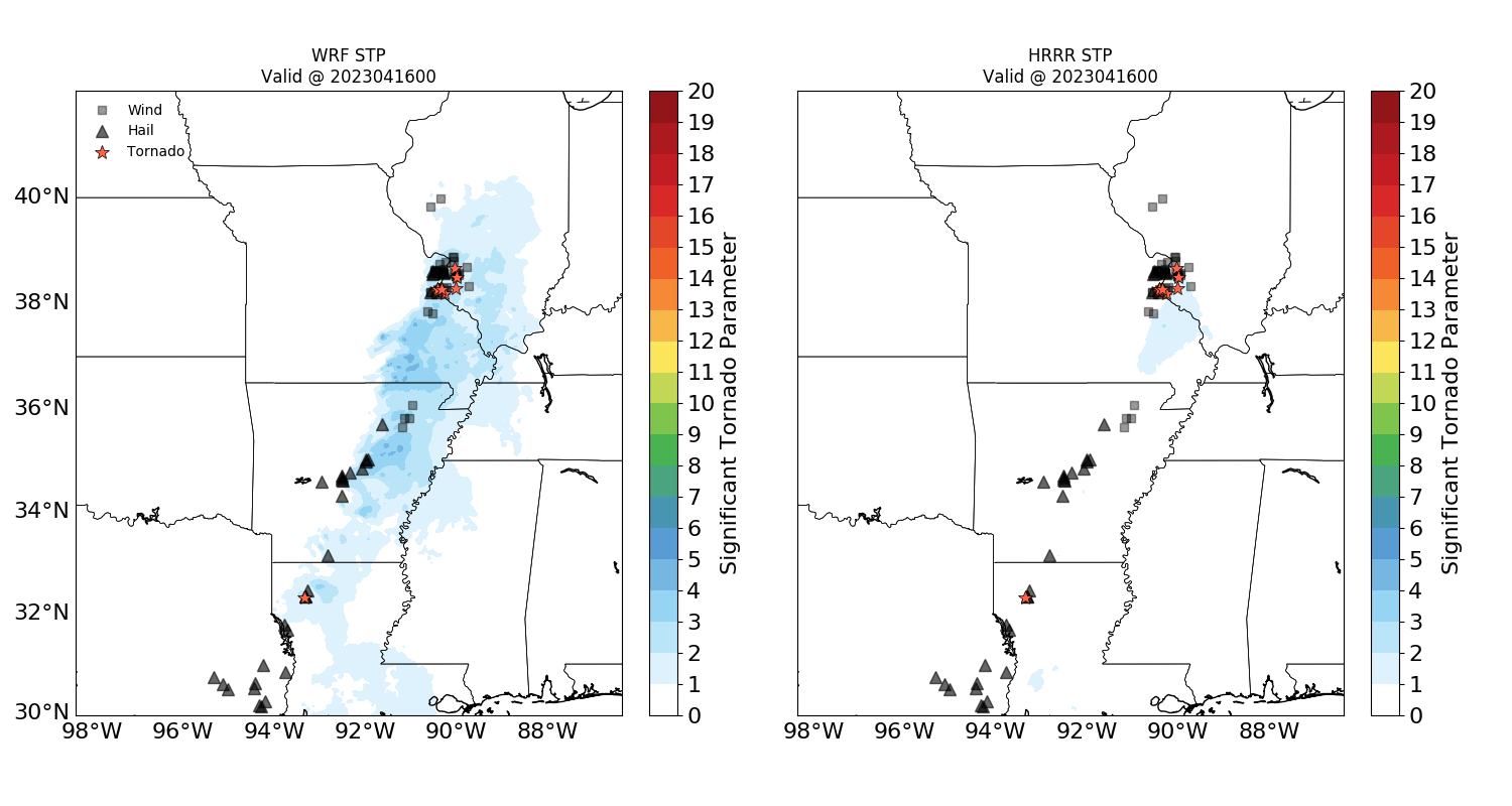
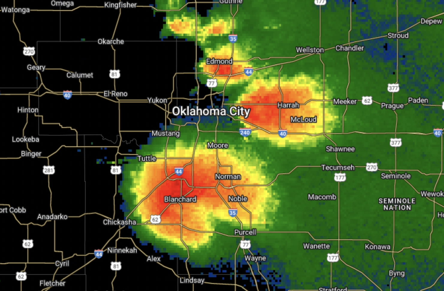
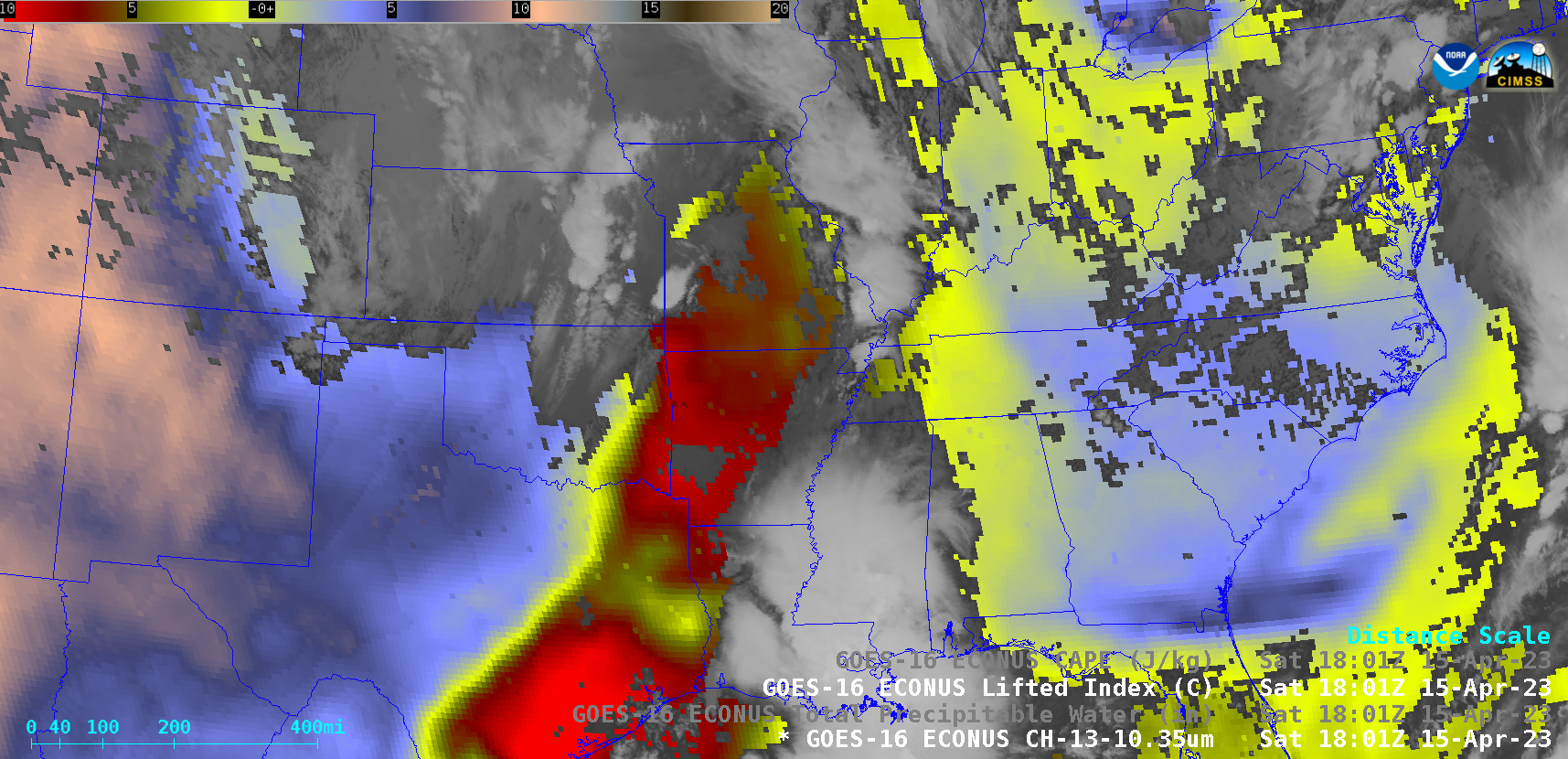
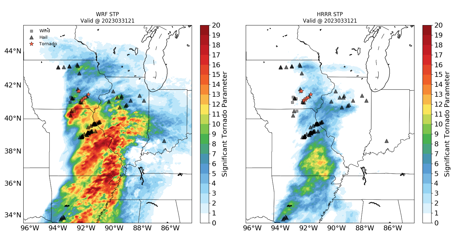
Severe weather on 15 April and 19 April affords another opportunity to compare Significant Tornado Parameter predictions from a 4-km WRF simulation that includes information from Polar Hyperspectral Soundings and a 3-km HRRR simulation that does not. Consider the example, above, at 2200 and 2300 UTC on 15 April and 0000 and... Read More
