Recent results from a numerical model input with Polar Hyperspectral Soundings fused with ABI data (Convective Weather edition)
The recent bouts of severe weather (See this blog post about the 31 March outbreak, or this one about the 4 April outbreak) over the central United States mean an opportunity to compare Numerical Model output from models that are initialized with temperature/moisture profiles derived from Polar Hyperspectral Soundings (using both infrared and microwave data from CrIS/ATMS or IASI/AMSU/MHS) to models that have not assimilated such data. Does the addition of the observations of temperature and moisture profiles observed by NOAA-20/NOAA-21 or MetopB/MetopC lead to a better prediction of convective weather? As happened in 2022, this Polar Hyperspectral Modeling System (PHSnMWnABI, or just PHS for short) will be demonstrated at SPC’s Hazardous Weather Testbed. The blog post will show a few examples of differences between PHS-enhanced modeling output, and a separate modeling system not so enhanced.
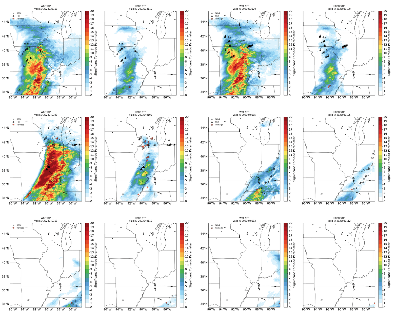
Significant Tornado Parameter (STP) can be computed from HRRR model output and from PHS/WRF model output, and that field, overlain with severe weather reports, is shown below at hourly intervals for the 31 March – 1 April severe weather event. There is good correpondence between the severe weather reports and the STP fields, moreso especially with PHS-enhanced WRF model over Iowa and Illinois at 2100, 2200, 2300, 0000 and 0100 UTC. (These fields show average values of 9 separate forecasts valid at the time shown, that is, the average of a 1-h forecast, a 2-h forecast, a 3-h forecast…, and a 9-h forecast valid at the time shown).

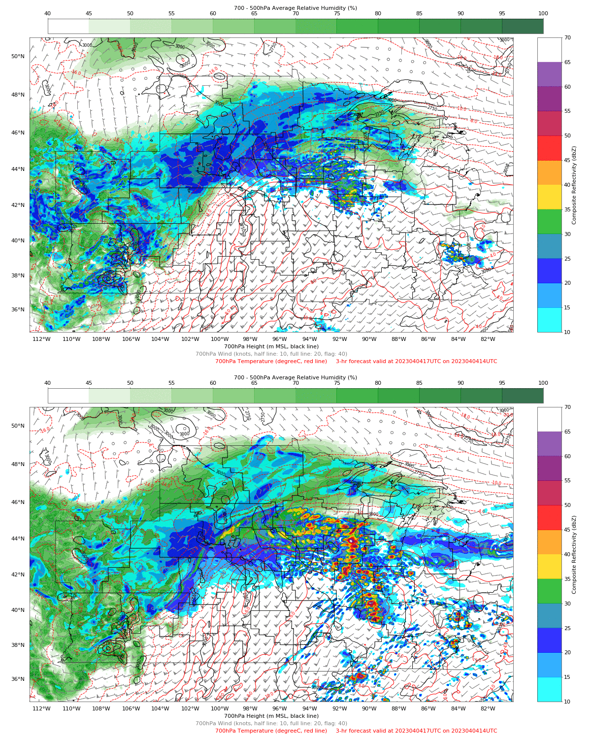
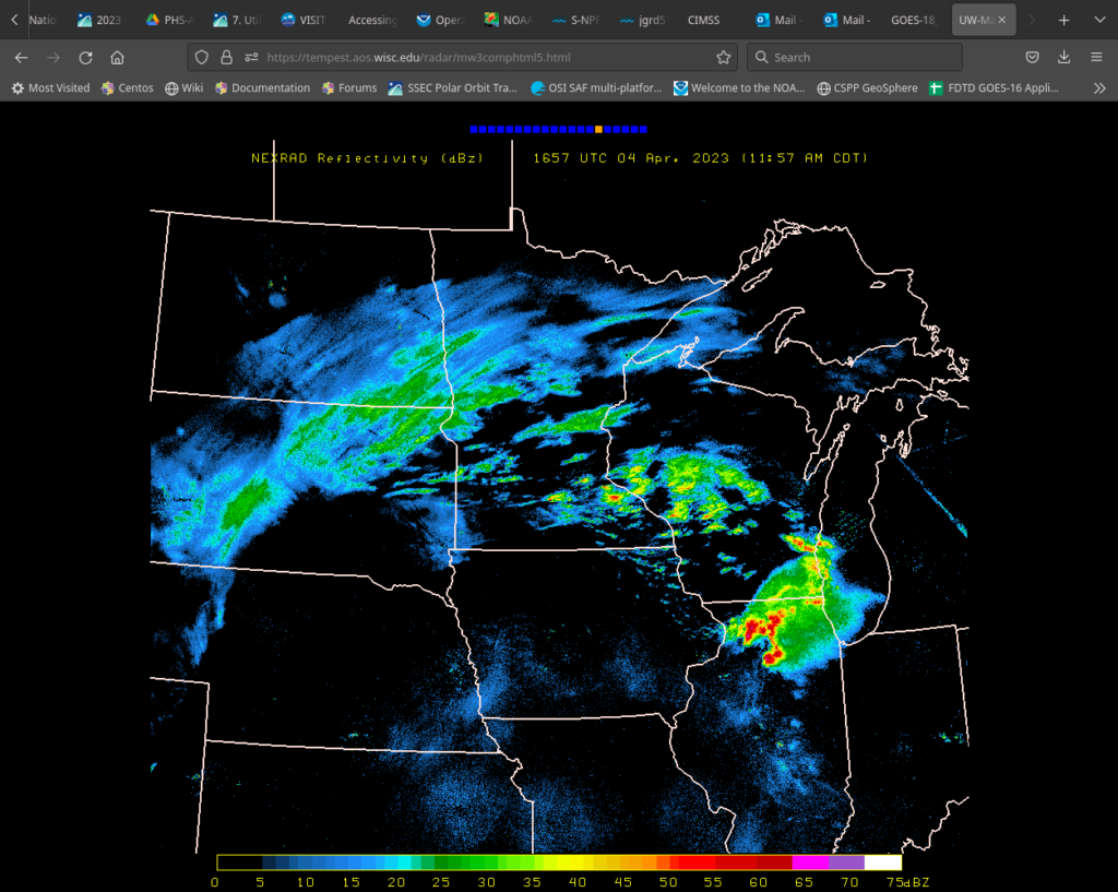
Consider the toggle below that compares HRRR model output (without PHS input) and WRF model output (with PHS input). There is a pronounced difference in the predicted radar reflectivity in this 3-h forecast to the west of Chicago (NWS WFO outlines are shown on that map). The 1700 UTC radar, below (source), shows better agreement with the PHS model, although an argument could be made that the PHS model is overpredicting the precipitation on this day.


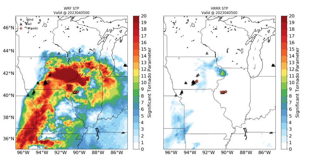
A comparison of the average STP from different forecasts enhanced by PHS observations and forecasts that do not assimilate PHS data is shown below for the same event, but at 0000 UTC on 5 April 2023. (Here’s the same figure for 1500 UTC on the 4th, and 0900 UTC on the 5th). In general, STP values are greater in the WRF run that starts with assimilated moisture and temperature observations from Hyperspectral Soundings.

More results from this modeling system will be shown in the coming weeks. Imagery in this blog post is courtesy Qi Zhang, CIMSS. Model output from this system is available online here.

