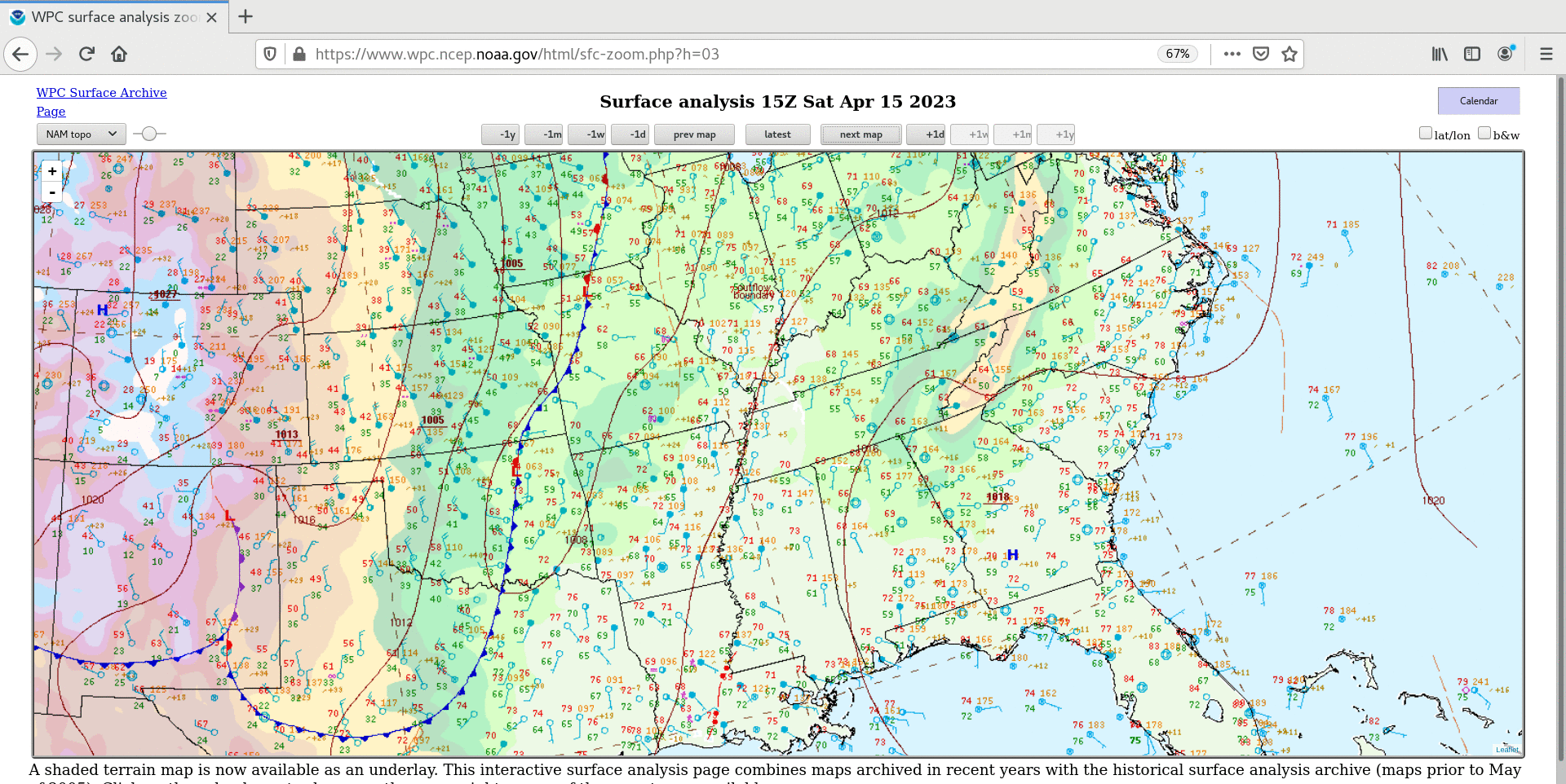
Severe thunderstorms across the Mid-South and Midwest

GOES-16 Total Precipitable Water, Lifted Index and Convective Available Potential Energy derived products [click to play animated GIF | MP4]

GOES-16 “Red” Visible (0.64 µm) images, with time-matched SPC Storm Reports plotted in red [click to play animated GIF | MP4]
The corresponding 1-minute GOES-16 “Clean” Infrared Window (10.3 µm) images with plots of time-matched SPC Storm Reports (below) indicated that some of the thunderstorm overshooting tops exhibited infrared brightness temperatures in the -65 to -70ºC range (darker red to black enhancement).
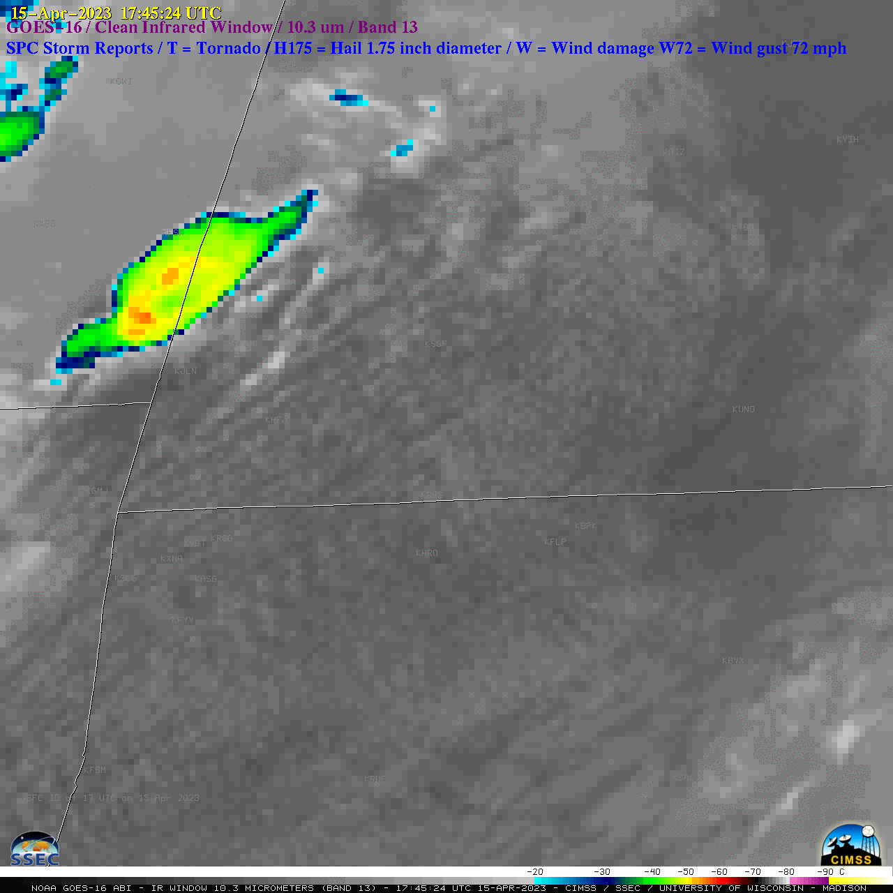
GOES-16 “Clean” Infrared Window (10.3 µm) images, with time-matched SPC Storm Reports plotted in blue [click to play animated GIF | MP4]

GOES-16 “Red” Visible (0.64 µm) images, with time-matched SPC Storm Reports plotted in red [click to play animated GIF | MP4]
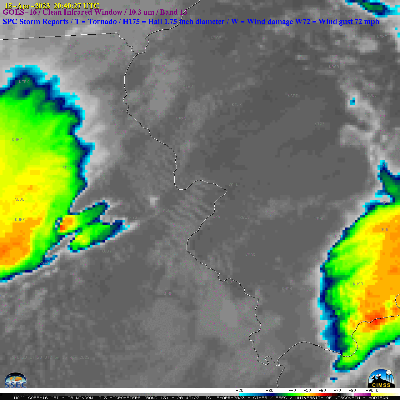
GOES-16 “Clean” Infrared Window (10.3 µm) images, with time-matched SPC Storm Reports plotted in blue [click to play animated GIF | MP4]