More results from a numerical model input with Polar Hyperspectral Soundings fused with ABI data (Convective Weather edition)
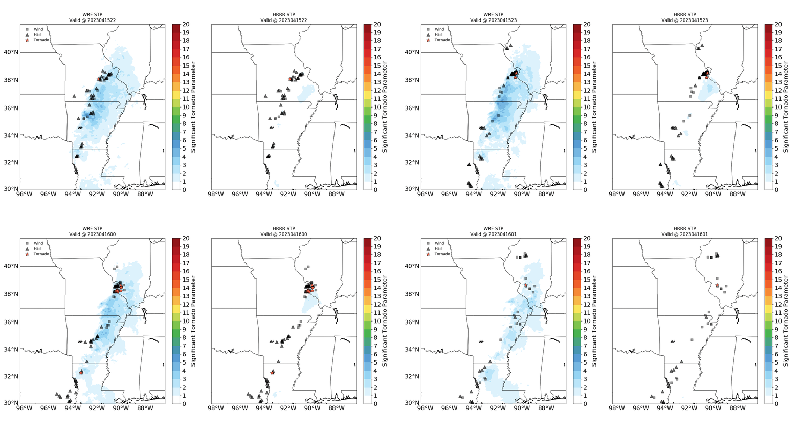
Severe weather on 15 April and 19 April affords another opportunity to compare Significant Tornado Parameter predictions from a 4-km WRF simulation that includes information from Polar Hyperspectral Soundings and a 3-km HRRR simulation that does not. Consider the example, above, at 2200 and 2300 UTC on 15 April and 0000 and 0100 UTC on 16 April. Each model shows the averages of 9 different forecasts valid at the given time. The HRRR output shows a maximum in STP over southeastern Missouri. The WRF output (driven by an initial field that includes information from Polar Hyperspectral Soundings) has a maximum in STP farther to the west where severe weather was occurring.
The example below is from the severe weather event on 19 April, again showing STP from the PHS-enhanced WRF simluation on the left and from the HRRR on the right. As on 15 April, the alignment of the severe weather events more closely matches the model predictions of STP when the model has PHS data are part of its input cycle.
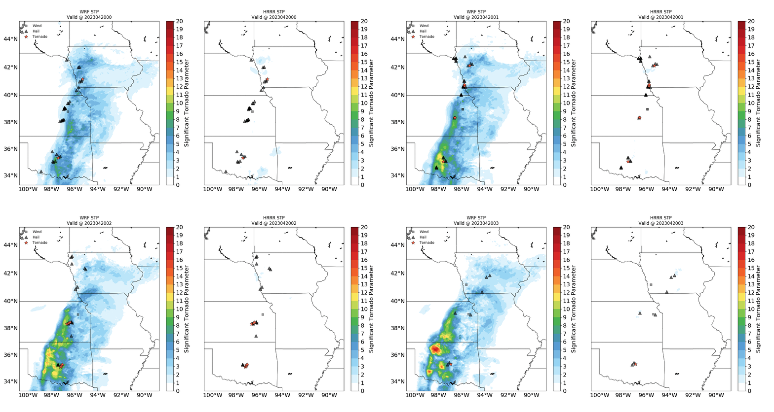
Imagery for this blog post is courtesy Qi Zhang, CIMSS; PHS model runs are available here in real time. This model output will be evaluated at the Hazardous Weather Testbed in May and June.
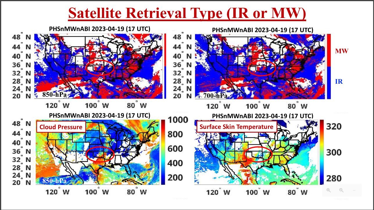
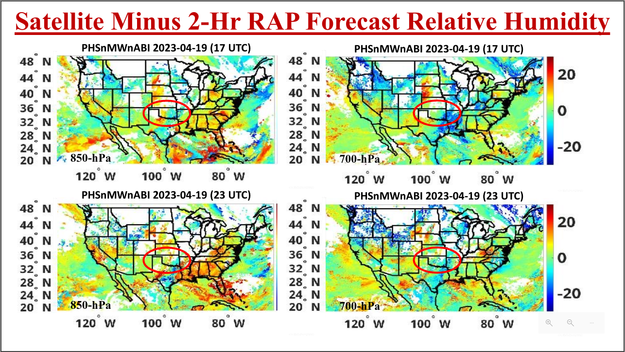
The animation above (created at the CSPP Geosphere site) shows abundant — but thin — clouds over the southern USA between 1700 and 1900 UTC on 19 April 2023, i.e., before the PHS imagery shown above from 0000 to 0300 UTC on 20 April. The satellite retrievals at 1700 UTC on the 19th, shown below, included both infrared and microwave components over Oklahoma, as shown below (image courtesy Bill Smith Sr). That infrared retrievals could occur is testimony to the broken cloud field. How do the satellite retrievals alter the relative humidities? That is also shown below for 1700 and 2300 UTC (top and bottom) for 850 and 700 mb (left and right). Satellite data has altered the RH such that deeper moisture is farther to the west.
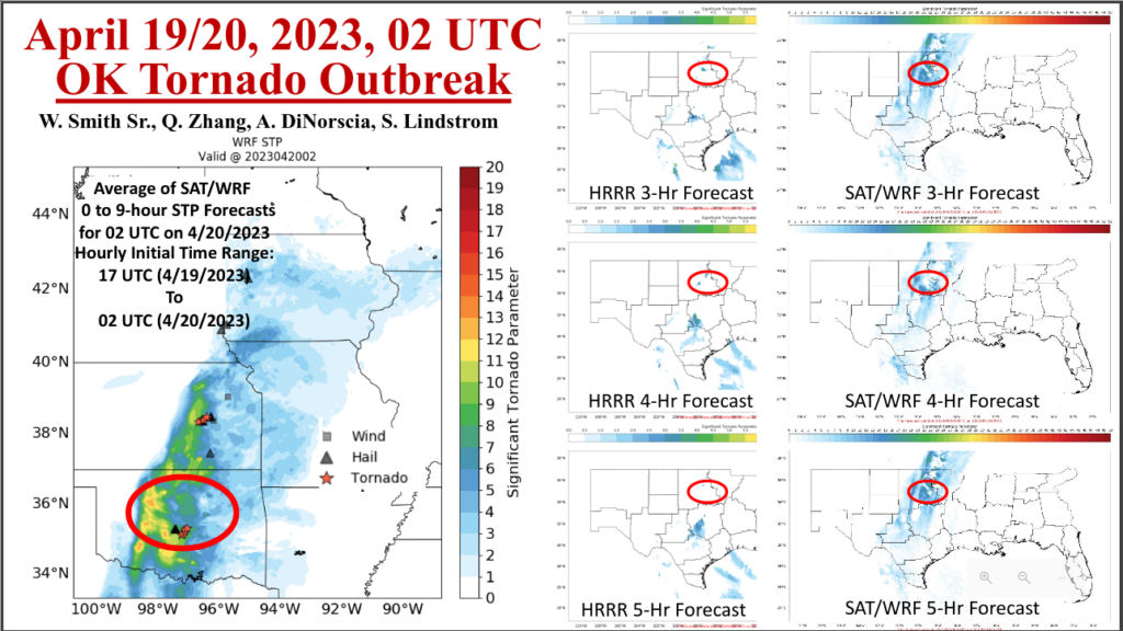
The image below, created by Bill Smith Sr, shows how the changed low-level moisture field from the Polar Hyperspectral data in this case leads to a more accurate simulation (the SAT/WRF model on the right, compared to the HRR model) of where severe weather occurs.
