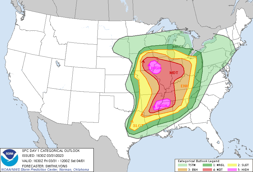
Widespread outbreak of severe thunderstorms across the Midwest and South

GOES-16 Total Precipitable Water, Lifted Index and Convective Available Potential Energy (CAPE) derived products [click to play animated GIF | MP4]
1-minute Mesoscale Domain Sector GOES-16 “Clean” Infrared Window (10.3 µm) images (below) included plots of time-matched (+/- 3 minutes) SPC Storm Reports during the period from 1615 UTC on 31 March to 1137 UTC on 01 April.

GOES-16 “Clean” Infrared Window (10.3 µm) images, with time-matched SPC Storm Reports plotted in cyan [click to play animated GIF | MP4]
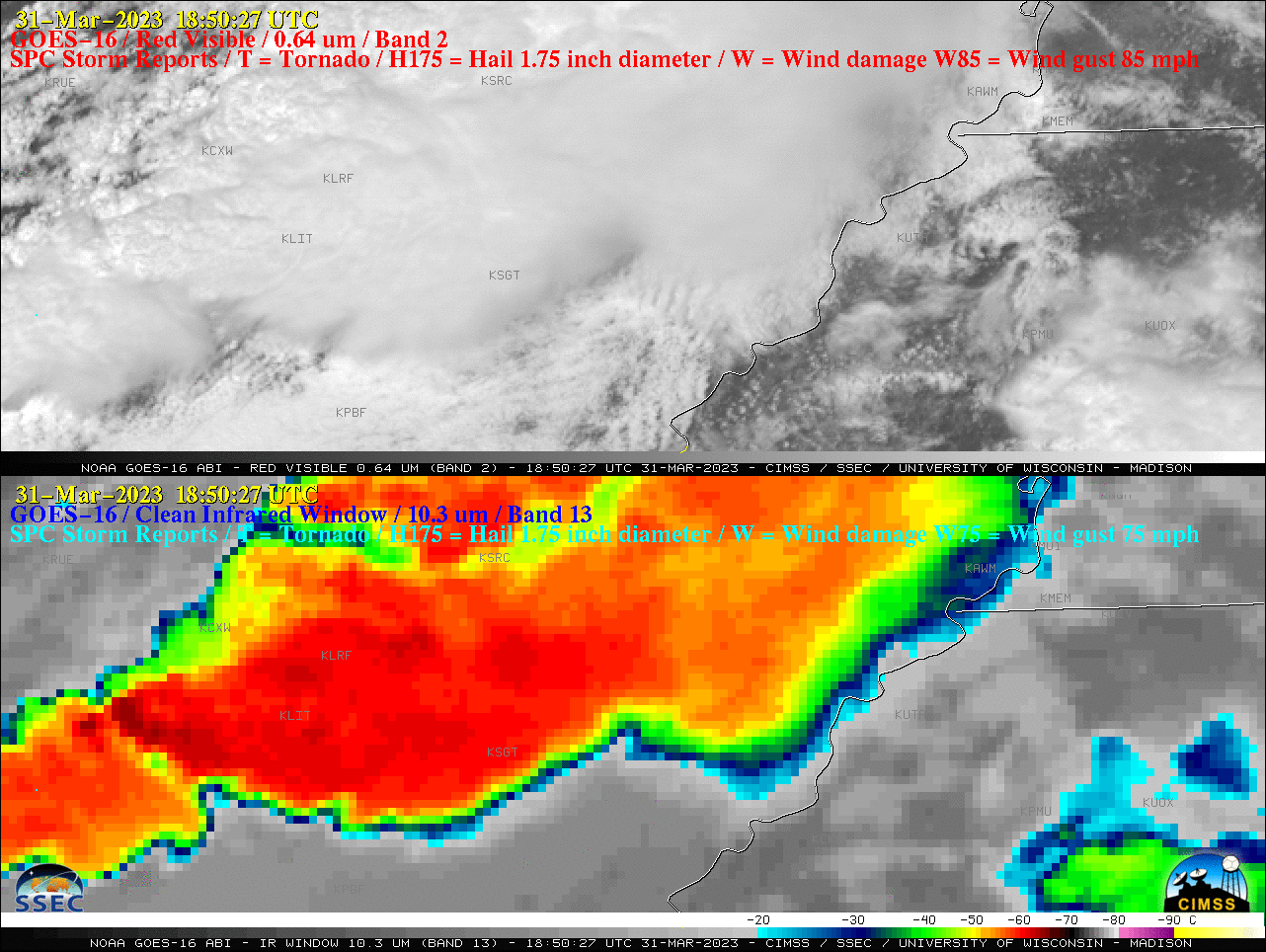
GOES-16 “Red” Visible (0.64 µm, top) and “Clean” Infrared Window (10.3 µm, bottom) images, with time-matched SPC Storm Reports plotted in red/cyan [click to play animated GIF | MP4]
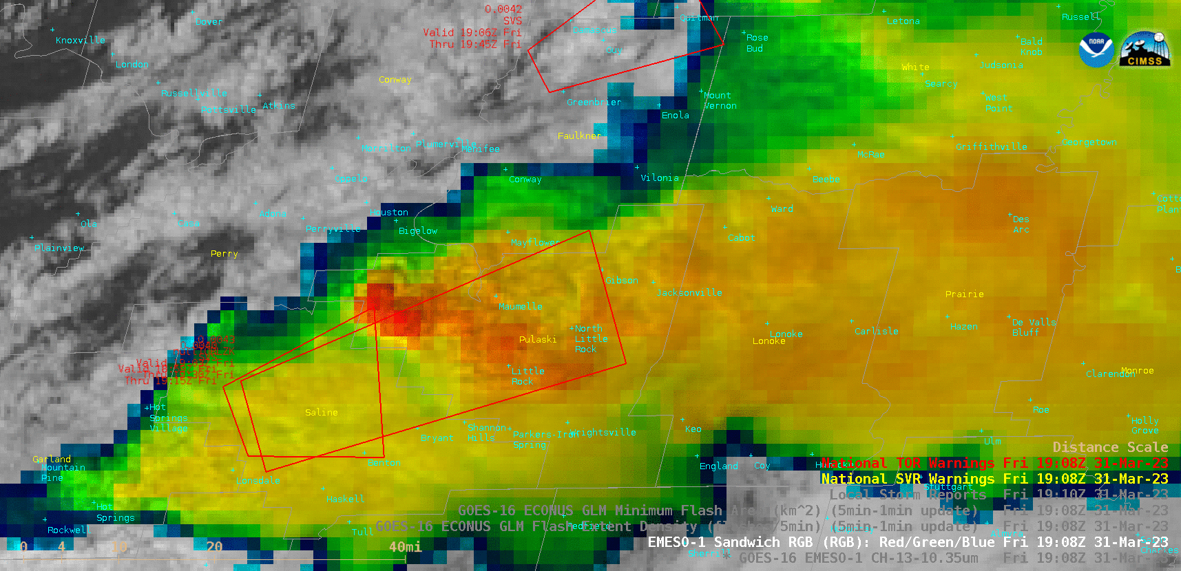
GOES-16 Visible/Infrared Sandwich RGB images, with polygons of Severe Thunderstorm and Tornado Warnings plotted in yellow/red [click to play animated GIF | MP4]

GOES-16 “Red” Visible (0.64 µm, top) images, with time-matched SPC Storm Reports plotted in red [click to play animated GIF | MP4]

GOES-16 Visible/Infrared Sandwich RGB images, with time-matched Local Storm Reports plotted in red [click to play animated GIF | MP4]