This website works best with a newer web browser such as Chrome, Firefox, Safari or Microsoft Edge. Internet Explorer is not supported by this website.

Category: Severe convection

Severe thunderstorms across the Deep South
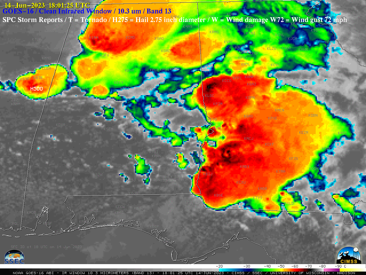
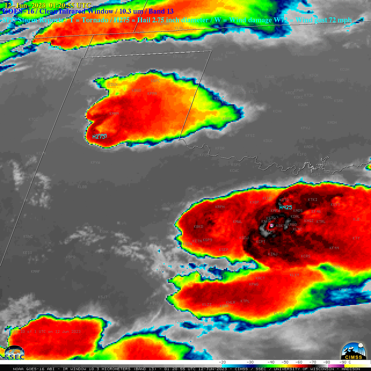
 and Ohio Valley

1-minute GOES-16 (GOES-East) Mesoscale Domain Sector “Red” Visible (0.64 µm) images (above) included time-matched (+/- 3 minutes) plots of SPC Storm Reports — which showed severe thunderstorms that moved east-northeastward across parts of the Deep South and Ohio Valley on 12 January 2023.1-minute GOES-16 “Clean” Infrared Window (10.3 µm) images (below) indicated that the coldest pulsing overshooting tops associated... Read More

Thundersnow in the Upper Midwest, and 30-second imagery of severe thunderstorms across the Deep South

GOES-16 (GOES-East) Mid-level Water Vapor (6.9 µm) images with an overlay of GLM Flash Extent Density (above) covered part of a widespread winter storm event — which included thundersnow in parts of Nebraska, Iowa, South Dakota and Minnesota — that occurred on 03 January 2023. Areas that reported thundersnow experienced convectively-enhanced snowfall rates... Read More

There GOES a Review of 2022

It’s very hard to choose just one event from every month of the year, but the goal is to show the range of phenomena and locations that NOAA‘s GOES ABI routinely monitors, in this case during 2022. Most loops generated are from the University of Wisconsin-Madison CIMSS Satellite Blog, which... Read More

Severe thunderstorms across the south-central US

1-minute GOES-16 (GOES-East) Mesoscale Domain Sector “Red” Visible (0.64 µm) images (above) included time-matched (+/- 4 minutes) plots of SPC Storm Reports — which showed thunderstorms that moved northeastward across parts of Texas, Oklahoma, Arkansas and Louisiana during the hours leading up to sunset on 04 November 2022.The corresponding 1-minute GOES-16 “Clean” Infrared Window (10.35 µm) images ... Read More