30-second images of severe thunderstorms along the Gulf Coast of Florida
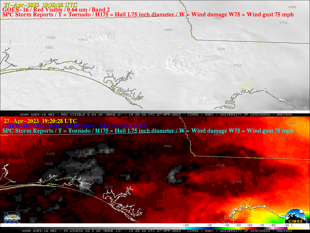
GOES-16 “Red” Visible (0.64 µm, top) and “Clean” Infrared Window (10.3 µm, bottom) images, with time-matched SPC Storm Reports plotted in red/cyan [click to play animated GIF | MP4]
The coldest overshooting tops were associated with experimental CLAVR-x Cloud Top Height of 16.64 km (54593 ft), vs. 47866 ft (14.59 km) with the Operational CONUS sector Cloud Top Height product (below). The CLAVR-x derived GOES cloud products produced at CIMSS are at full 2 km spatial resolution — in contrast to some of the Operational cloud products, including Cloud Top Height, which are still disseminated at reduced resolutions of 10 km over the CONUS sector (although the Cloud Top Height spatial resolution is 4 km for the Mesoscale Domain Sector).
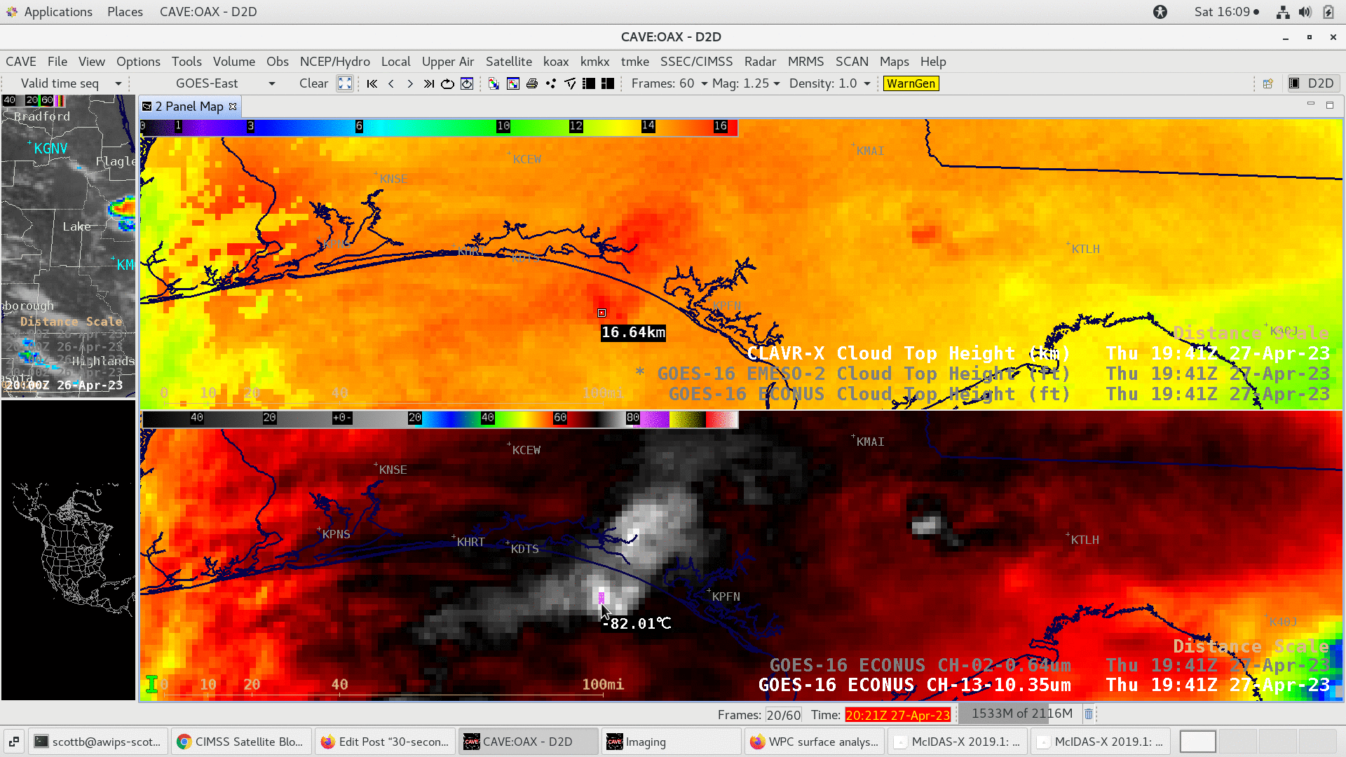
GOES-16 CLAVR-x vs Operational CONUS sector Cloud Top Height (top) and “Clean” Infrared Window (10.3 µm, bottom) images at 1941 UTC [click to enlarge]