Severe thunderstorms produce an EF3 tornado in Virginia Beach
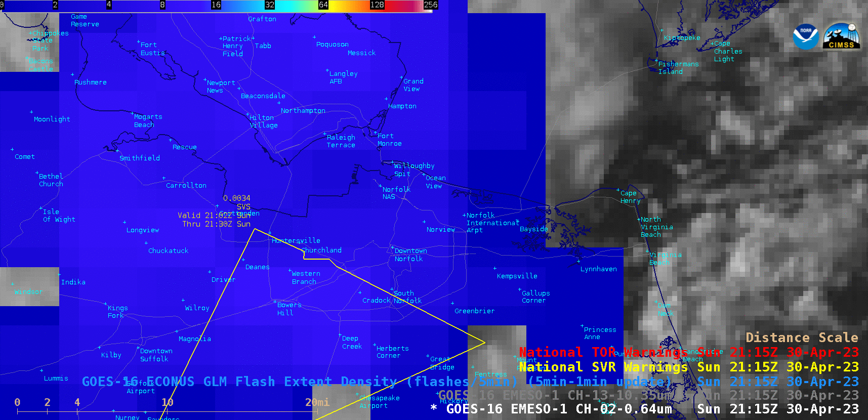
GOES-16 “Red” Visible (0.64 µm) images (with/without an overlay of GLM Flash Extent Density) and “Clean” Infrared Window (10.3 µm) images [click to play animated GIF | MP4]
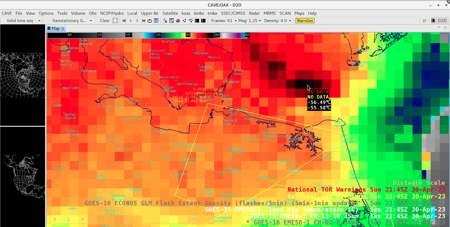
A plot of rawinsonde data (source) from Wallops, Virginia at 0000 UTC on 01 May (below) indicated that the -56.49ºC Cloud Top Temperature value roughly corresponded to a Most Unstable air parcel Equilibrium Level (MU EL) overshoot of about 1 km.
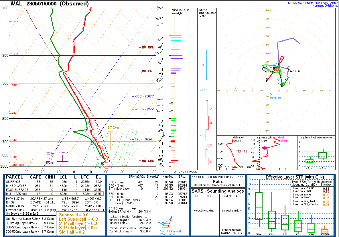
Plot of rawinsonde data from Wallops, Virginia at 0000 UTC on 01 May 2023 [click to enlarge]
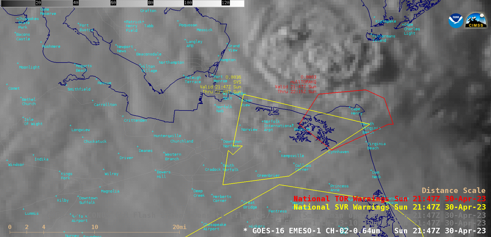
GOES-16 “Red” Visible (0.64 µm), “Clean” Infrared Window (10.3 µm) and GLM Flash Extent Density images at 2147 UTC [click to enlarge]
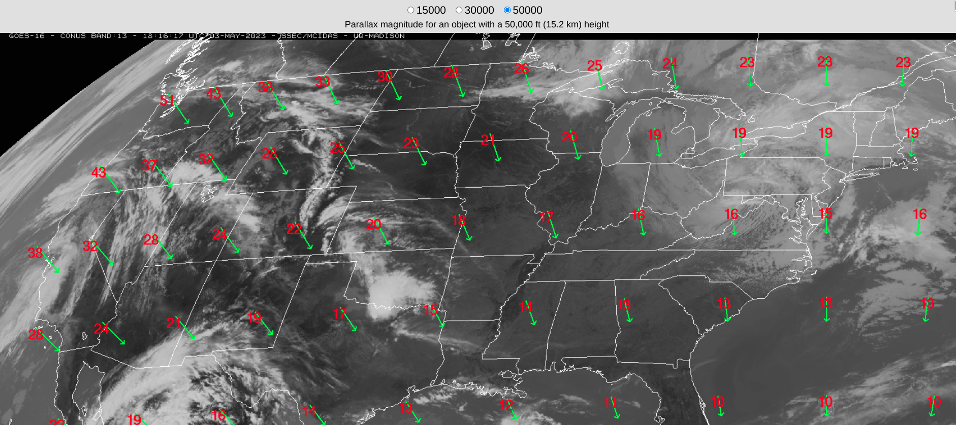
Parallax offset direction (green) and magnitude (red, in km) for a cloud top of 50,000 feet or 15.2 km [click to enlarge]