Severe thunderstorms across North Texas
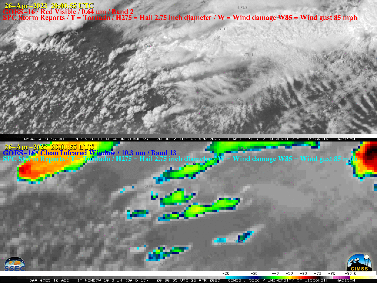
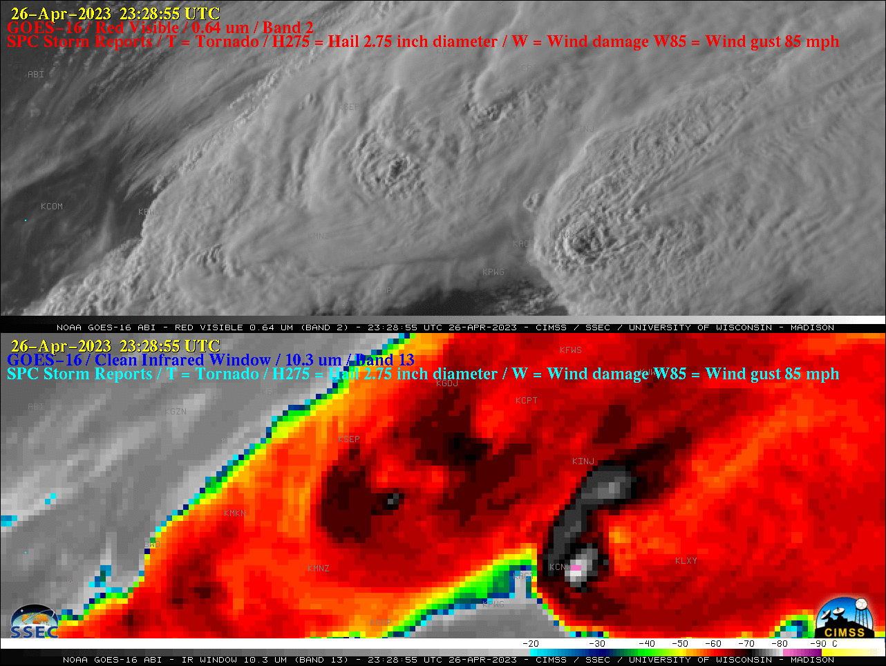
GOES-16 “Red” Visible (0.64 µm, top) and “Clean” Infrared Window (10.3 µm, bottom) images, with time-matched SPC Storm Reports plotted in red/cyan [click to play animated GIF | MP4]
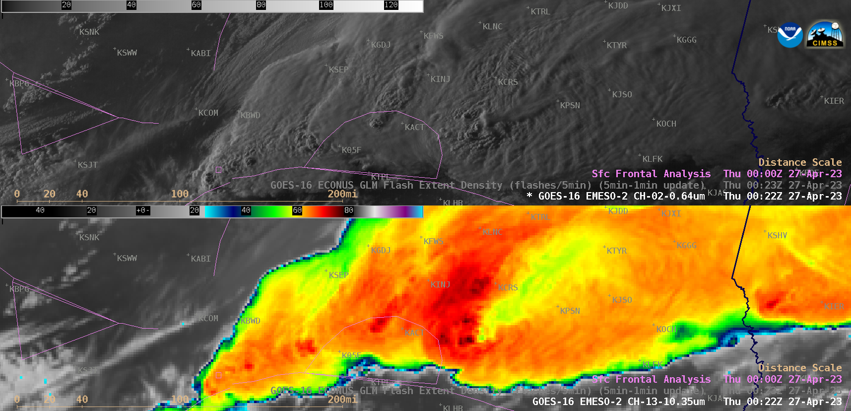
1-minute GOES-16 Visible and Infrared images with/without an overlay of GLM Flash Extent Density (below) revealed that the easternmost supercell thunderstorm tended to exhibit a bit more lightning activity. These severe thunderstorms developed just to the north of a quasi-stationary frontal boundary that was draped across North Texas.

GOES-16 “Red” Visible (0.64 µm, top) and “Clean” Infrared Window (10.3 µm, bottom) images, with/without an overlay of GLM Flash Extent Density [click to play animated GIF | MP4]
GOES-16 “Red” Visible (0.64 µm, top) and “Clean” Infrared Window (10.3 µm, bottom) images at 0022 UTC [click to enlarge]
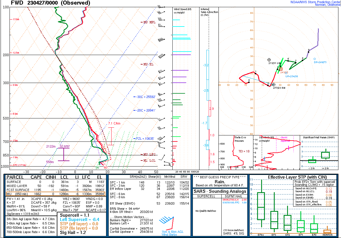
Plot of rawinsonde data from Fort Worth, Texas at 0000 UTC on 27 April [click to enlarge]