Ice Motion in Lake Superior
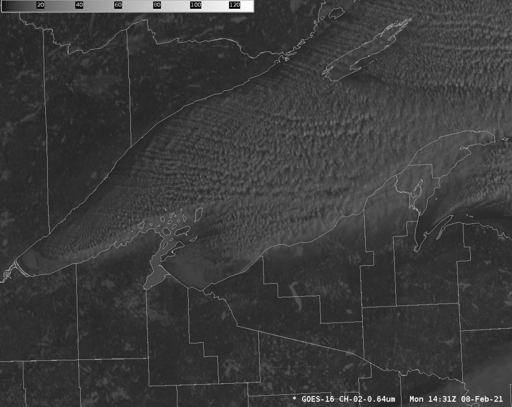
GOES-16 Visible (0.64 µm) Imagery over western Lake Superior, 1431 – 1836 UTC, 8 February 2021 (Click to enlarge)
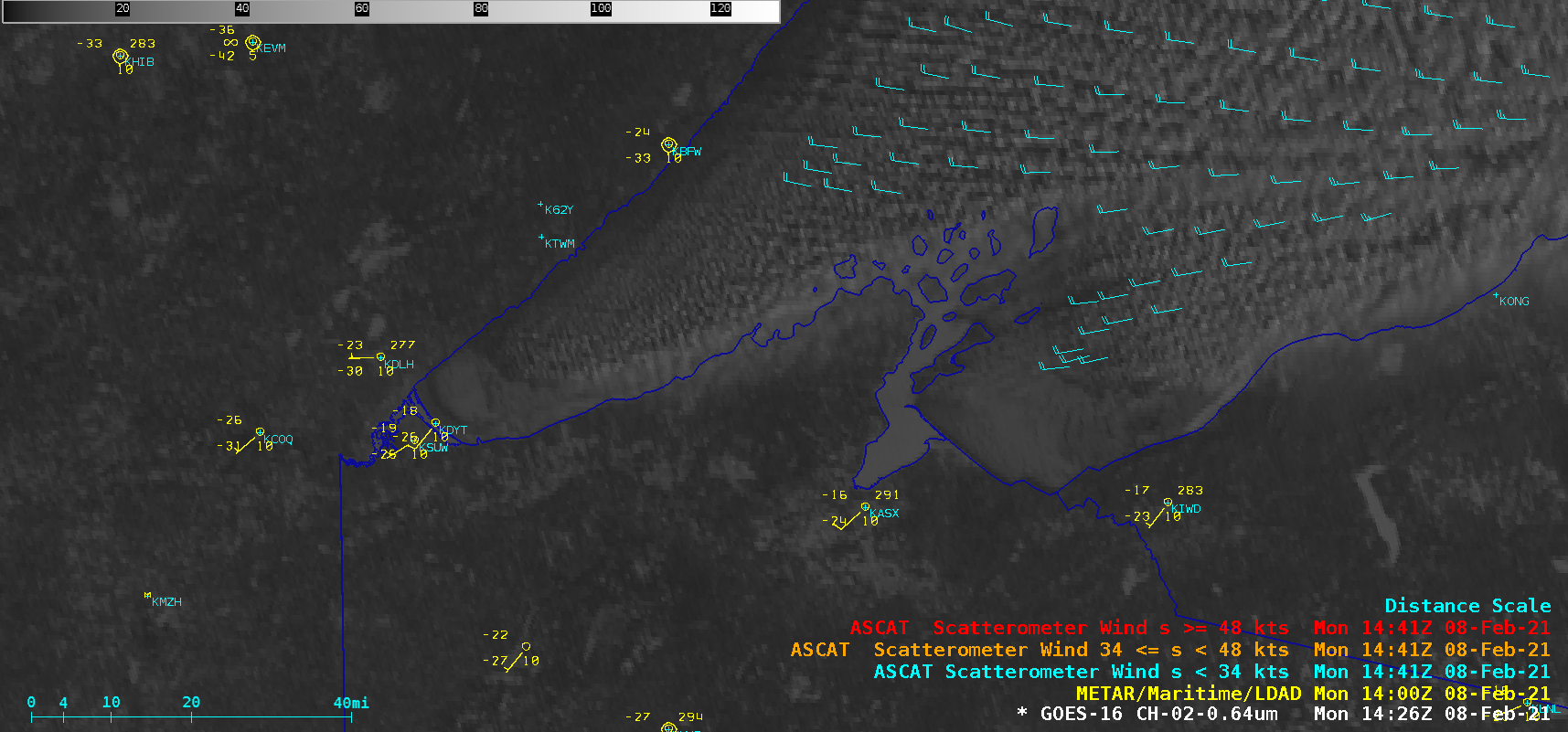
GOES-16 visible animations from the morning of 8 February show ice motion along the south shore of Lake Superior, moving northeastward away from Duluth Harbor, and also east and northeastward to the south of Madeline Island. Winds at this time were from the west or southwest at 15-20 knots as shown below by GOES-16 Derived Motion Wind vectors, and by onshore observations.

GOES-16 Visible (0.64 µm) Imagery with and without surface observations and derived motion wind vectors, 1501 UTC on 8 February 2021 (Click to enlarge)
An overpass of Metop-A at 1429 UTC provided ASCAT surface scatterometer winds (below) — which were as strong as 22 knots near Wisconsin’s Apostle Islands.
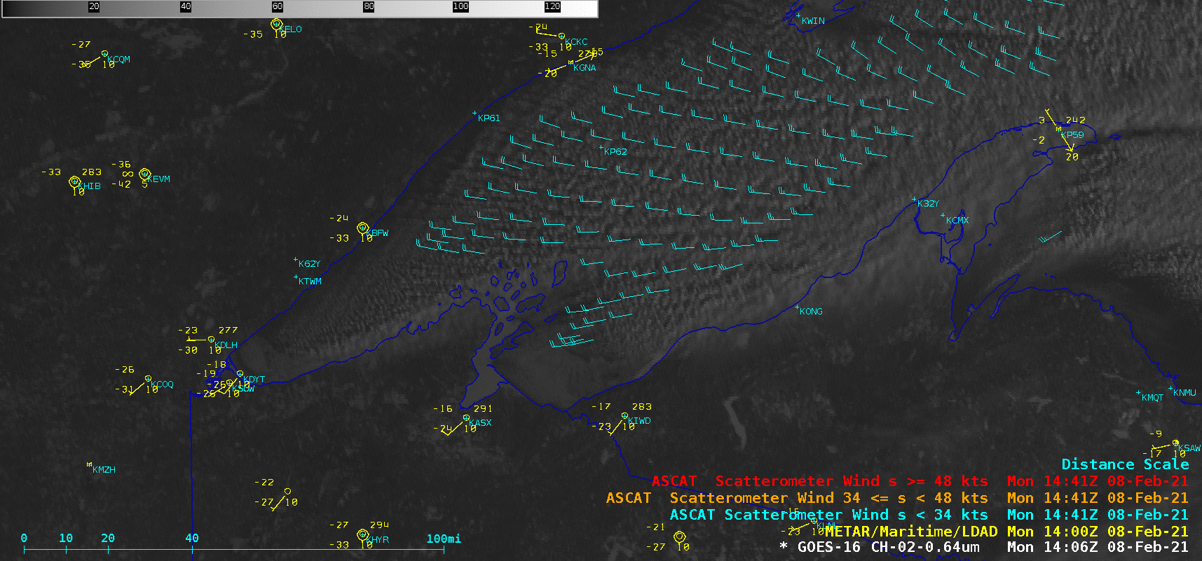
GOES-16 “Red” Visible (0.64 µm) images, with plots of Metop-A ASCAT wnds and surface reports [click to play animation | MP4]
Thanks to Patrick Ayd, SOO at WFO Duluth, for alerting us to this ice motion case.
(Why it’s important to know about ice moving along the shore of the Lake)