Northeast US winter storm
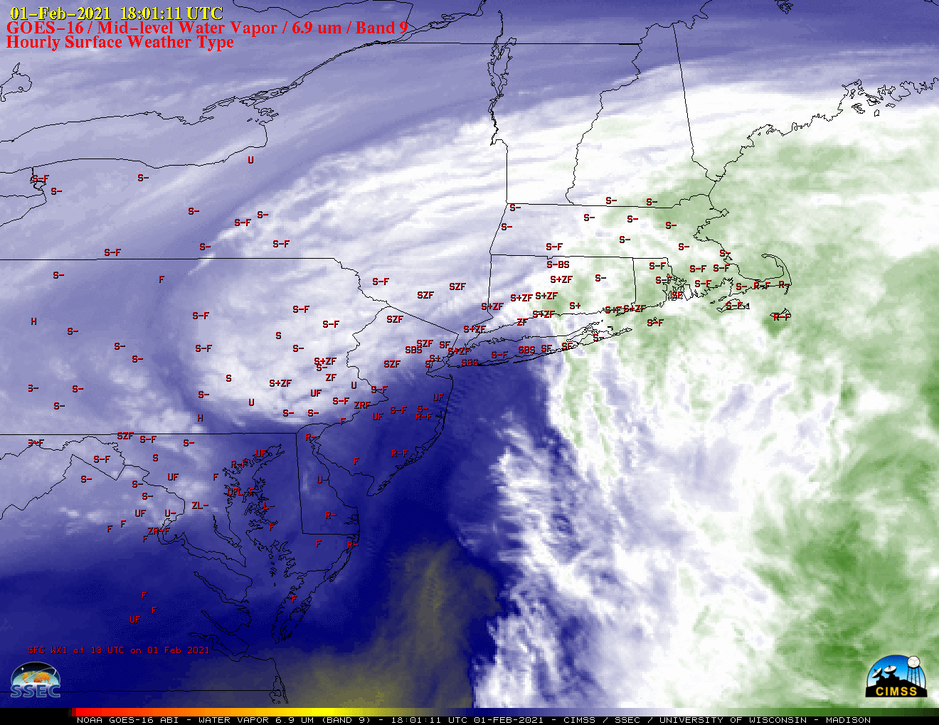
GOES-16 (GOES-East) Mid-level Water Vapor (6.9 µm) images with plots of hourly surface weather type (above) showed the formation of a well-defined cold conveyor belt that moved westward across parts of the Northeast US during the 01 February – 02 February 2021 period. This moist airstream helped to enhance snowfall rates, with 2-4 inches... Read More
