Comparing SAR wind data to GOES-16 ABI imagery

Sentinel-1A wind information over northern Lake Michigan, 2342 UTC on 14 February 2021 (Click to enlarge)
Synthetic Aperture Radar (SAR) imagery can be used to produce very high resolution mapping of winds. Imagery is available in selected domains at this NOAA/OSPO website; OSPO is the Office of Satellite Product Observations. Data are available from three different satellites: Sentinel-1/Sentinel-2 (managed by the European Space Agency) and RADARSAT (managed by the Canadian Space Agency). These space-borne radars can operate in a mode that provides very small-scale wind information, as shown above. Note the fine detail in the winds — elongated regions of winds in excess of 20 knots from north of Green Bay southeastward across Lake Michigan to North and South Manitou islands. What does the ABI Imagery look like at the same time?
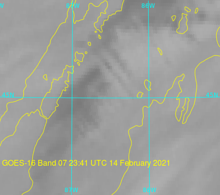
GOES-16 Band 7 (3.9 µm) imagery, below, similarly shows three parallel lines of colder cloud tops (the greyscale enhancement used is such that colder values are whiter). SAR data shows that convective bands over the lake have stronger surface winds than regions in between the convective bands.


