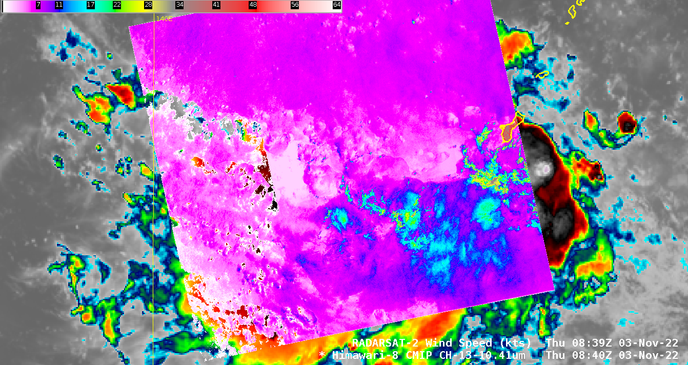
This website works best with a newer web browser such as Chrome, Firefox, Safari or Microsoft Edge. Internet Explorer is not supported by this website.

Category: Satellite winds

Moist air over the tropical western Pacific Ocean

Microwave estimates of total precipitable water over the western Pacific Ocean (available here) show a moist airmass — out of which Typhoon In-Fa (seen near Taiwan in the animation) emerged — over the western Pacific Ocean. (The circulation of Tropical cyclone Cempaka is also apparent near the Gulf of Tonkin)... Read More

Elsa briefly regains hurricane intensity before making landfall along the Florida coast

Late in the day on 06 July 2021, Tropical Storm Elsa regained hurricane intensity as of 0000 UTC, just off the west coast of Florida. 1-minute Mesoscale Domain Sector GOES-16 (GOES-East) “Red” Visible (0.64 µm) and “Clean” Infrared Window (10.35 µm) images (above) showed the tropical cyclone during the 1500 UTC to 0000 UTC time period. In the morning, cloud-top infrared brightness temperatures of -80ºC... Read More

Subtropical storm Raoni off the coast of South America

GOES-16 (GOES-East) “Red” Visible (0.64 µm) images (above) showed the circulation of Subtropical Storm Raoni (discussion issued by MARINHA) off the coast of Argentina/Uruguay on 28 June 2021.In the corresponding GOES-16 “Clean” Infrared Window (10.35 µm) images (below), the coldest cloud tops exhibited infrared brightness temperatures around -50ºC (shades of yellow).===== 29 June Update =====GOES-16 Visible... Read More