SAR data over Tropical Cyclone Freddy in the Indian Ocean
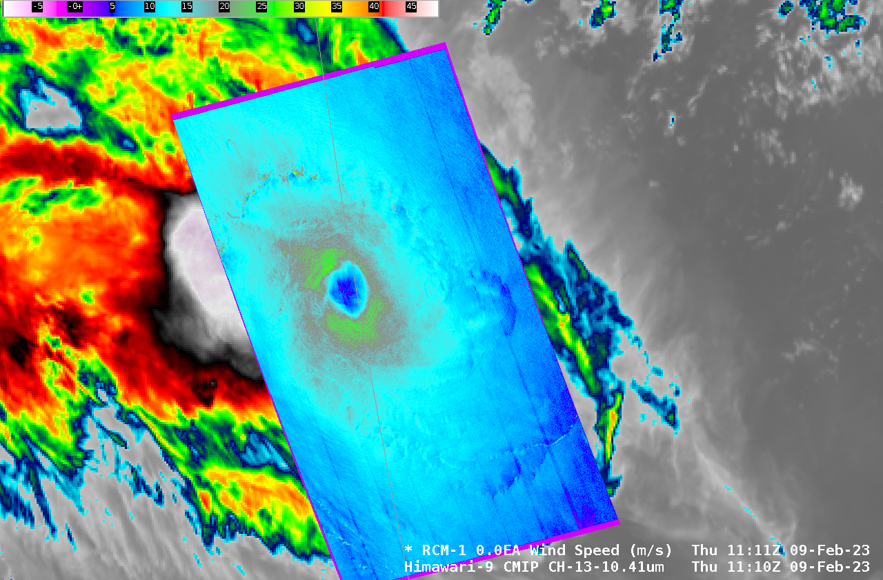
RADARSAT Constellation Mission Satellite 1 (RCM-1) overflew tropical cyclone Freddy in the eastern Indian Ocean on 9 February, and Synthetic Aperture Radar (SAR) winds from the satellite captured a well-developed eye with (instantaneous) surface winds that peaked around 25 m/s. More information on SAR winds with Freddy is available here. The toggle above shows the storm center displaced significantly to the east... Read More
