Banded wind structures over Lake Huron
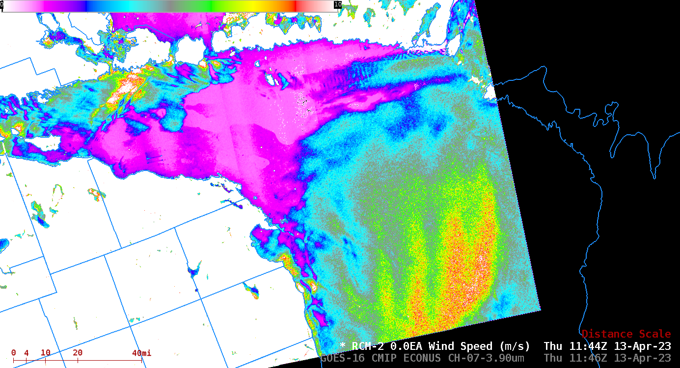
The SAR wind analysis above shows curious banded wind features over central Lake Huron. The bands have a vertical separation of around 10 km and exist just south of essentially calm winds (magenta in the enhancement used). Peak winds within the bands 8-10 m/s, and the (weaker) winds in between... Read More
