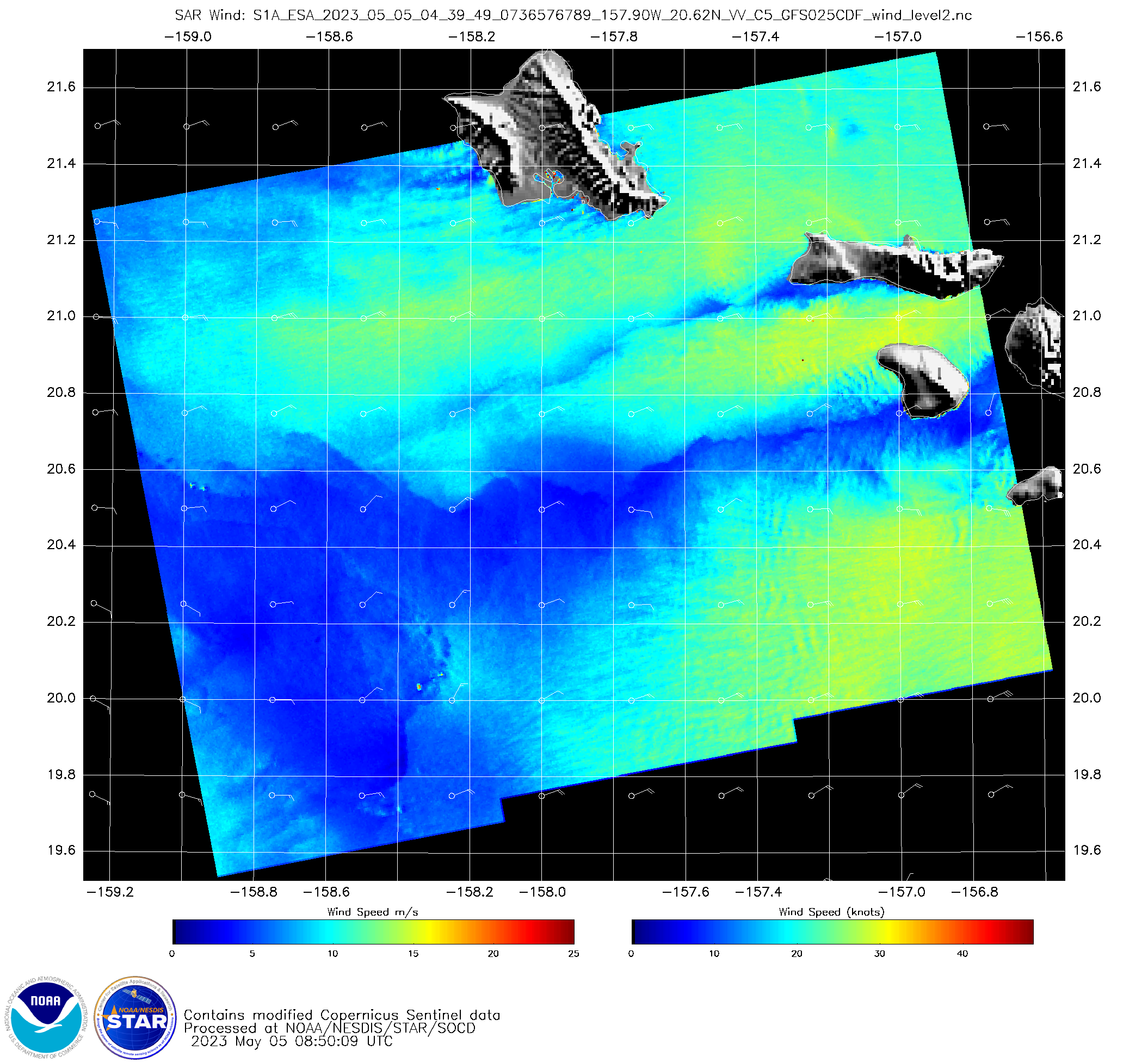
SAR winds with cloud lines north of Hawai’i

Visible imagery from near sunset on 16 May 2023, above, shows multiple horizontal cloud lines north of the islands of Oahu and Kauai. Each of the clouds lines is associated with a local modulation of the wind field in the SAR Wind field. The wind /Normalized Radar Cross Section fields are also available online... Read More
