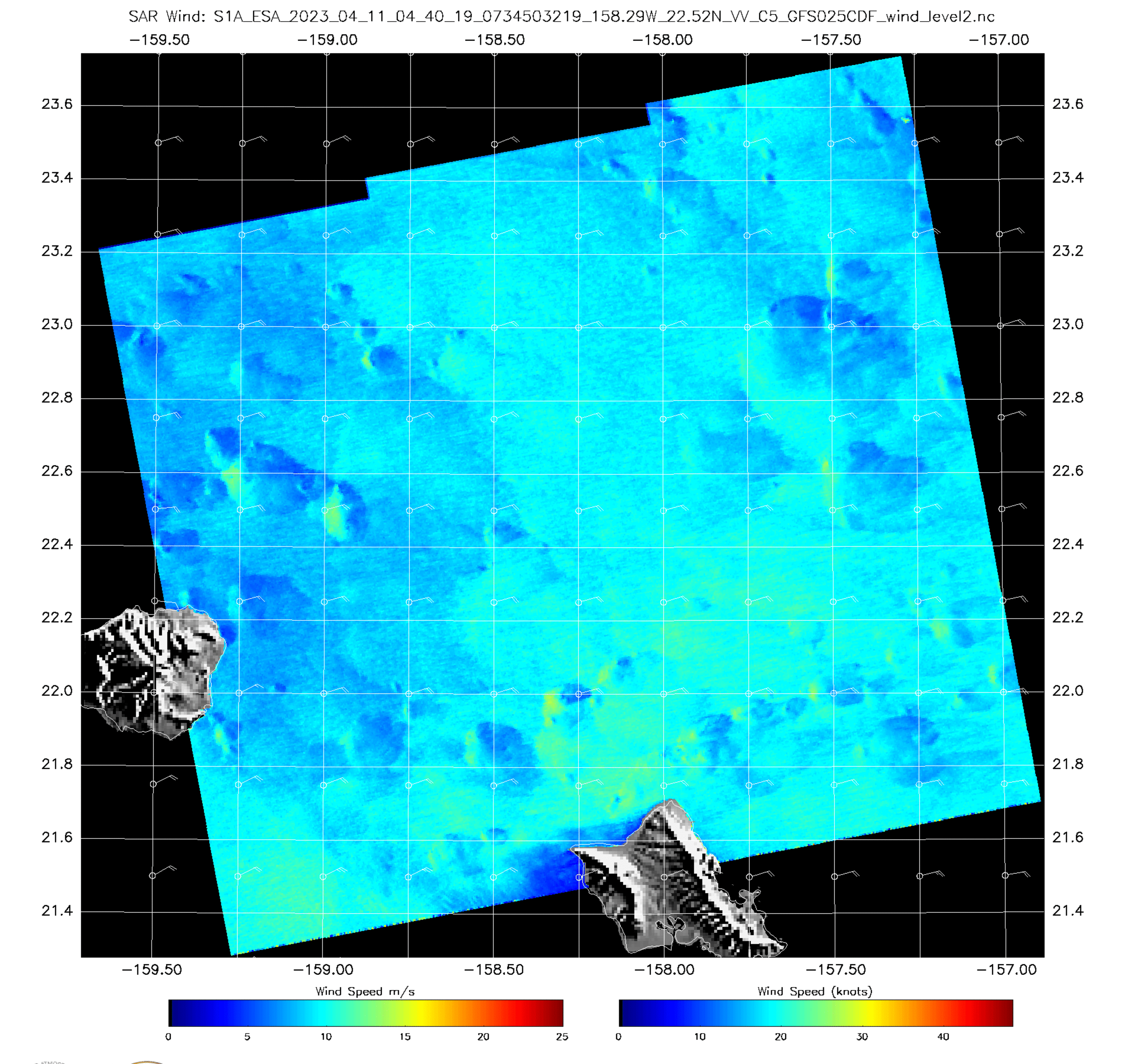
Sentinel-1A SAR Observations over Hawai’i late on 10 April

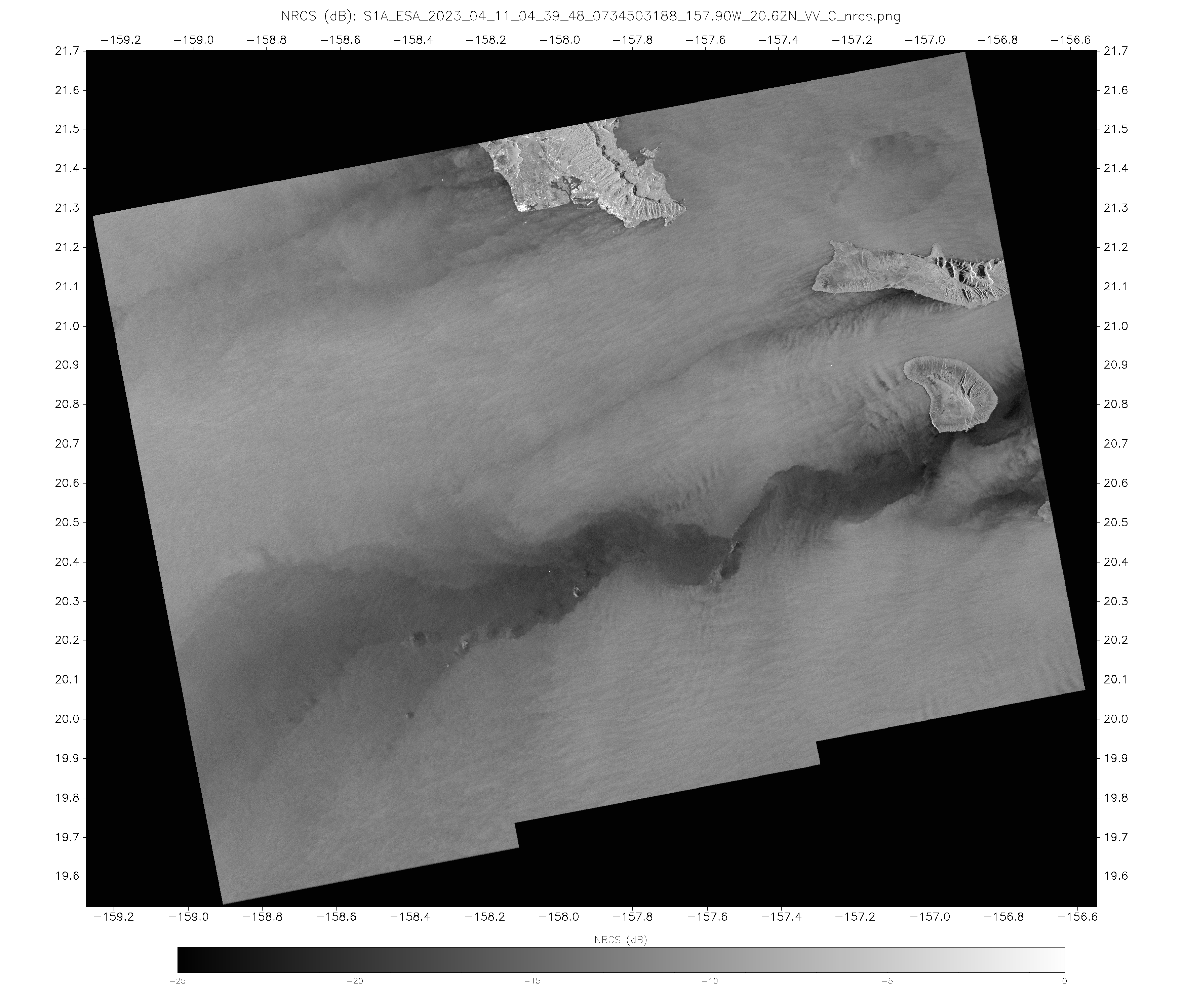
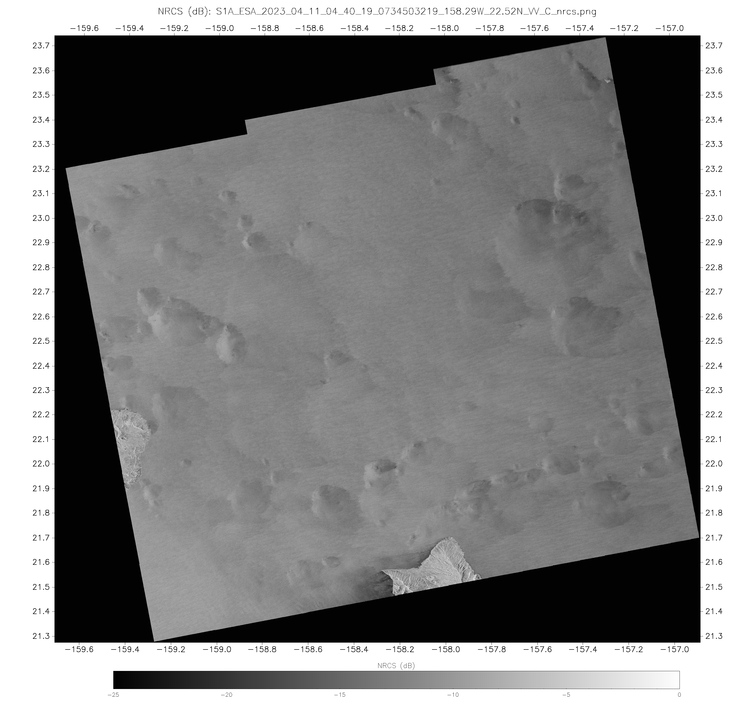
Sentinel-1A overflew the central Hawai’ian islands near sunset on 10 April 2023, and the SAR data collected are shown above. Data are also available online at this website. The toggles below compare wind speed from that website (04:39:48 and 04:40:19 from south to north) with Normalized Radar Cross Section fields (04:39:48 and 04:40:19). The character of the wind fields are much different north and south of the Hawai’ian Island chain, with the southern winds showing marked funneling between islands, and smaller regions of lighter winds in the lee of the islands.

The Slider below shows the SAR wind field north of Hawai’i with the brightened GOES-18 Visible imagery. There is excellent correspondence between local wind maxima and cloud features (presumably showers). Sometimes, the strongest SAR winds are associated with misinterpretation of strong reflection from cloud ice by the SAR Wind algorithm; when that happens, ‘feathery’ structures are usually apparent in the NRCS field. There is little evidence of that happening in the SAR winds above.
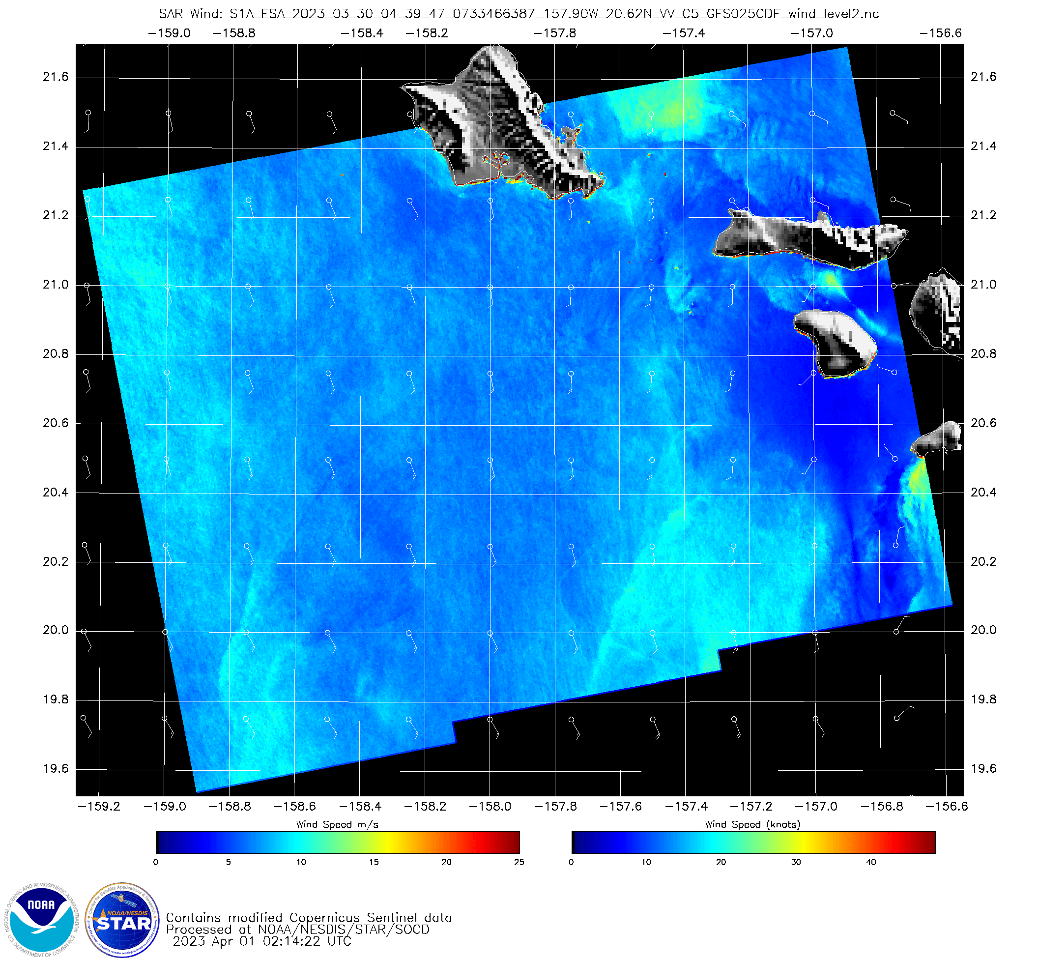
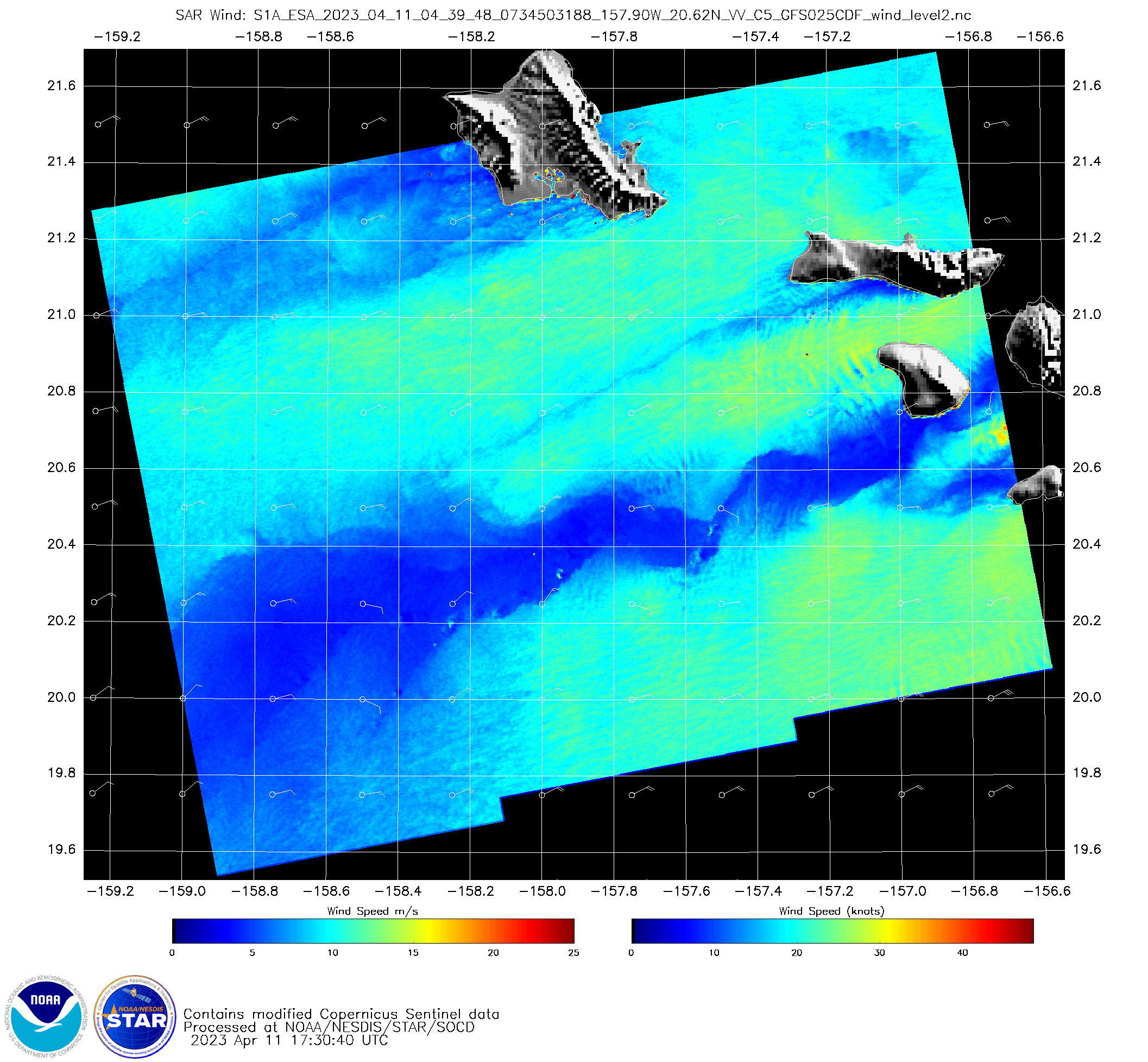
Sentinel-1A has a 12-day repeat cycle, so the same domain as above should have been duplicated 12 days earlier, late in the day on 29 March (or around 0400 UTC on 30 March). The toggle below compares the data at 04:39:37 on 30 March and 04:39:38 on 11 April. This scene should be repeated on 23 April this month. ESA does provide kml files that show when the next collections will happen (link).