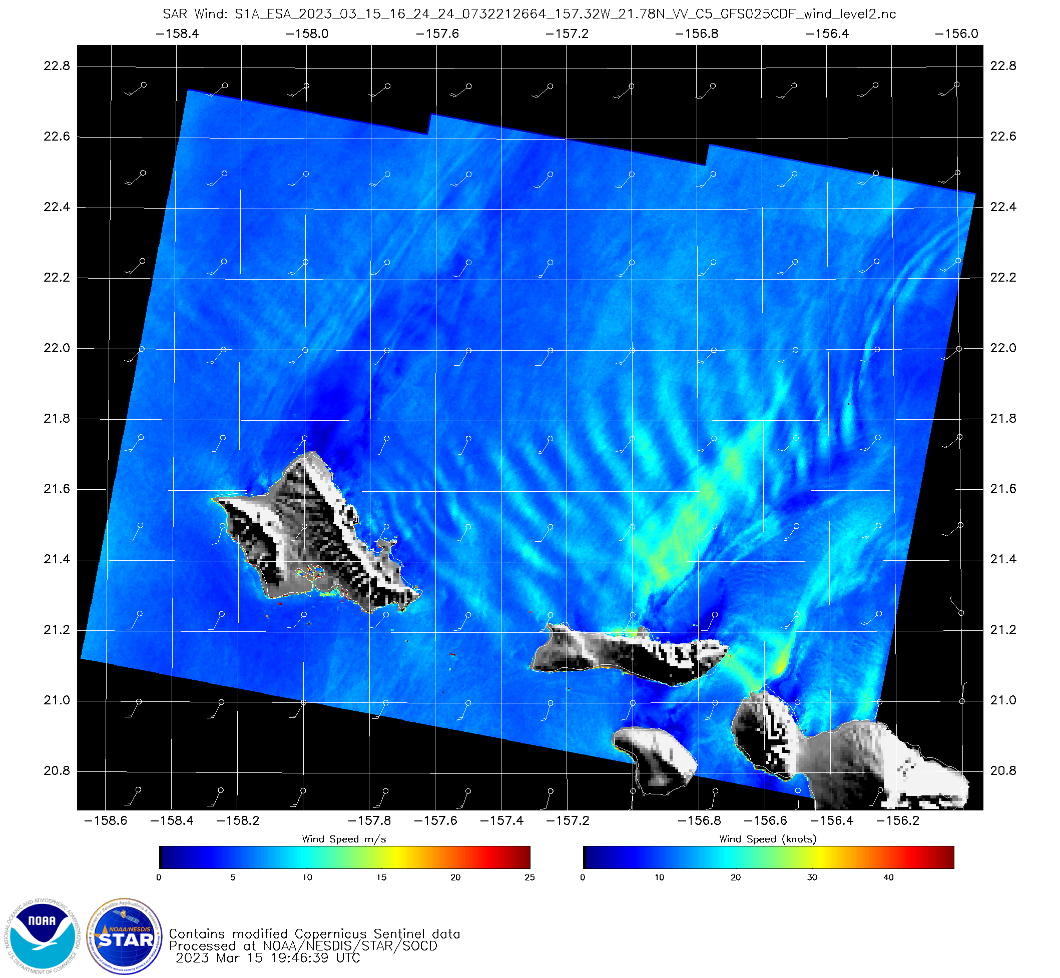
SAR Winds around Kaua’i
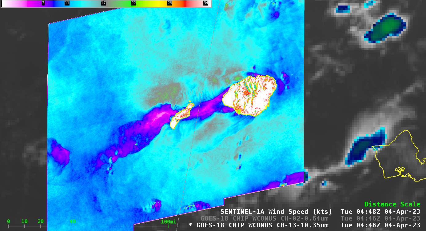
Sentinel-1A overflew the western Hawai’ian islands late on 4 April 2023, observing surface winds around the islands of Kaua’i and Ni’ihau. The image above shows the winds overlain on top of a GOES-18 infrared image. A pronounced region of light winds extends downwind of both islands — the region in... Read More
