Banded wind structures over Lake Huron

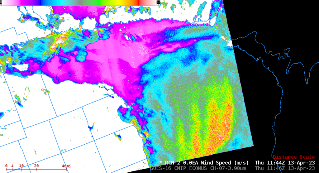
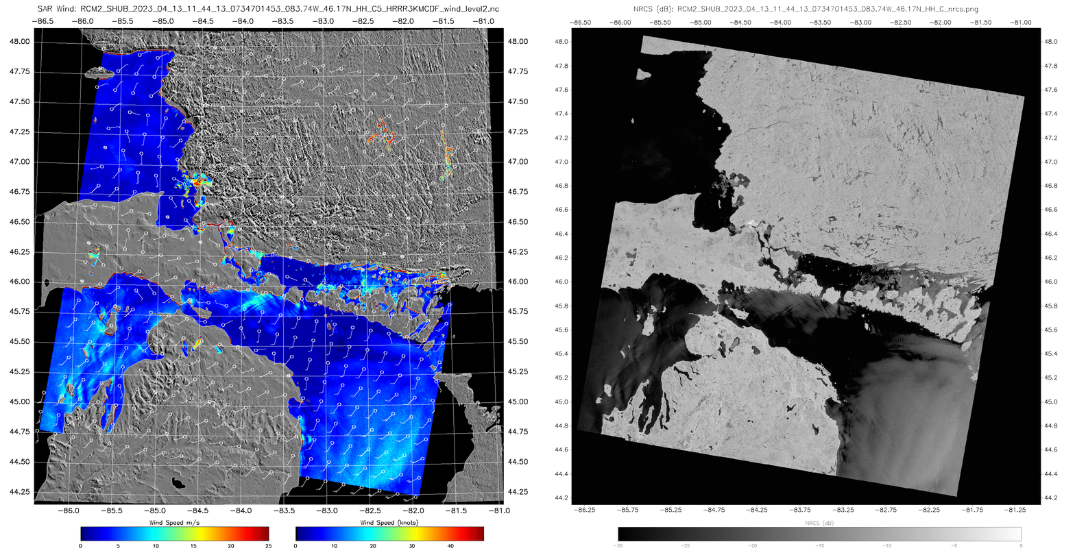
The SAR wind analysis above shows curious banded wind features over central Lake Huron. The bands have a vertical separation of around 10 km and exist just south of essentially calm winds (magenta in the enhancement used). Peak winds within the bands 8-10 m/s, and the (weaker) winds in between the peaks are 4-6 m/s. Because this blogger can’t quite figure out why they’re there, the ‘What the Heck is this?’ category is being used. The region of light winds is between a cold front to the north, and high pressure to the south (1500 UTC surface analysis). The slider below compares the wind field to the 3.9 µm brightness temperature field (Note that only values between 0 and 6o C are shown). There is an obvious relationship between brightness temperatures between the very light winds between northern lower Michigan and Manitoulin Island — the lake surface has brightness temperatures between 2.2o and 2.8o C where winds are lighter vs. 3o – 3.9o C where stronger winds exist to the south; however, the banded wind features do not appear to have an appreciable effect on the underlying lake surface temperatures.
The 1200 UTC sounding from Detroit, from the Wyoming Sounding site, shows stable air below 800 mb. The airmass will be chilled from beneath when it moves over the Lake, too, so a strong surface inversion likely exists as well.
The toggle below compares derived winds and Normalized Radar Cross Section (NRCS) fields at 1144 UTC from RCM-2 observations.

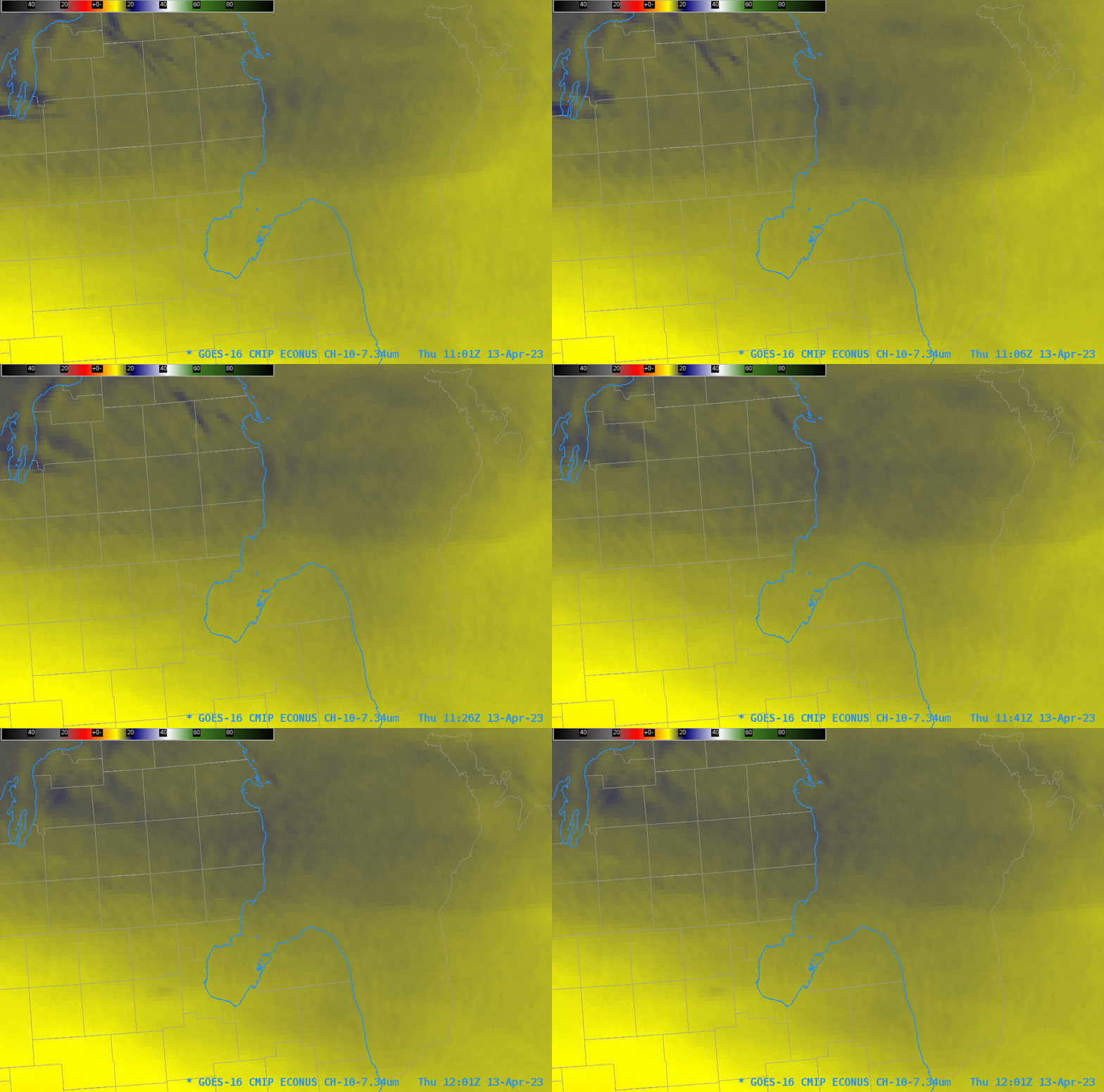
Added: 17 April 2023: This website shows SAR data over Lake Huron only (other individual Great Lakes views are available here). Included at the Lake Huron website is a netcdf file that combines both scenes on this day over Lake Huron, shown below in a slider with the GOES-16 Low-Level water vapor imagery (that is, Band 10 at 7.34 µm). There are features in the ABI imagery that overlap the wind features. (Click here to see a toggle). Note that the color enhancement bounds have been altered slightly from the default (-109 to 55 oC) to -107 to 58 oC to make the bands more obvious.
The animation of GOES-16 Band 10 imagery from 1101 – 1201 UTC (i.e. bracketing the SAR observations), below, shows that the bands persist, at least for this hour, and perhaps the wind features extend inland over lower Michigan; at least, the features in the Band 10 imagery show up there!

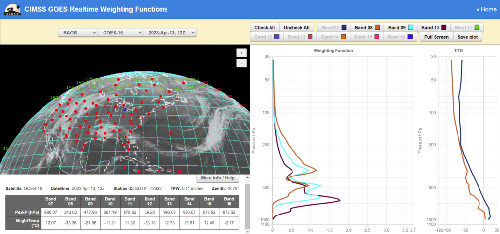
The computed weighting function for the Detroit sounding at 1200 UTC on 13 April 2023, below, (from the CIMSS Weighting Function site) shows results for the three ABI infrared Water Vapor channels (Bands 8, 9 and 10 at 6.19, 6.95 and 7.34 µm, respectively). Much of the energy sensed by the ABI at 7.34 µm originates from a layer between 600 and 700 mb.


