Sentinel-1A SAR Winds over the Samoan Islands on 13 April 2023
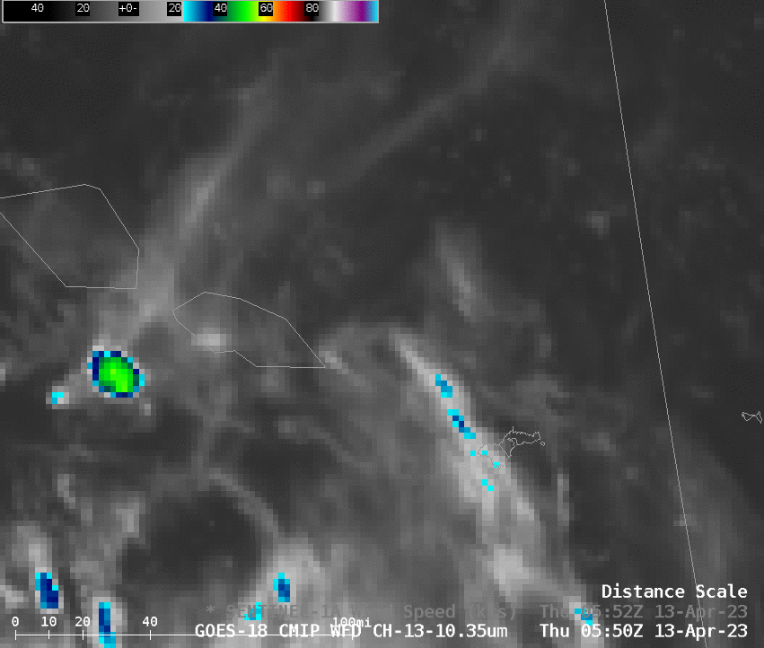
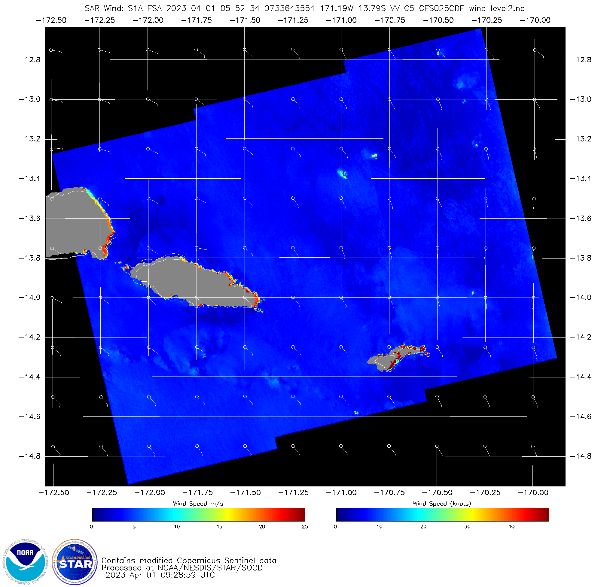
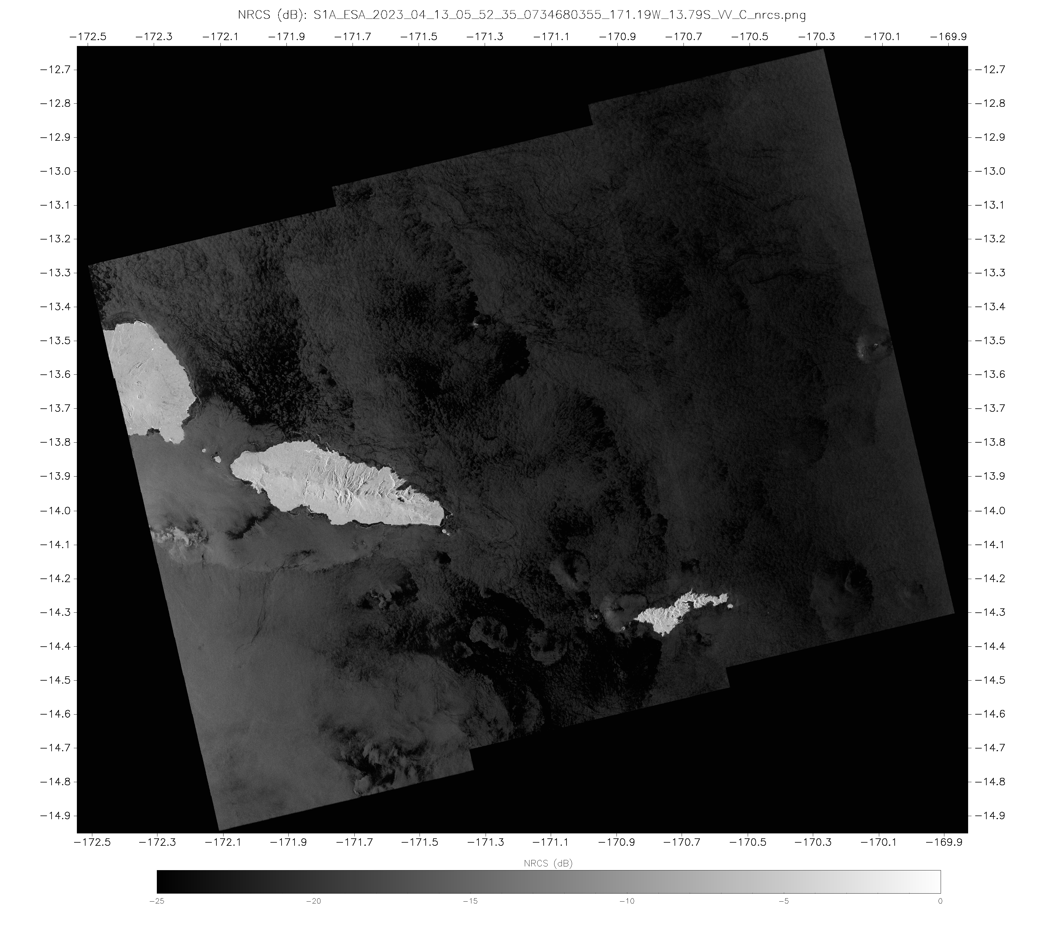
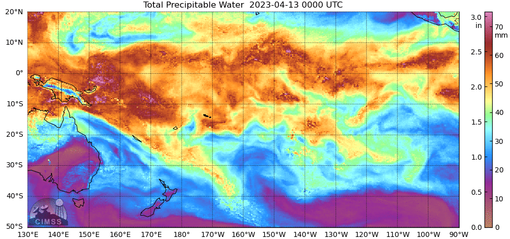
Sentinel-1A orbits have a repeat cycle of 12 days, and the second observation in April over Samoan waters occurred on 13 April, as shown above (there were SAR winds created in this domain on 1 April as well, here, on a similar weak-wind day). Diagnosed winds are uniformly light (3-7 knots) in the absence of strong convection. The atmosphere is very moist, as shown in the MIMIC Total Precipitable Water animation (below) from 0000-0900 UTC on 13 April. Note that the region of strongest winds in the image above, to the west of Upolu and near the western edge of the domain, is likely an artifact from reflection of the SAR signal off of ice from the deep convective cloud at the western edge of the SAR domain. This toggle of winds and Normalized Radar Cross Section (NRCS) data shows the characteristic feathery structure in NRCS fields that arise when cloud ice is present.
Sentinel-1A will overfly Samoa again around 0552 UTC on 25 April.