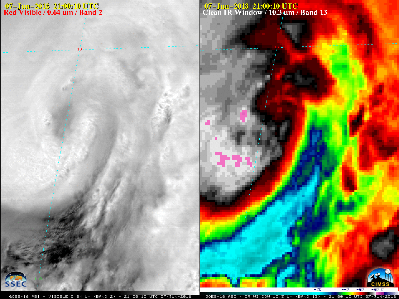
This website works best with a newer web browser such as Chrome, Firefox, Safari or Microsoft Edge. Internet Explorer is not supported by this website.

Category: Other Satellites

Hurricane Irma

GOES-16 data posted on this page are preliminary, non-operational and are undergoing testingThe animation above shows Irma every 6 hours from 31 August through 8 September, using the GOES-16 “Clean Window” Imagery (10.3 µm). The animation below shows the GOES-16 Upper-Level Water Vapor Infrared Imagery (6.19 µm) (Click here for... Read More

Hurricane Irma in the eastern Atlantic Ocean

A toggle between nighttime images of Suomi NPP VIIRS Infrared Window (11.45 µm) and Day/Night Band (0.7 µm) data at 0347 UTC (courtesy of William Straka, SSEC/CIMSS) showed a high-resolution view of the eye of Category 3 Hurricane Irma. GOES-16 data (ABI and GLM) posted on this page are preliminary, non-operational... Read More

Harvey near the coast of Texas

GOES-16 data (ABI and GLM) posted on this page are preliminary, non-operational and are undergoing testingMeandering Tropical Storm Harvey is near the Gulf Coast of Texas during the day on Monday 28 August as shown in the 4-panel Animation above. The Four panels include, clockwise from lower left, Upper Level... Read More