Cyclone Kelvin makes landfall in Australia
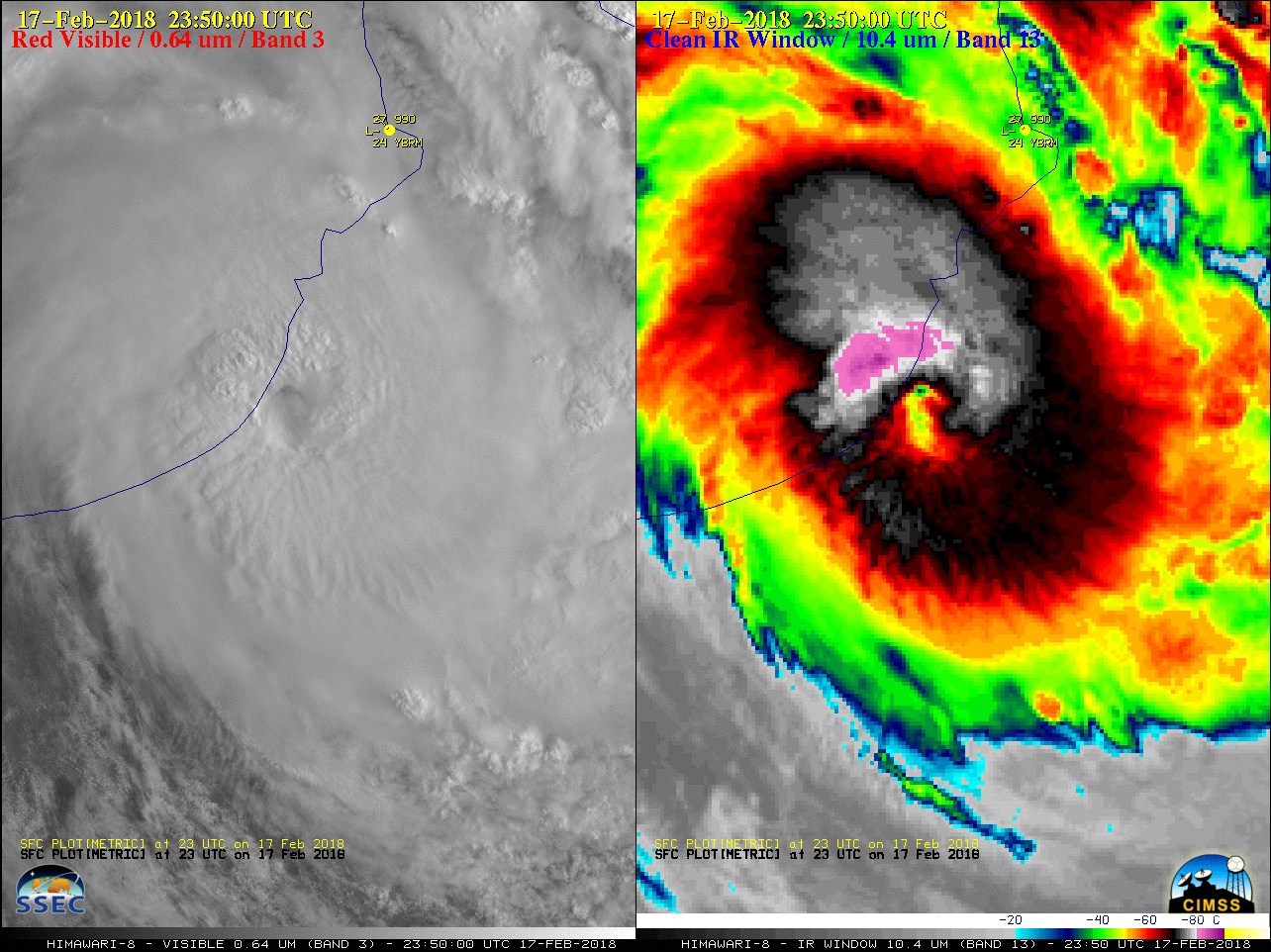
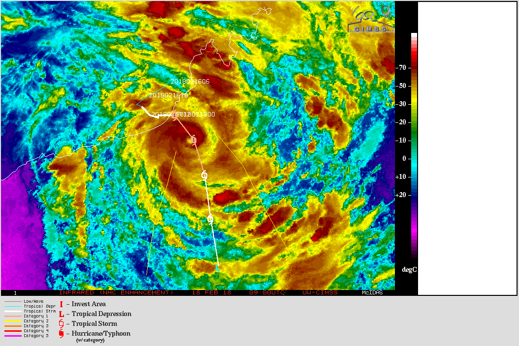
Himawari-8 Visible (0.64 µm) and Infrared Window (10.4 µm) images (above) showed Cyclone Kelvin as it made landfall in Western Australia as a Category 1 storm on 18 February 2018. Kelvin continued to intensify shortly after making landfall, with estimated winds of 80 gusting to 100 knots — and a distinct eye feature could be seen... Read More
