Hurricane Aletta
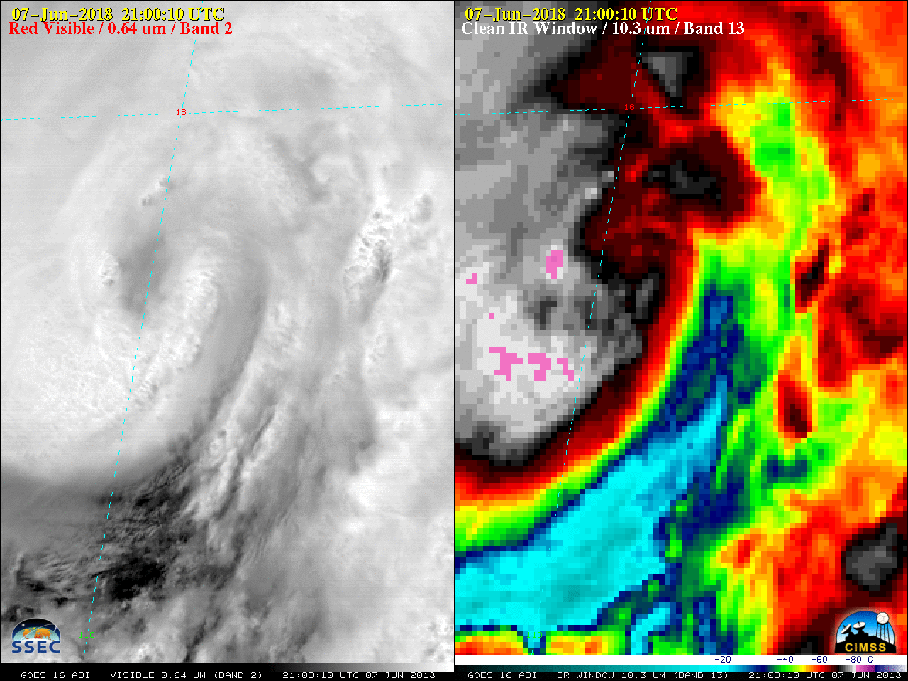
GOES-16 “Red” Visible (0.64 µm, left) and “Clean” Infrared Window (10.3 µm, right) images [click to play MP4 animation]
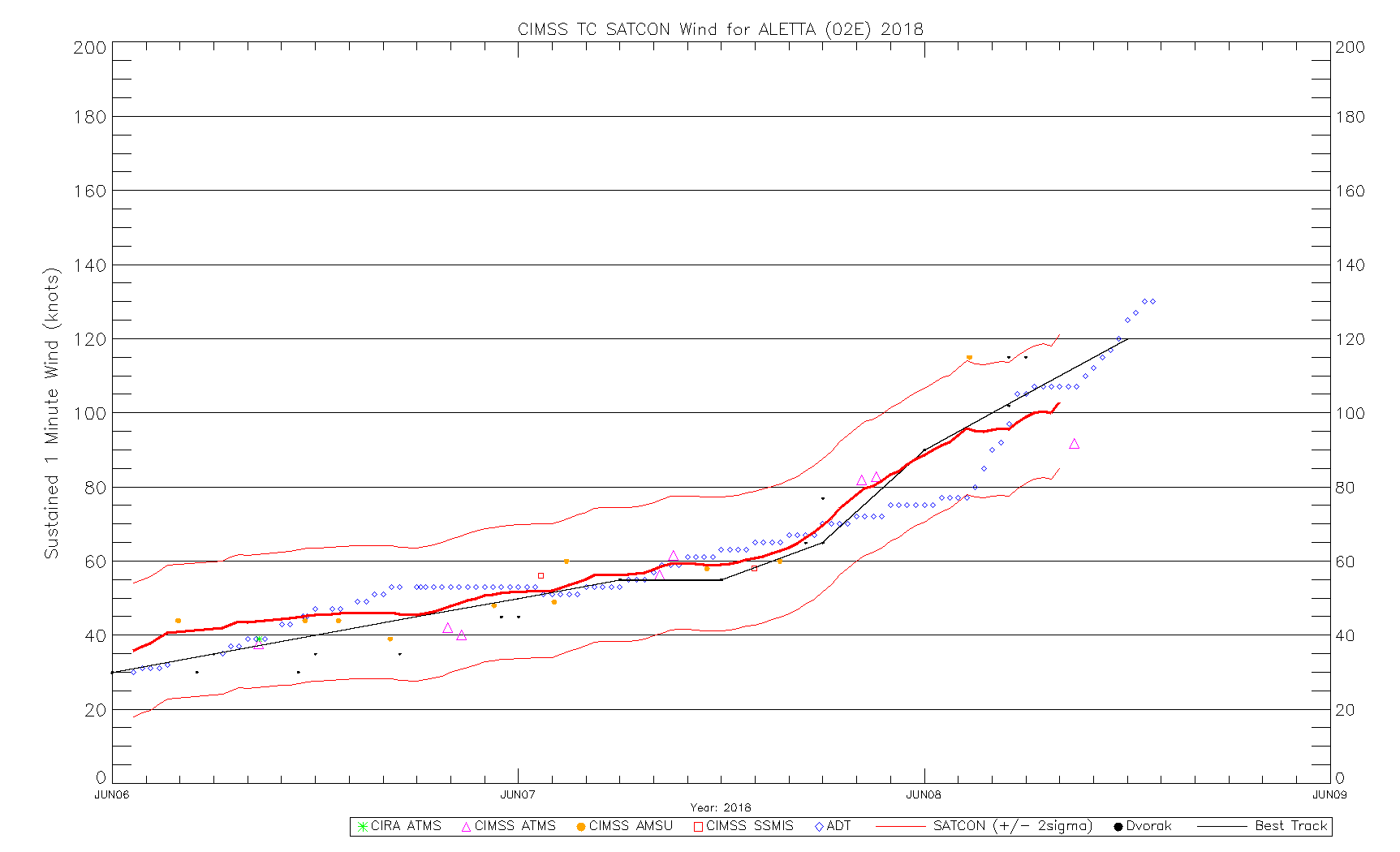
DMSP-15, DMSP-17 and GPM GMI Microwave (85 GHz) imagery from the CIMSS Tropical Cyclones site (below) showed an increase in organization of the eye structure as the day progressed.
![DMSP-15 SSMI Microwave image [click to enlarge]](https://cimss.ssec.wisc.edu/satellite-blog/wp-content/uploads/sites/5/2018/06/180607_1022utc_dmsp15_ssmi_microwave_Aletta.jpeg)
DMSP-15 SSMI Microwave image [click to enlarge]
![DMSP-17 SSMIS Microwave image [click to enlarge]](https://cimss.ssec.wisc.edu/satellite-blog/wp-content/uploads/sites/5/2018/06/180607_1356utc_dmsp17_ssmis_microwave_Aletta.jpeg)
DMSP-17 SSMIS Microwave image [click to enlarge]
![GPM GMI Microwave image [click to enlarge]](https://cimss.ssec.wisc.edu/satellite-blog/wp-content/uploads/sites/5/2018/06/180608_0031utc_gmi_microwave_Aletta.jpeg)
GPM GMI Microwave image [click to enlarge]
===== 08 June Update =====
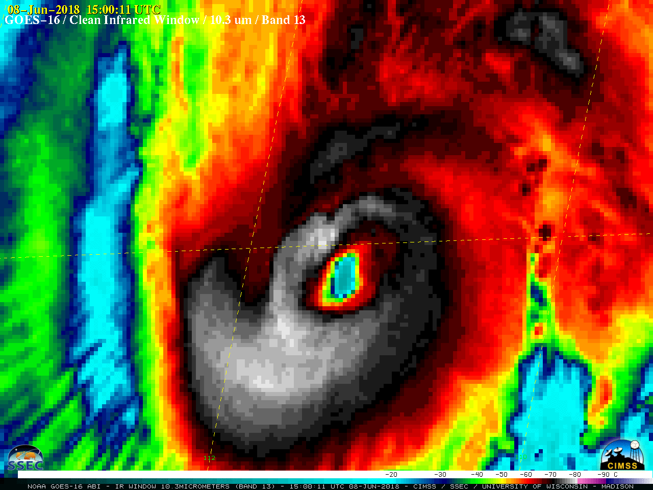
GOES-16 “Clean” Infrared Window (10.3 µm) images [click to play MP4 animation]
After sunrise, GOES-16 Visible images (below) initially hinted at the presence of mesovortices within the eye of Aletta.
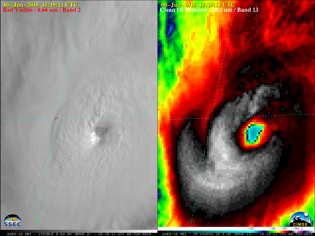
GOES-16 “Red” Visible (0.64 µm, left) and “Clean” Infrared Window (10.3 µm, right) images [click to play MP4 animation]
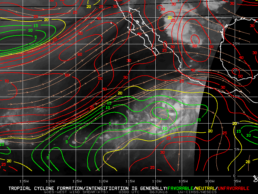
![Sea Surface Temperature and Deep-Layer Wind Shear products [click to enlarge]](https://cimss.ssec.wisc.edu/satellite-blog/wp-content/uploads/sites/5/2018/06/180608_sst_shear_Aletta.jpeg)
Sea Surface Temperature and Deep-Layer Wind Shear products [click to enlarge]
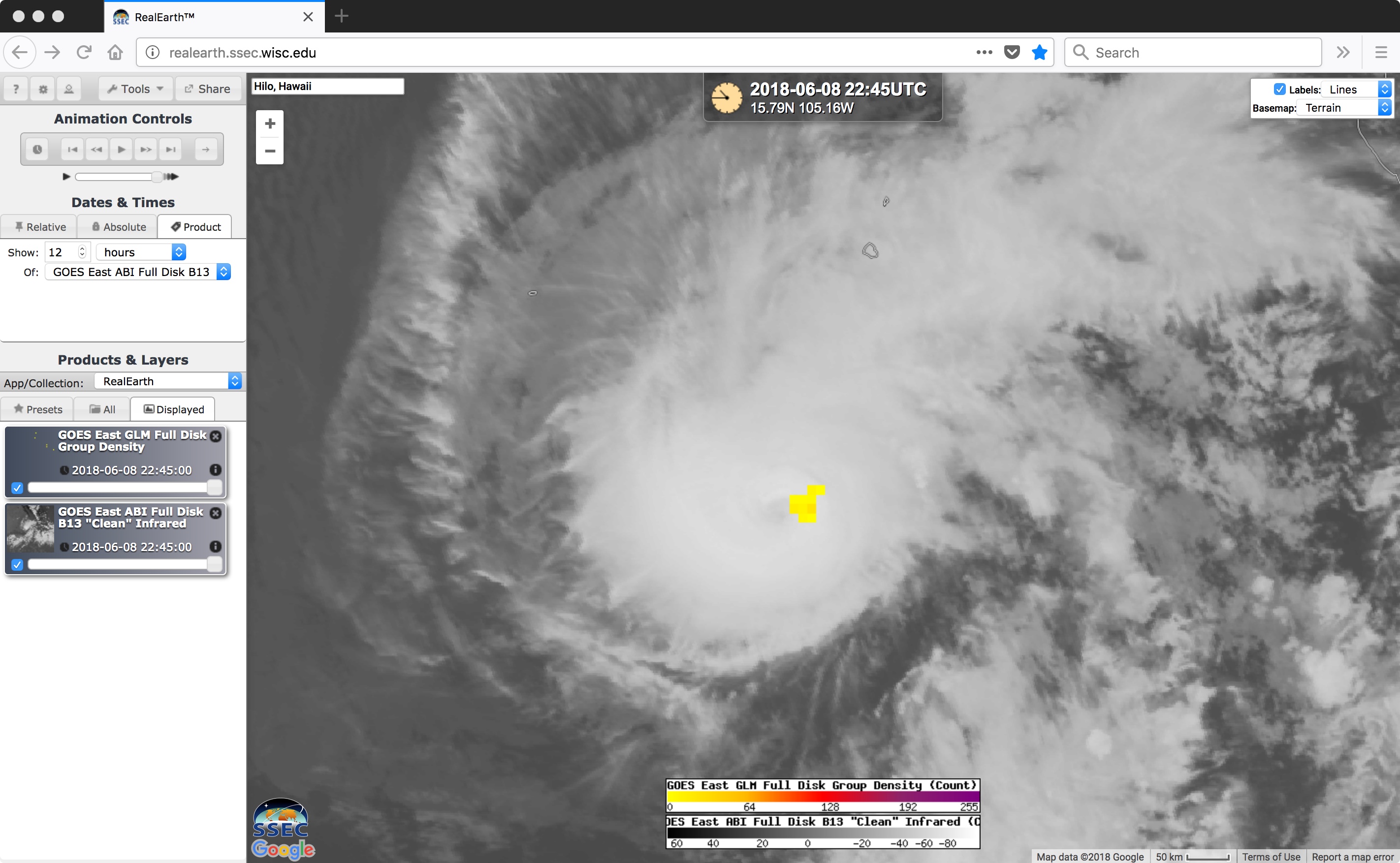
GOES-16 “Clean” Infrared Window (10.3 µm) with GLM Group Density counts [click to play MP4 animation]