Ice Jam flooding on the Kankakee River in Illinois
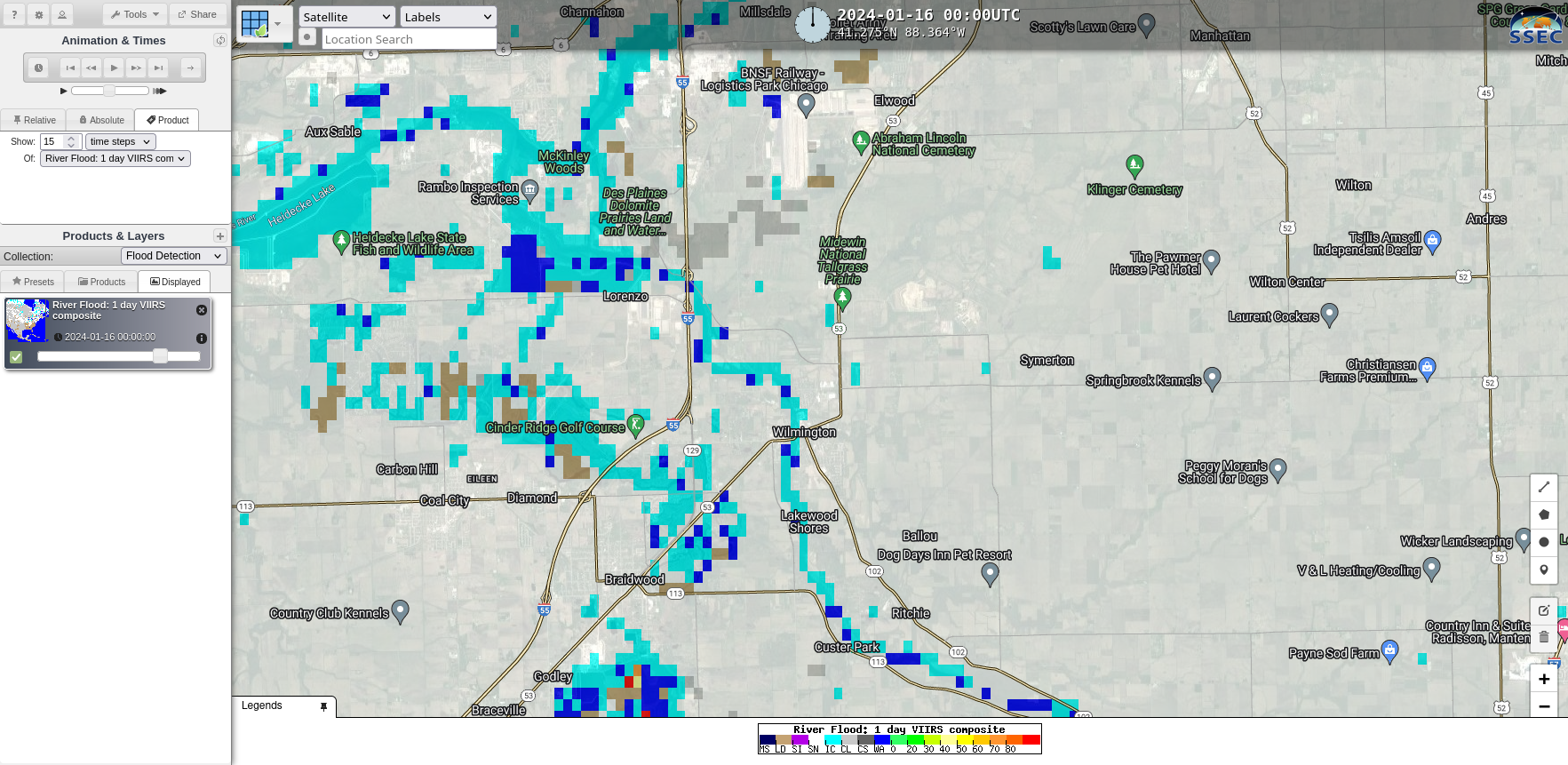
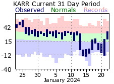
A cold snap in mid-January 2024 (Click here to see a High/Low temperature chart for Aurora Illinois from this site) led to rapid ice formation on the Kankakee River southwest of Chicago, and an ice jam with ice jam flooding subsequently developed. The map above shows different flood gauge records along... Read More
