Severe thunderstorms across the Deep South and Ohio Valley
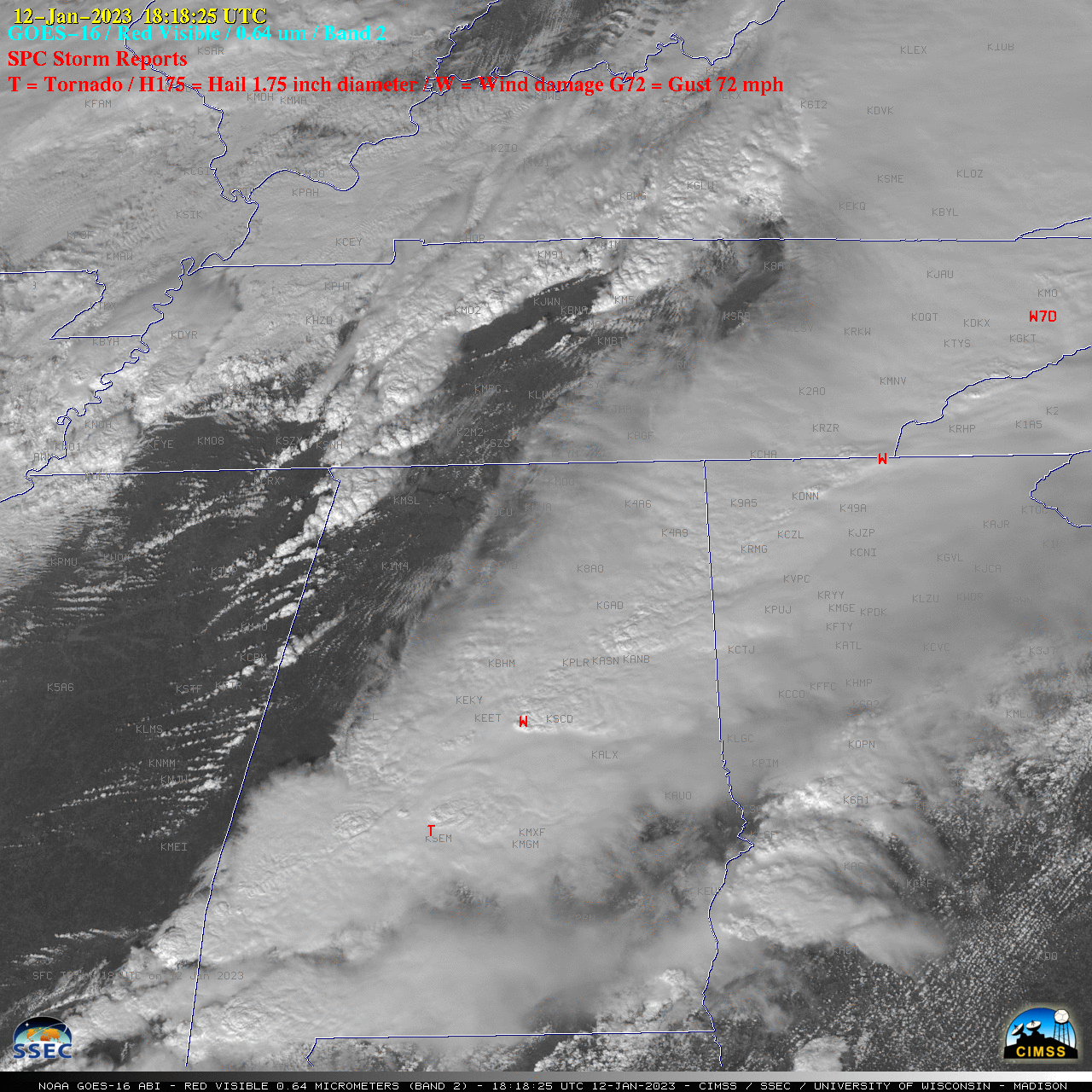
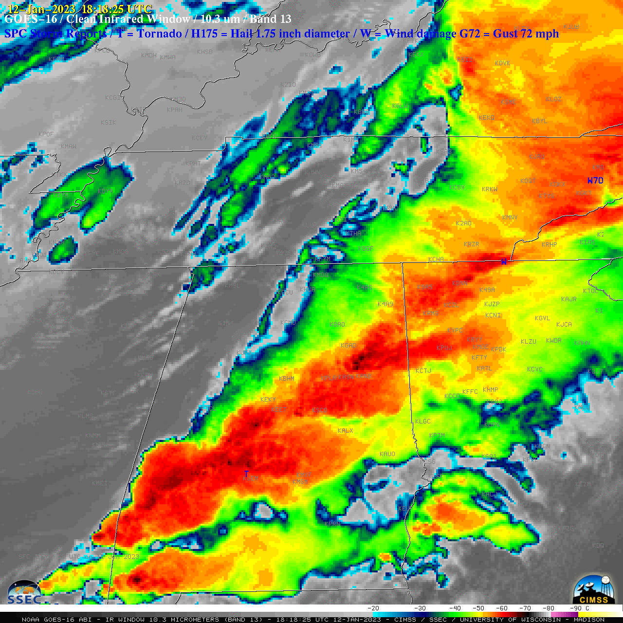
1-minute GOES-16 (GOES-East) Mesoscale Domain Sector “Red” Visible (0.64 µm) images (above) included time-matched (+/- 3 minutes) plots of SPC Storm Reports — which showed severe thunderstorms that moved east-northeastward across parts of the Deep South and Ohio Valley on 12 January 2023.1-minute GOES-16 “Clean” Infrared Window (10.3 µm) images (below) indicated that the coldest pulsing overshooting tops associated many of the storms exhibited infrared brightness temperatures around -70ºC range (darker black enhancement). These thunderstorms produced numerous tornadoes (with multiple fatalities in Alabama and Georgia), hail up to 1.75 inches in diameter in Mississippi and Alabama, and damaging winds up to 67 mph in Alabama.
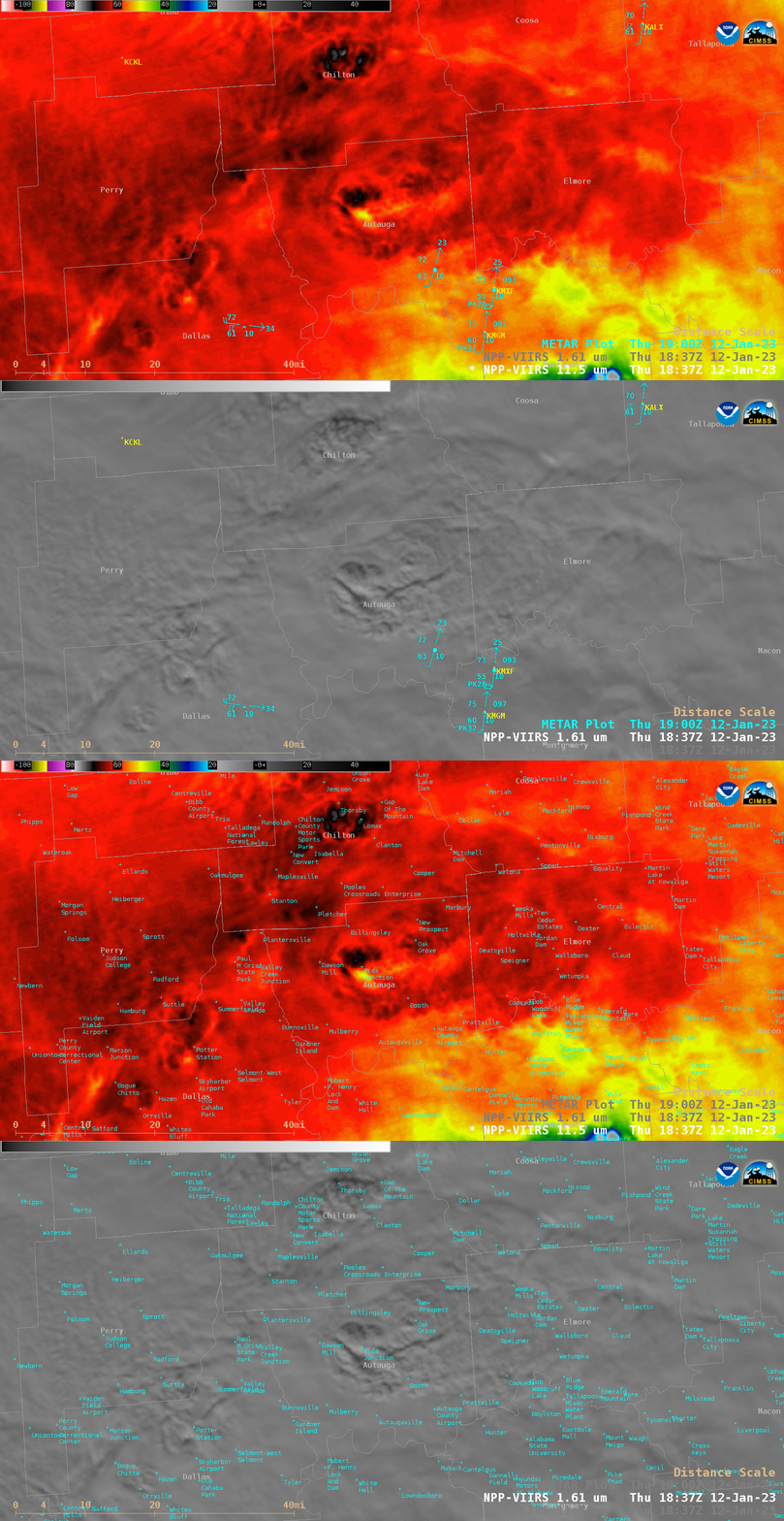
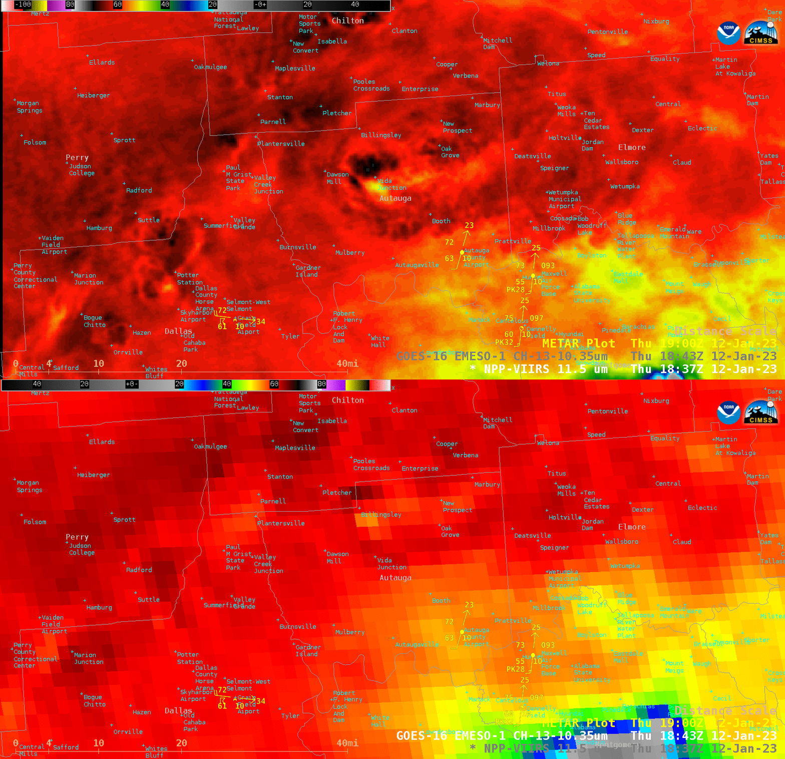
In a toggle between NOAA-20 (mislabeled as NPP) VIIRS Infrared Window (11.45 µm) and Near-Infrared (1.61 µm) images valid at 1843 UTC (below), the thunderstorm located over Autauga County, Alabama (where at least 7 fatalities occurred) appeared to exhibit a subtle Above-Anvil Cirrus Plume or AACP (reference | VISIT training) — along with a pronounced cold / warm (-71ºC / -50ºC) cloud-top infrared brightness temperature couplet. According to NWS Birmingham, this was the same tornado-producing thunderstorm that produced extensive damage in Selma (located just to the southwest, in adjacent Dallas County) about 30 minutes earlier. A toggle between Infrared Window images from NOAA-20 VIIRS (11.45 µm) and GOES-16 ABI (10.3 µm) valid at 1843 UTC (below) revealed the parallax displacement of thunderstorm cloud-top features that is inherent in geostationary imagery (which is dependent on latitude, storm top height and the resulting satellite viewing angle). In this case, there was a north-northwestward parallax offset of about 4 miles (6.4 km) for the Autauga County AACP feature; according to 1200 UTC Birmingham rawinsonde data (source), the -71ºC overshooting top sensed by VIIRS was roughly equivalent to a Most Unstable air parcel altitude near 12.5 km. For a higher-altitude storm top of 15.2 km over Alabama, the GOES-16 parallax offset would be around 13.5 km.In addition, the cold / warm storm-top thermal couplet sensed by GOES-16 was -65ºC / -55ºC; the multispectral Cloud Top Temperature derived product values were only about 0.7ºC colder.