Cyclonic Storm Jawad and Typhoon Nyatoh in GK2A imagery
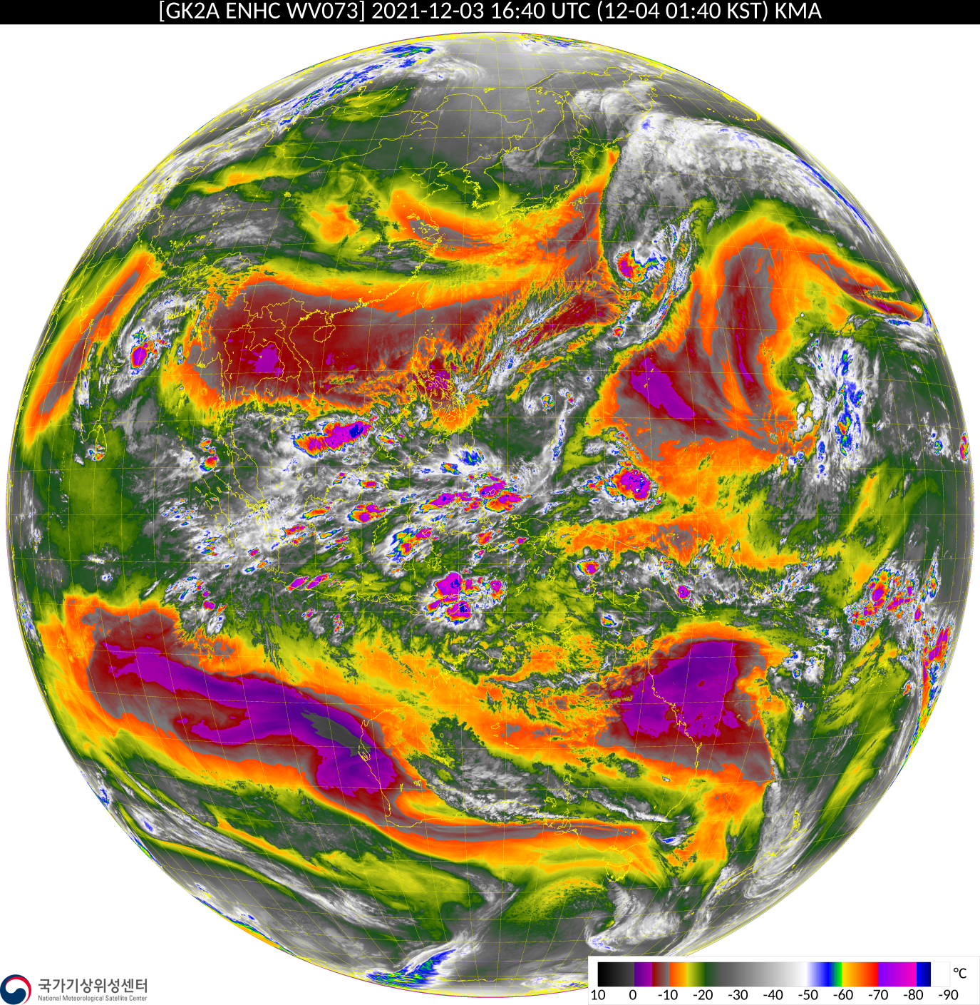
South Korea’s GK2A satellite (carrying the AMI instrument that is very similar to both AHI on Himawari-8 and ABI on GOES-16/GOES-17) is overhead on the Equator at 128 E Longitude, and satellite imagery (link) and products (link) are available online. The low-level Water Vapor animation (GK2A Band 10, 7.3 µm),... Read More

