Moisture returns to the US West Coast

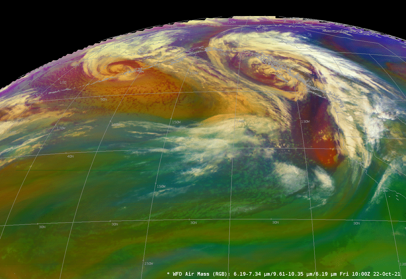
A sequence of two intense storms in the north Pacific Ocean, noted in the GOES-17 airmass RGB below, has drawn moisture into the northwestern United States. A MIMIC (Morphed Integrated Microwave Imagery at CIMSS) Total Precipitable Water rocking animation, above (rocking animation from this site), shows the development of a ribbon of moisture that moved into the northwestern United States.
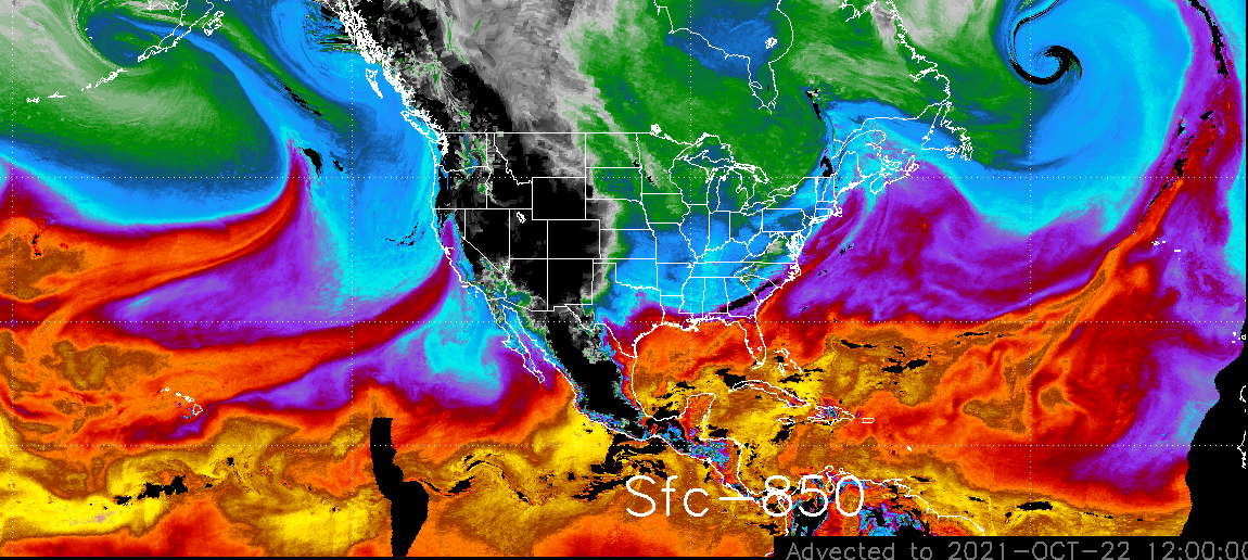
Advected Layer Precipitable Water (ALPW, from this website), differentiates the moisture into layers. At 1200 UTC, one moisture axis was right across the Bay Area of California, with 20-24 mm of moisture in the sfc-850 mb layer, 10-12 mm of moisture in the 850-700 mb layer, and 5 or 6 mm in the 700-500 mb layer.
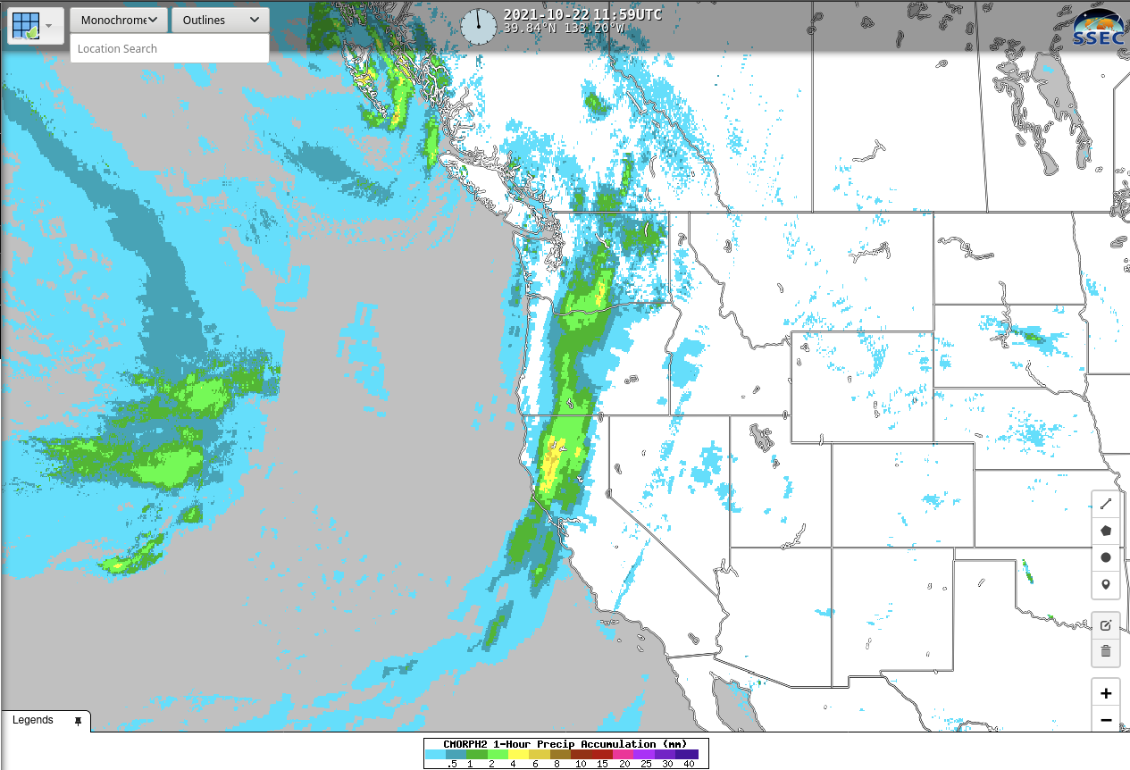
Accumulated 1-hour precipitation (estimated with CMORPH-2) for the hour ending at 1200 UTC on 22 October, below, shows a ribbon of rain from just north of the Bay Area to central Oregon; largest amounts over northern California are 6-8 mm for the one hour. CMORPH-2 estimates of precipitation are available at RealEarth.