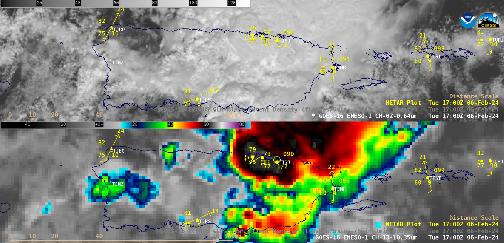
Assessing the likelihood of rain during a drought
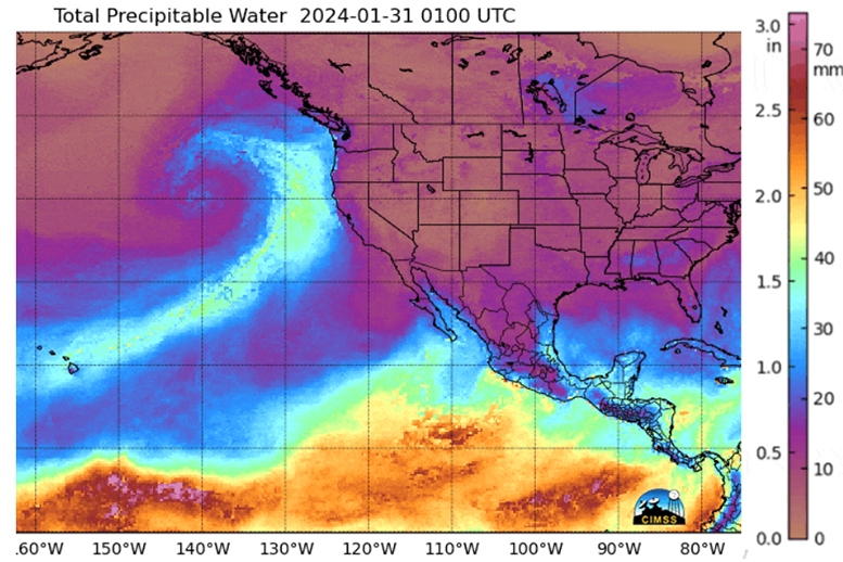
The US Drought Monitor for islands in the western Pacific Ocean, below, shows moderate to severe drought in some of the islands, especially those farthest from the Equator. Is there anything on the horizon that might bring rains?MIMIC Total Precipitable Water fields, below, show mostly dry conditions over the western Pacific with... Read More