Comparing SAR and ASCAT data south of Samoa

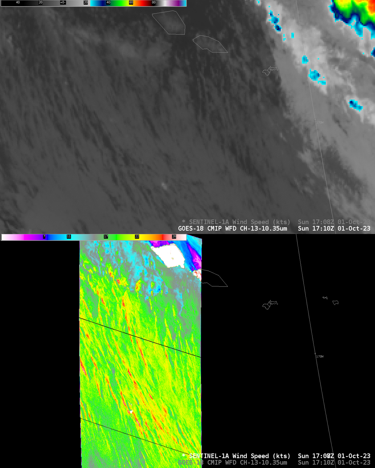
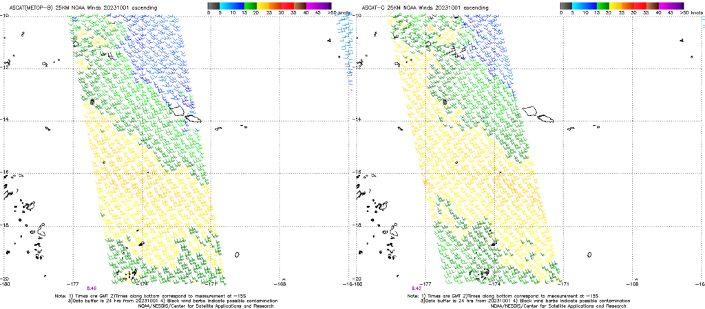
Sentinel-1A overflew the country of Savai’i and the south Pacific to its south on 1 October 2023 (Click here to view the scene at the OceanDataLab website; data are also available at NOAA/STAR’s SAR data website). A benefit of the SAR data is its remarkable horizontal resolution, manifest above as very narrow regions of strongest winds (nearly 30 knots, red in the enhancement used) within a broad region of 20-knot winds (green and yellow in the enhancement used). The southern edge of this scene is 16.8oS, and the arcs of stronger wind start at about 14.3oS. Metop-B and Metop-C sampled the region on 1 October, as shown below, two Advanced Scatterometer (ASCAT) views from the ascending passes (near 0900 UTC) and descending passes (near 2000 UTC).

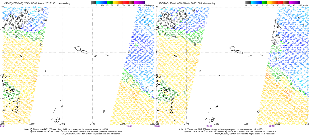
The ca. 2000 UTC ASCAT observations shown below don’t really sample the region (between 14o and 17o S) sampled by SAR data above. One might be tempted to draw a line from the eastern to western swaths of strongest winds to anticipate winds of 20-25 knots to the south of Samoa, that is, an expansion northward of the observed winds at ca. 0900 UTC shown above. Peak ASCAT winds are 25 knots however, in contrast to the 30-knot SAR observations.

Ascending (morning) and Descending (afternoon) passes on 1 and 2 October, below, show the expansion of strong winds from south of Samoa to north of Samoa. Note also at the end the appearance of weaker winds downwind of Savai’i, Opolu and Tutuila due to the islands blocking the wind.

Consider the horizontal scale of the wind observations you are using as you interpret them.

