Satellite products useful for anticipating tropical cyclone development

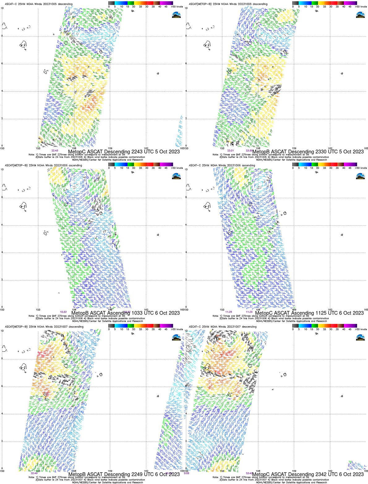
Tropical Storm Bolaven has formed in the western Pacific and is moving towards the Marianas Islands. Were there satellite products useful in monitoring the atmosphere prior to the storm’s development? One such useful product is the Advanced Scatterometer (ASCAT) that is on both MetopB and MetopC polar orbiters at this website (or this one). The stepped animation above, from late on 05 October through late on 07 October, shows 6 different MetopB/MetopC observations of the developing system. At around 2300 UTC on 5 October, a belt of strong westerlies between 2oN and 6oN Latitude is Equatorward of easterly winds closer to 10oN. Twelve hours later, near 1100 UTC on 6 October, a cyclonic circulation is apparent near 9oN, 156oE, with winds approaching 25 knots away from the cyclonic center. By 2200 UTC on 7 October, a well-defined storm is shown near 153oE with tropical-storm forced winds diagnosed by the ASCAT.
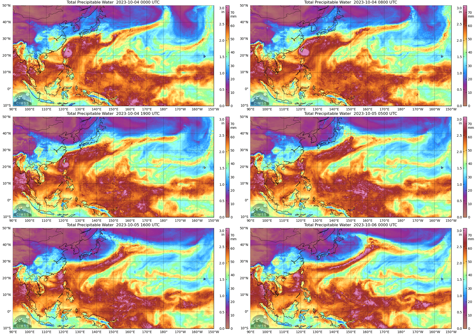
MIMIC Total Precipitable Water fields from this same time show a band of rich moisture in the same location of the storm’s formation. The observations of moisture in these fields are from microwave instruments on polar orbiters that sample the Equator occasionally. The movement of the fields is determined by GFS wind output (as described in mp4 / PowerPoint training) A slow increase in cyclonic motion in the moisture fields is apparent south of 10oN latitude around 155oE longitude.

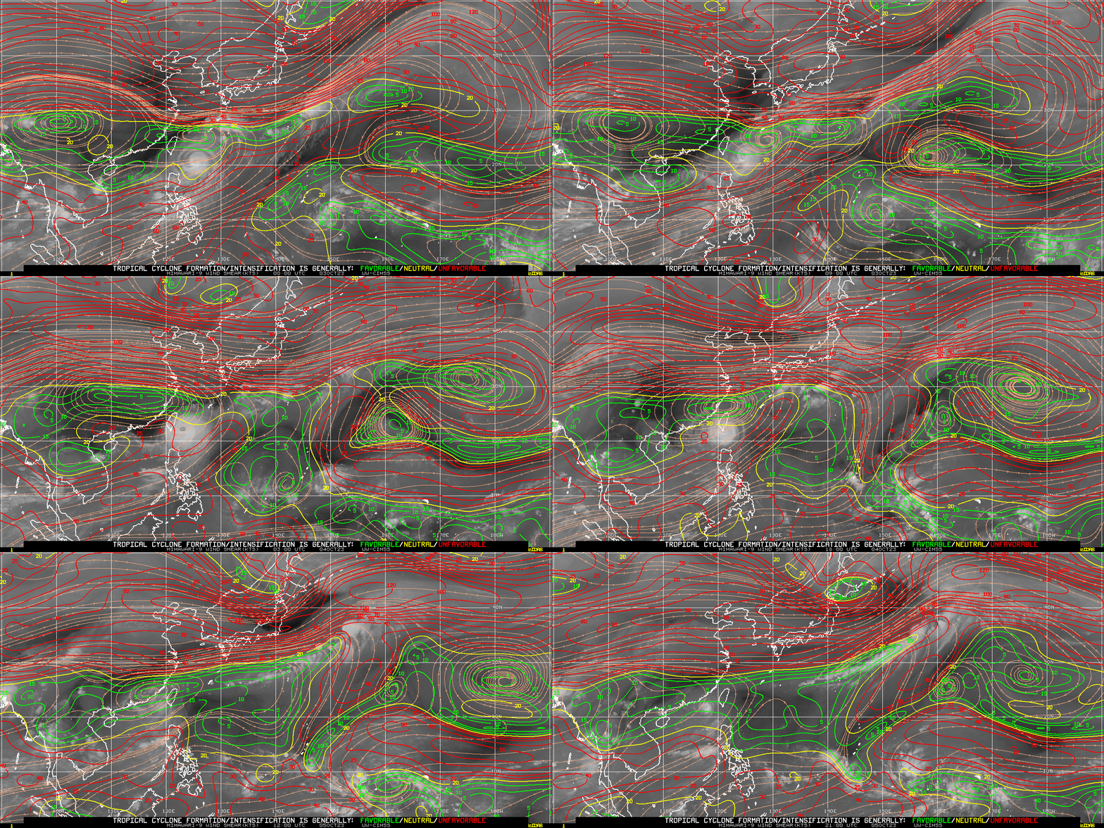
Moisture and a cyclonic circulation can mean that a storm is present. For a tropical cyclone to develop and strengthen, low values of vertical wind shear are also required. A wind shear analysis from 0000 UTC on 3 October to 2100 UTC on 5 October, showing wind shear fields from the SSEC/CIMSS Tropical Weather website, below, shows a band of low shear values between the Equator and 10oN Latitude between 150oE Longitude and the Dateline. Low shear values, abundant moisture, and a cyclonic circulation all co-located over the warm waters of the tropical Pacific all suggest a storm might develop.


