Typhoon Koinu reaches Category 4 intensity as it approaches Taiwan
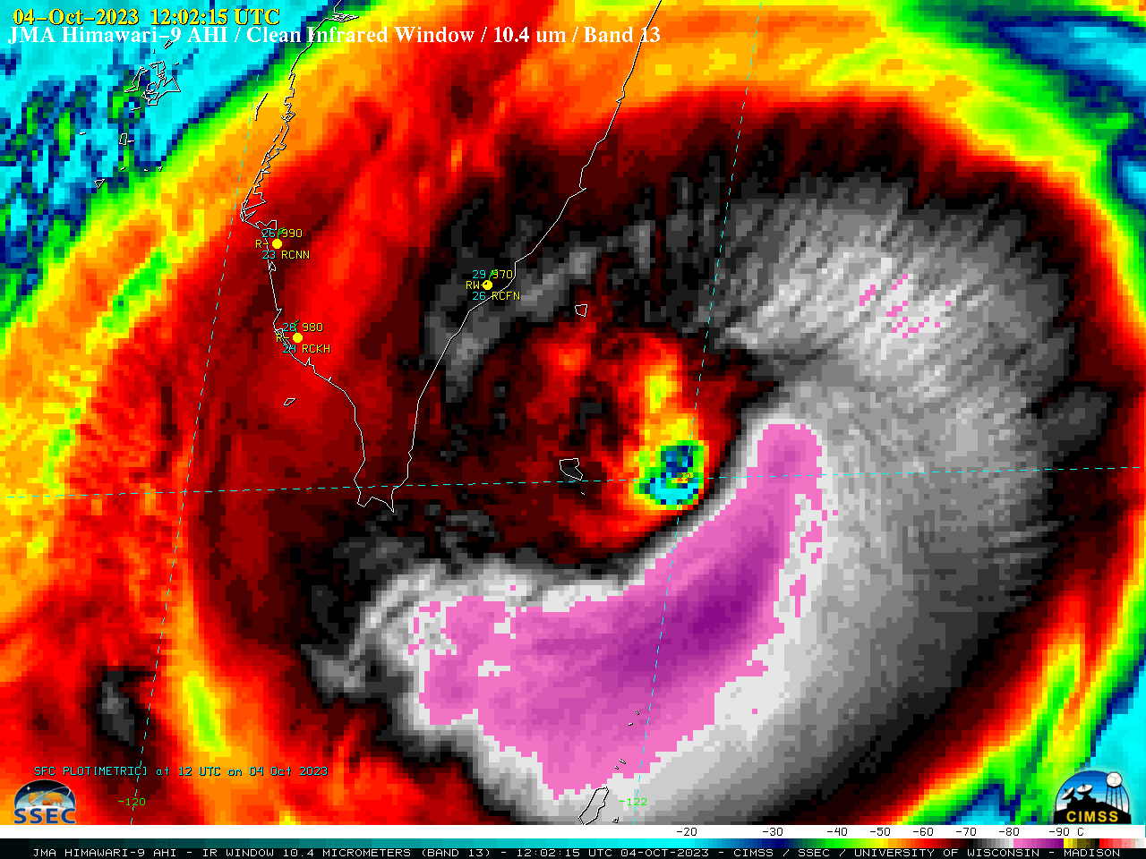
JMA Himawari-9 Clean Infrared Window (10.4 µm) images, from 0602 UTC to 2347 UTC [click to play animated GIF | MP4]
Target Sector (2.5-minute interval) JMA Himawari-9 AHI Clean Infrared Window (10.4 µm) images (above) showed Typhoon Koinu after it reached Category 4 intensity at 0600 UTC (SATCON) on 04 October 2023. The coldest cloud-top infrared brightness temperatures (-80 to -89C, shades of violet to purple) were generally confined to the southern semicircle of the storm. A faster animation (GIF | MP4) revealed a bit of trochoidal motion (wobble) to Koinu’s eye.
Even though Koinu was traversing an area of warmer water (Sea Surface Temperature | Ocean Heat Content), it was moving through an environment of increasing deep-layer wind shear (source). The general satellite presentation began to deteriorate — with the eye becoming more cloud-filled — as it approached the far southern tip of Taiwan, making landfall around 2332 UTC.
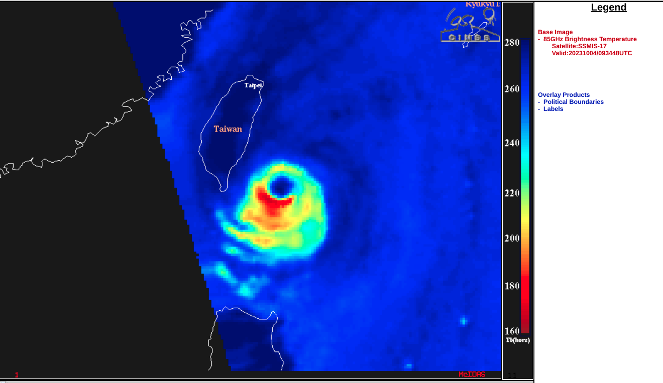
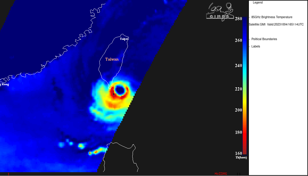
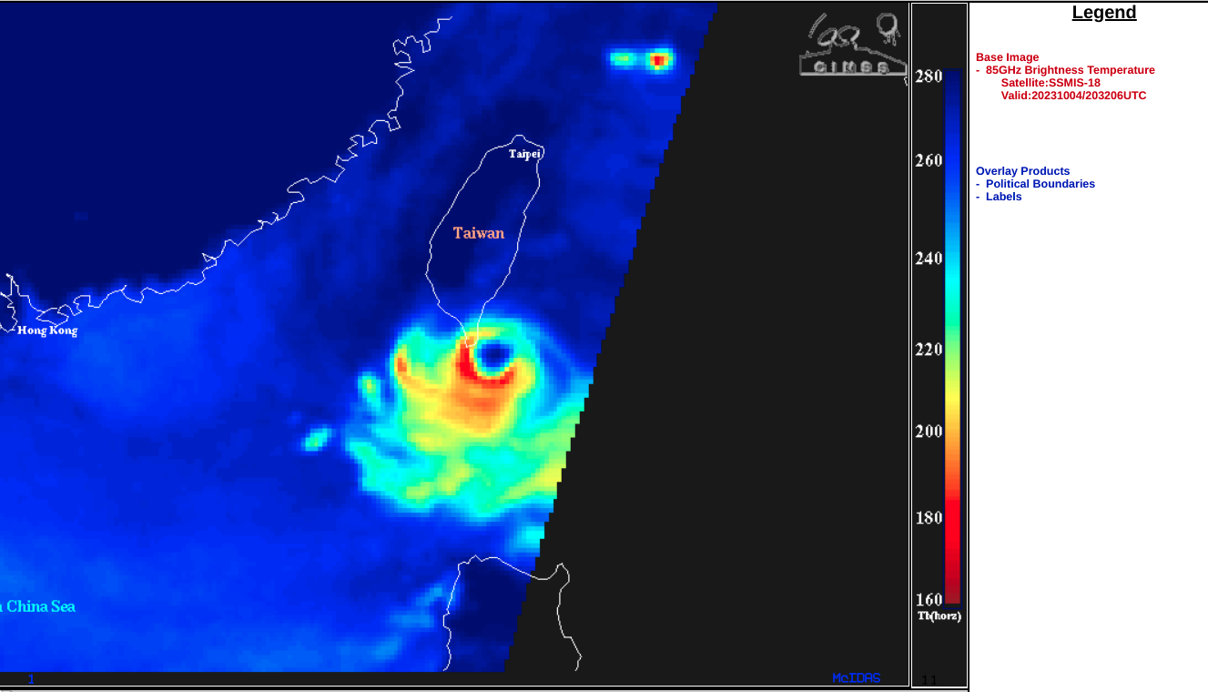
Microwave (85 GHz) images from DMSP and GMI satellites (below) provided 3 views of the evolving eyewall structure at 0934 UTC, 1651 UTC and 2032 UTC.
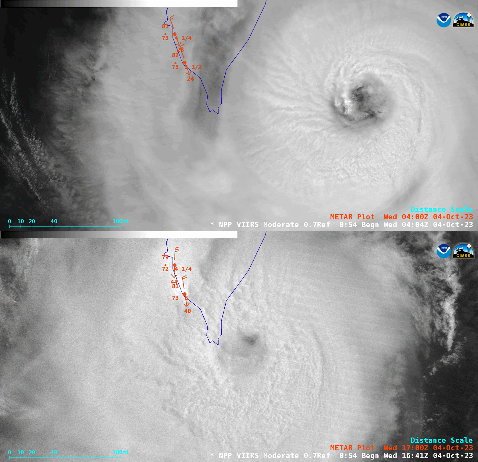
A toggle between daytime (0450 UTC) and nighttime (1719 UTC) Suomi-NPP VIIRS Day/Night Band (0.7 µm) images (below) also showed that Koinu’s eye became more cloud-filled during that 12-hour period.
It is worth noting that the eye of Koinu passed directly over Orchid Island around 1334 UTC — where an unconfirmed wind gust of 213 mph (95.2 m/s) was measured at the Lanyu Weather Station within the rear eyewall at 1351 UTC.


