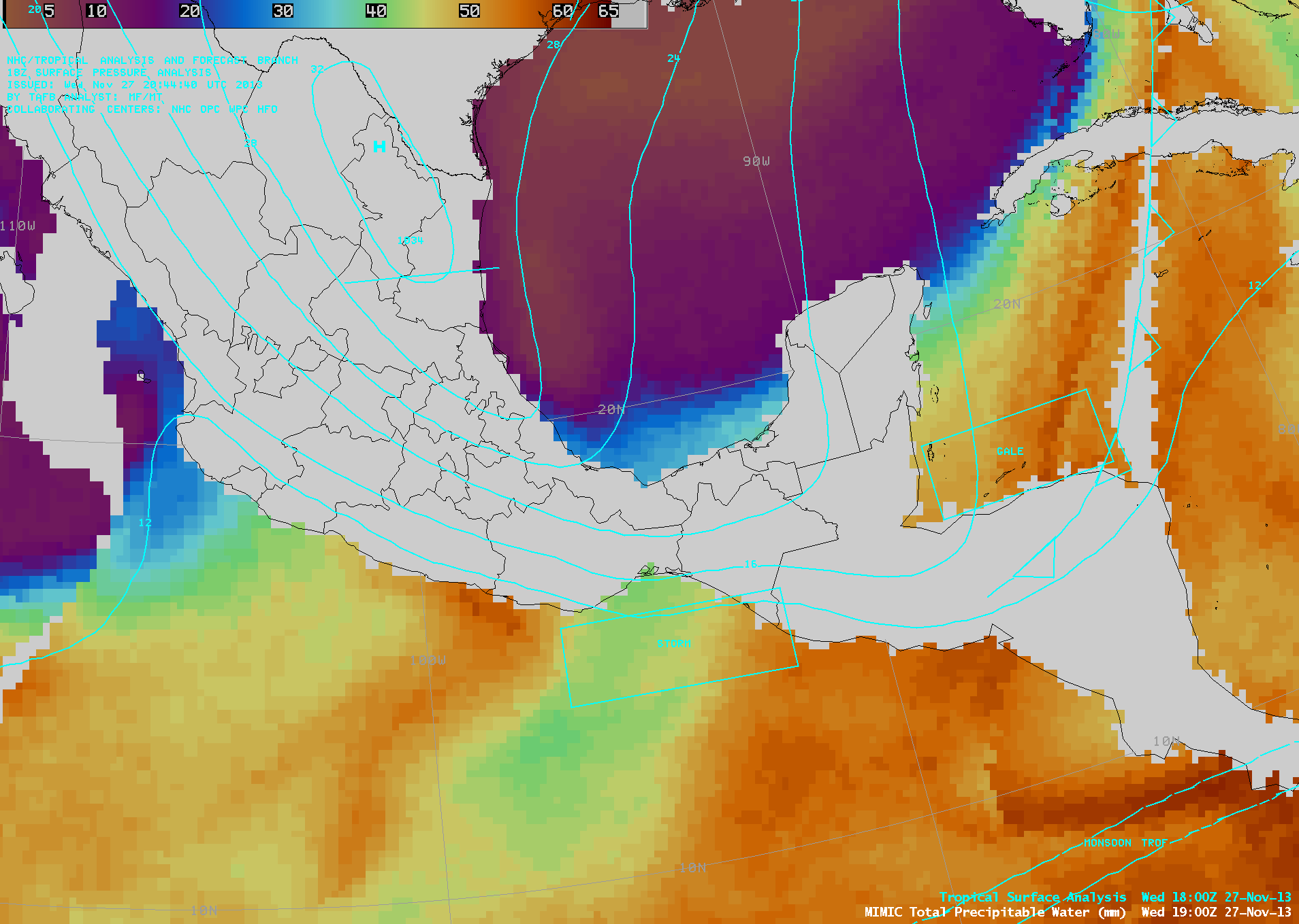
Tehuano wind event
An AWIPS-1 image of GOES-13 6.5 µm water vapor channel data (above) showed a large storm that was affecting much of the eastern US during the 26 November – 27 November 2013 period. Arctic air surging... Read More
An AWIPS-1 image of GOES-13 6.5 µm water vapor channel data (above) showed a large storm that was affecting much of the eastern US during the 26 November – 27 November 2013 period. Arctic air surging... Read More
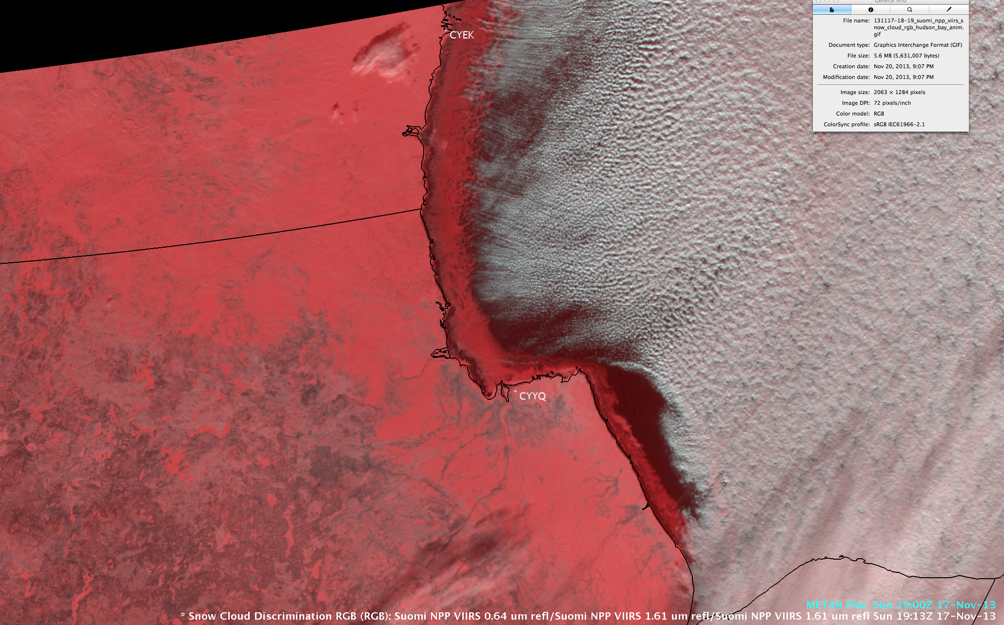
AWIPS II images of 375-meter resolution Suomi NPP VIIRS 0.64 µm visible channel data (above) showed the growth of new ice immediately offshore in the northwestern portion of Hudson Bay, Canada during the 17 November – Read More
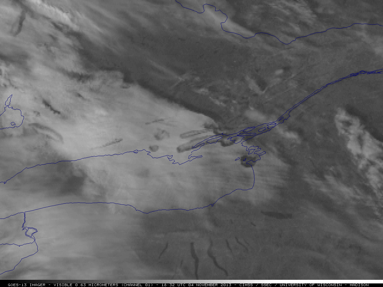
Hat tip to NWS Buffalo NY forecasters Jon Hitchcock and David Zaff for letting us know about a number of aircraft dissipation trails (also known as “distrails” or “hole punch clouds”) over the Lake Ontario region on 04 November... Read More
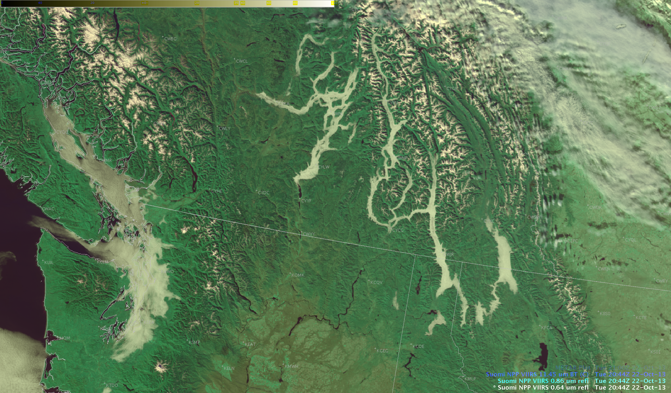
A strong upper-level ridge of high pressure coupled with a moist, stagnant boundary layer led to the formation of widespread areas of fog for several days across much of the interior lowlands of western British Columbia and Washington State, along with valley fog in the Rocky Mountains farther to the... Read More
