Persistent fog in British Columbia and the Pacific Northwest region of the US
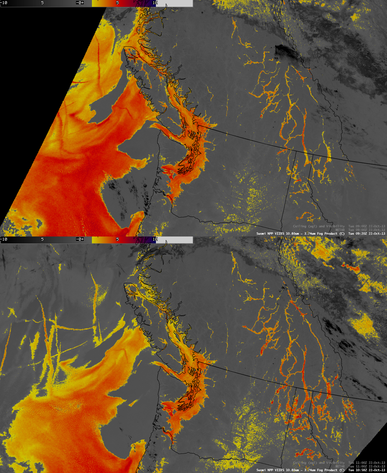
A strong upper-level ridge of high pressure coupled with a moist, stagnant boundary layer led to the formation of widespread areas of fog for several days across much of the interior lowlands of western British Columbia and Washington State, along with valley fog in the Rocky Mountains farther to the east (as was documented during 21 October 2013 on the GOES-R Fog Product Examples blog). On 22 October 2013, two consecutive Suomi NPP VIIRS IR brightness temperature difference (BTD) “fog/stratus product” images (above) at 09:20 UTC (2:20 AM local time) and 10:58 UTC (3:58 AM local time) showed little change to the areal coverage of the fog/stratus located over the Puget Sound region and adjacent interior lowlands, but a significant growth of narrow fingers of valley fog from eastern British Columbia southward into far northern Washington, Idaho, and Montana.
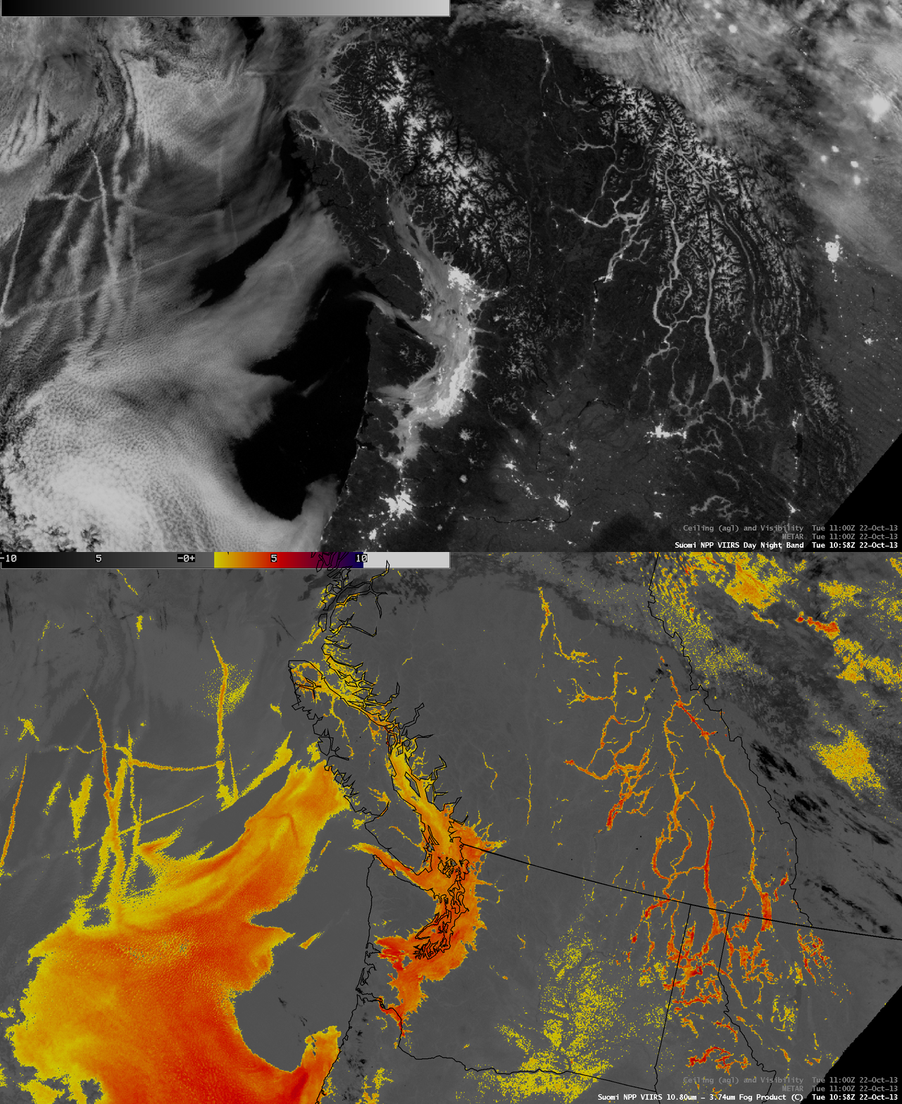
A comparison of the 10:58 UTC VIIRS 0.7 µm Day/Night Band (DNB) image with the corresponding IR BTD fog/stratus product image (below) showcased the “visible image at night” capability of the Day/Night Band, given sufficient illumination by the Moon (which was in the Waning Gibbous phase, at 84% of Full). Not only are the fog (and other cloud) features evident in the DNB image, but the snow-covered higher elevations of the Rocky Mountains could also be seen. A number of ship tracks also appear over the Pacific Ocean in the far western portion of the satellite scene.
A post-sunrise sequence of GOES-15 (GOES-West) 0.63 µm visible channel images (below; click image to play animation) revealed that many of the fog features were very persistent and slow to dissipate — a strong boundary layer temperature inversion and light winds inhibited the rate of fog burn-off in those areas.
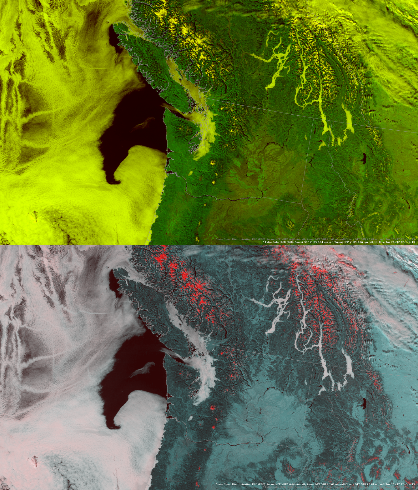
A comparison of two different AWIPS II false-color Red/Green/Blue (RGB) images (below) using VIIRS data at 20:44 UTC (1:44 PM local time) showed the value of using the 1.61 µm “snow/ice” channel to discriminate between snow cover (which appears as varying shades of red) and any fog, stratus, or other cloud features composed of water droplets (which appear as varying shades of white) in the area.
One other feature of interest can be seen on the VIIRS RGB images: in the far upper right corner, a pair of narrow aircraft dissipation trails (or “distrails”) can be seen within the broader band of mid-level supercooled water droplet clouds. As aircraft ascended (or descended) through the supercooled water droplet cloud layer, particles in the jet engine exhaust acted as ice condensation nuclei, causing thin streaks of the cloud to glaciate (hence their red appearance on the RGB image using the 1.61 µm VIIRS data) along the aircraft path. From the ground, these aircraft dissipation trails often appear as dramatic-looking “cirrus fall streaks”, as the larger, heavier ice crystals begin to descend from the supercooled cloud layer.


