Ice forming in Hudson Bay, Canada
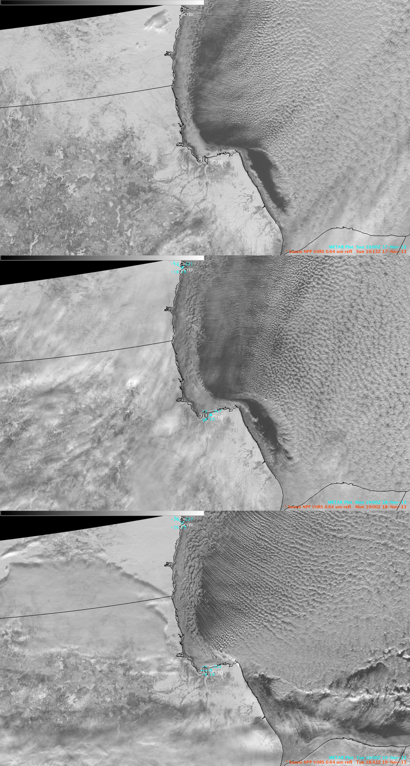
AWIPS II images of 375-meter resolution Suomi NPP VIIRS 0.64 µm visible channel data (above) showed the growth of new ice immediately offshore in the northwestern portion of Hudson Bay, Canada during the 17 November – 19 November 2013 time period. The northwesterly flow of cold arctic air in the Arviat, Nunavut (station identifier CYEK) region was also producing well-defined cloud streets over the open waters of Hudson Bay.
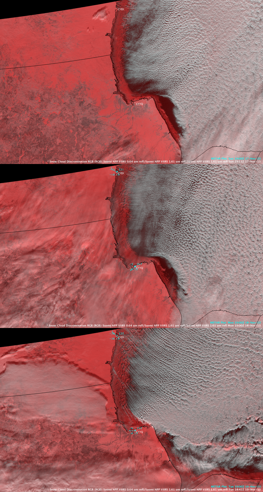
The corresponding false-color “Snow Cloud Discrimination” Red/Green/Blue (RGB) images (below) confirmed that the brighter white nearshore features seen on the visible images were ice — ice and snow cover appear as shades of red on the RGB images, in contrast to supercooled water droplet clouds which appear as varying shades of white.
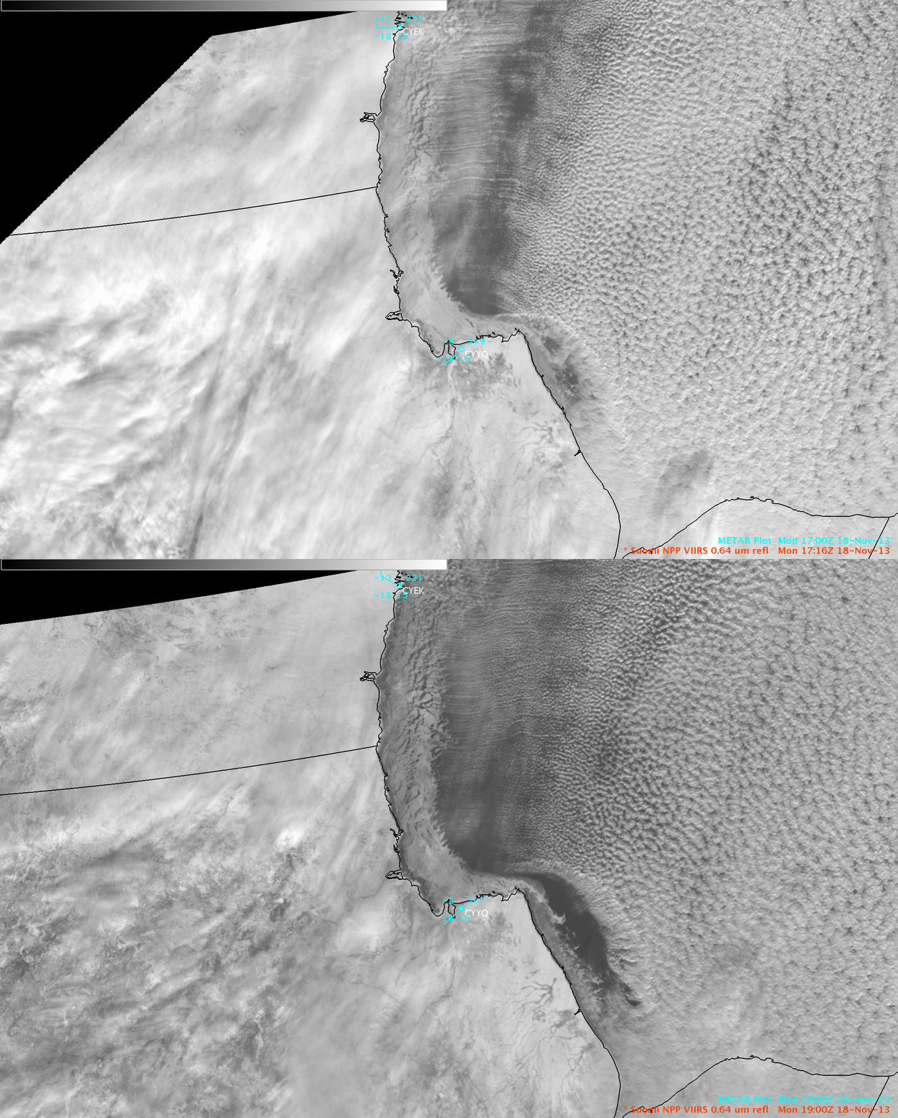
On 18 November, a significant amount of young pack ice motion can be seen in the 104-minute period between the 17:16 UTC and 19:00 UTC VIIRS visible images (below).
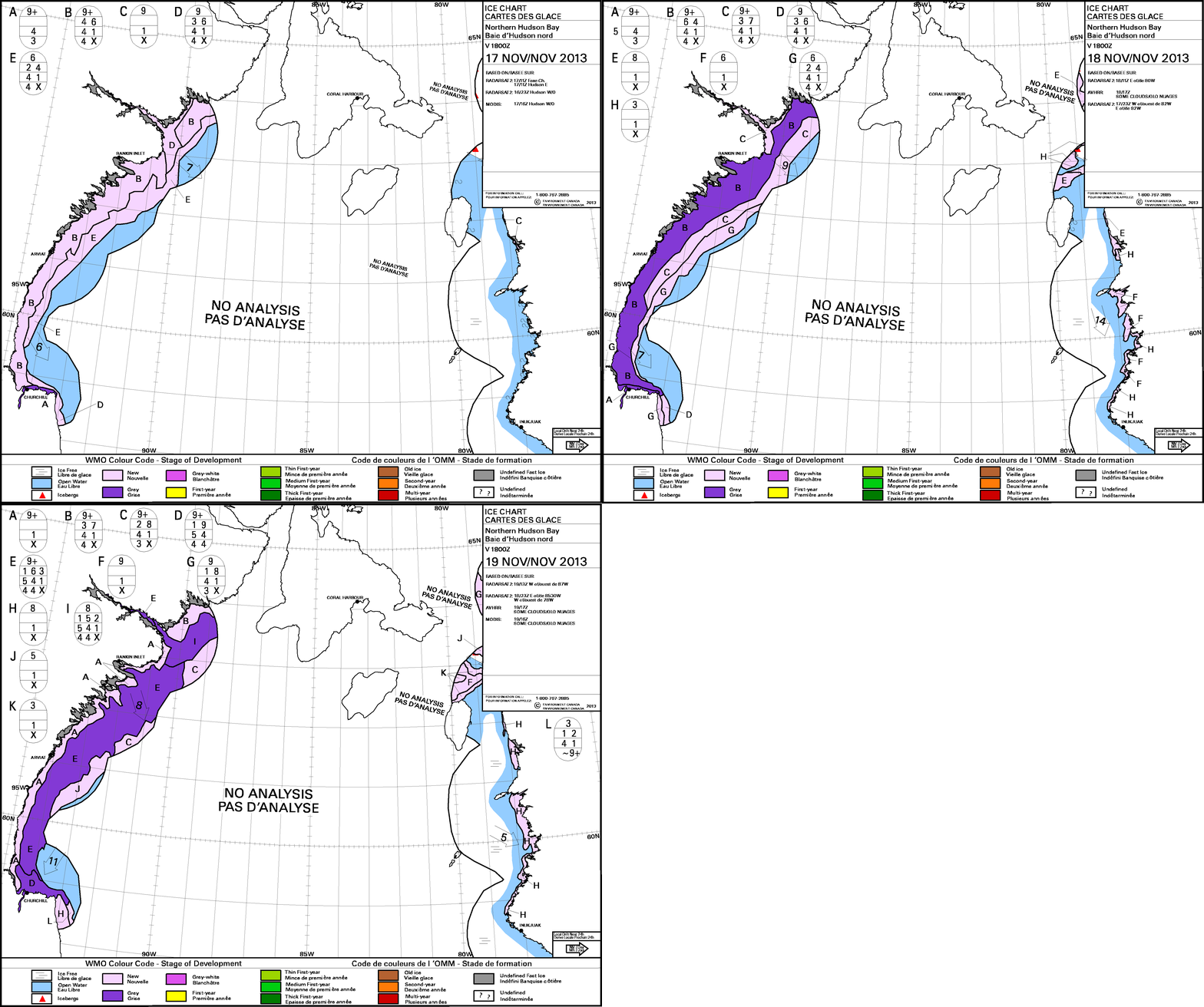
Daily “stage of development” ice analyses from the Canadian Ice Service are shown below.


