Hail-Producing storm over the Texas Hill Country
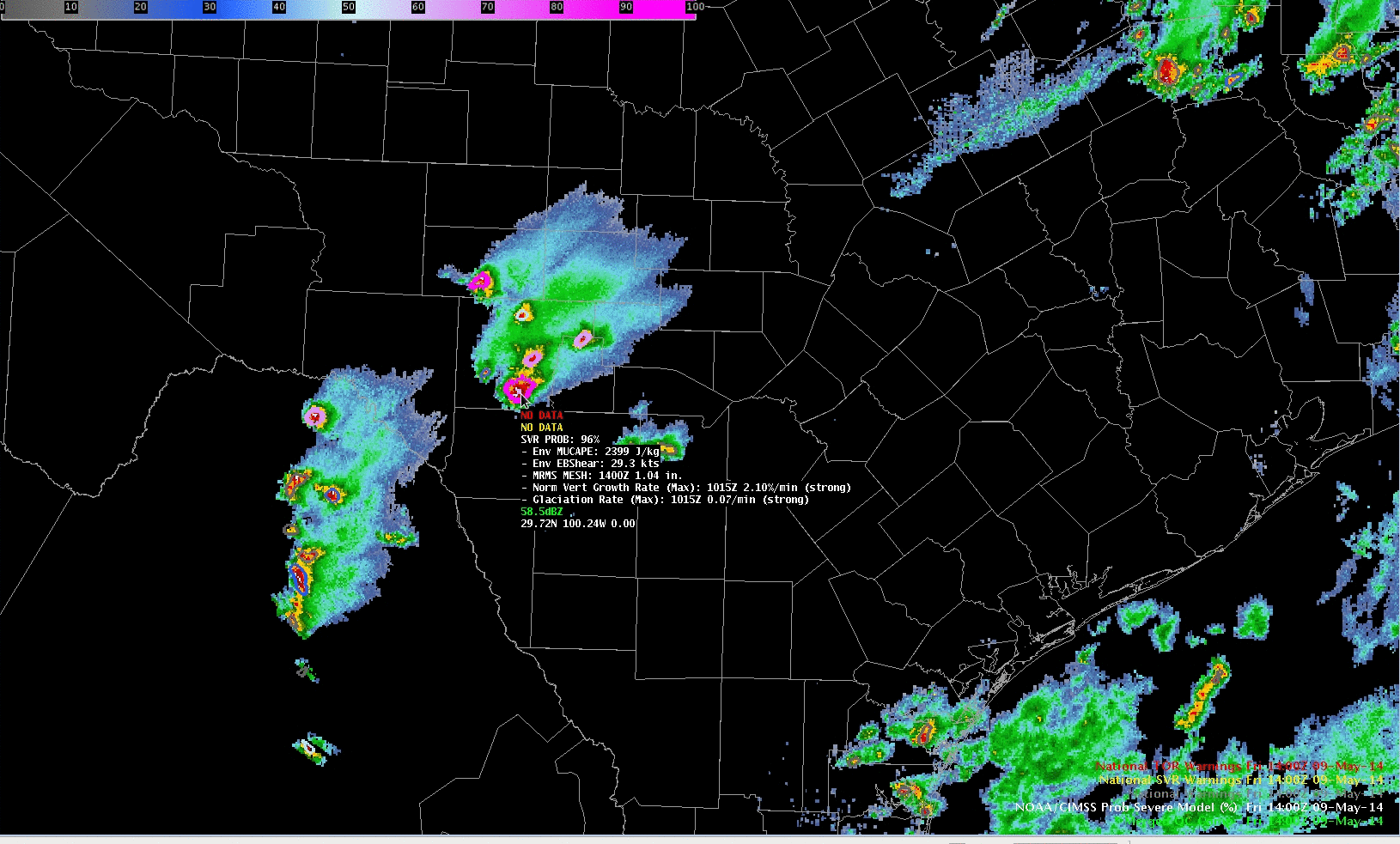
A hail-producing storm (cick here for Storm reports from SPC) moved through Edwards, Real and Bandera counties of Texas after sunrise on May 9th. This storm gives a nice opportunity to compare ProbSevere and GOES-14 SRSO-R depictions of a severe storm. The 1400 UTC image, above, shows ProbSevere > 95%,... Read More
