Hurricane Earl produces a low-level outflow boundary
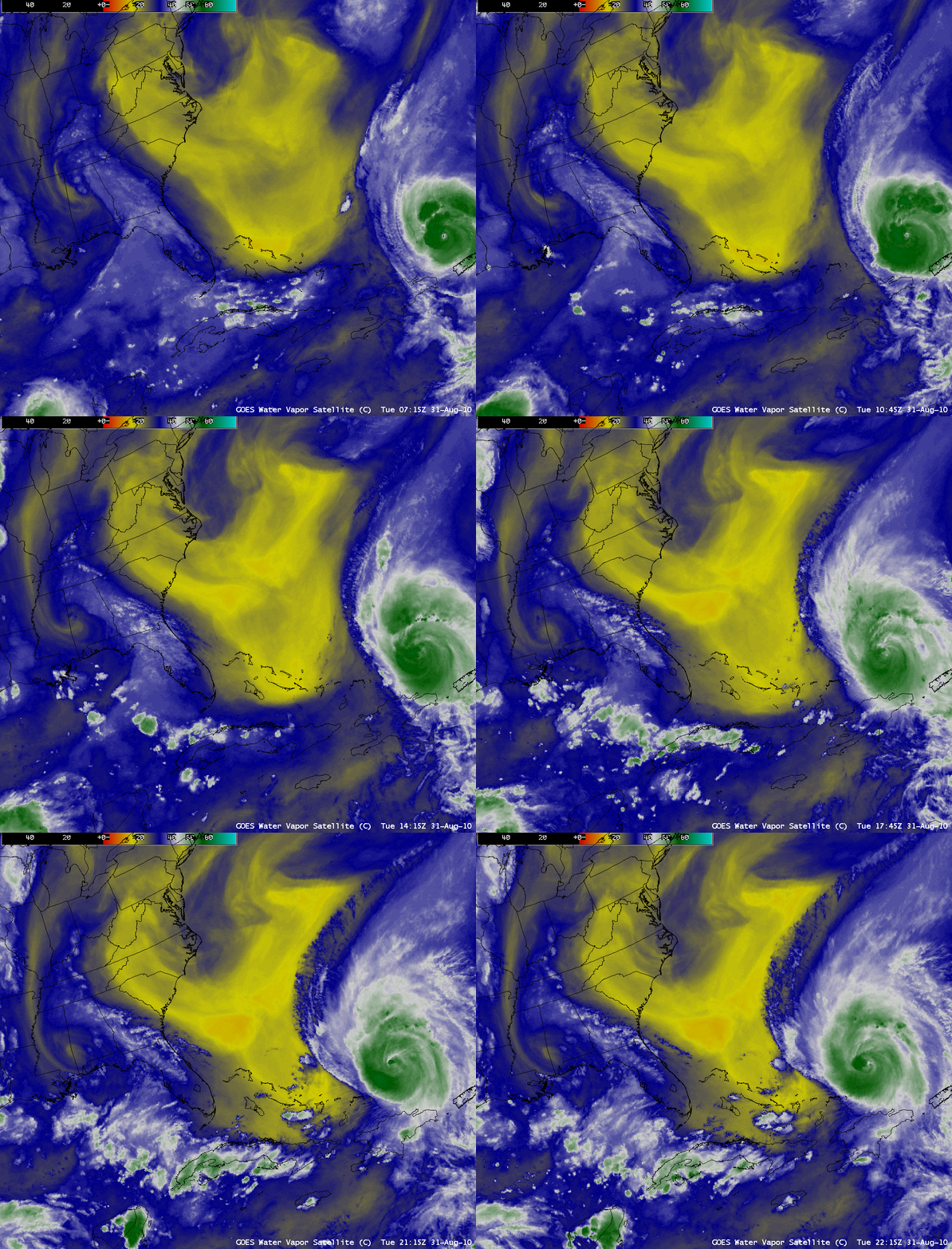
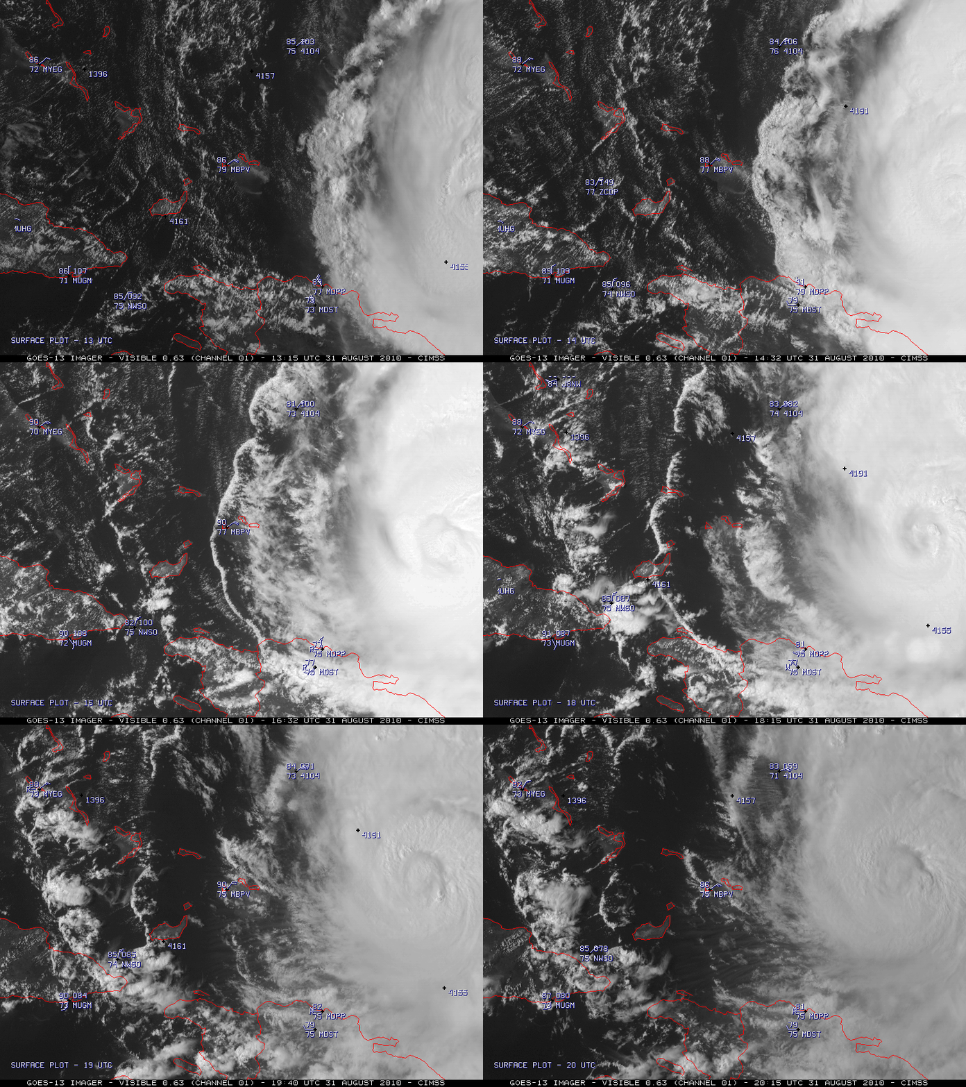
Evidence of a large region of mid-tropospheric dry air on AWIPS images of GOES-13 6.5 µm “water vapor channel” data (above; also available as a QuickTime movie) in tandem with an increase in southwesterly deep layer wind shear was helping to erode the upper level cloud canopy over the western portion of Category 4 Hurricane Earl — this allowed a well defined low-level outflow boundary to be seen on McIDAS images of GOES-13 0.63 µm visible channel data (below; also available as a QuickTime movie) on 31 August 2010.
It is also interesting to note the westward-propagating “shock waves” that were emanating from Hurricane Earl, which could be seen on the water vapor imagery in the dry region (denoted by the predominantly yellow color enhancement) over the western Atlantic Ocean.
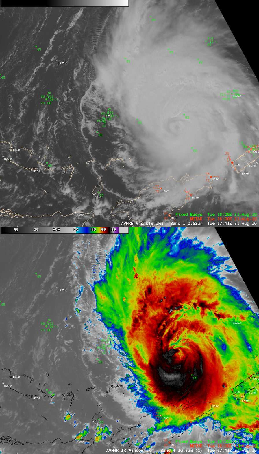
A comparison of AWIPS images of the POES AVHRR 0.63 µm visible and 10.8 µm IR channel data (below) seemed to support the fact that this was indeed a low-level feature, with the narrow cloud band of the outflow boundary feature exhibiting fairly warm IR brightness temperatures of 0º to +5º C.
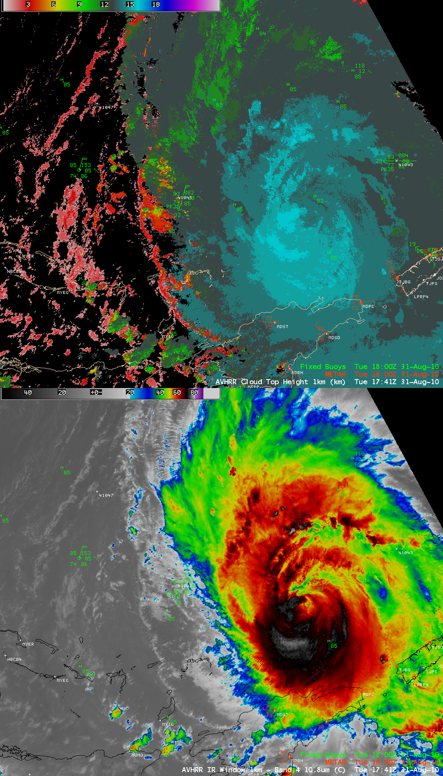
The POES AVHRR Cloud Top Height (CTH) product (below) gave maximum CTH values of 3-4 km (red color enhancement) for the outflow boundary feature — maximum CTH values near the center of Hurricane Earl were around 16 km (cyan color enhancement).
Further confirmation that this was a low-level feature was provided by an examination of the AVHRR Cloud Type product (below), which indicated that the narrow outflow boundary cloud band was composed of water droplets (cyan color enhancement).


