Nopiming Provincial Park Wildfire in Manitoba produces multiple pyrocumulonimbus clouds
1-minute GOES-19 Red Visible (0.64 µm) images with an overlay of the Fire Mask derived product, from 1501 UTC on 13 May to 0100 UTC on 14 May [click to play MP4 animation]
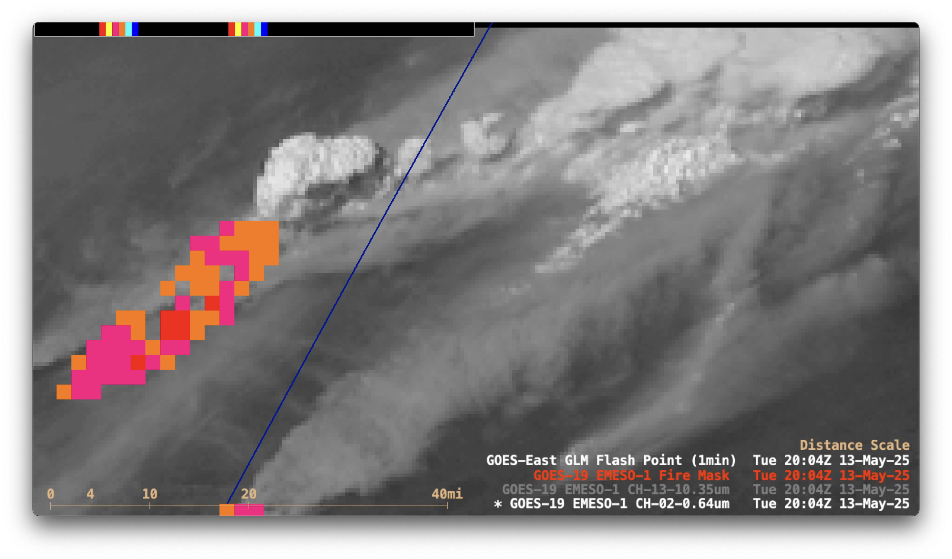
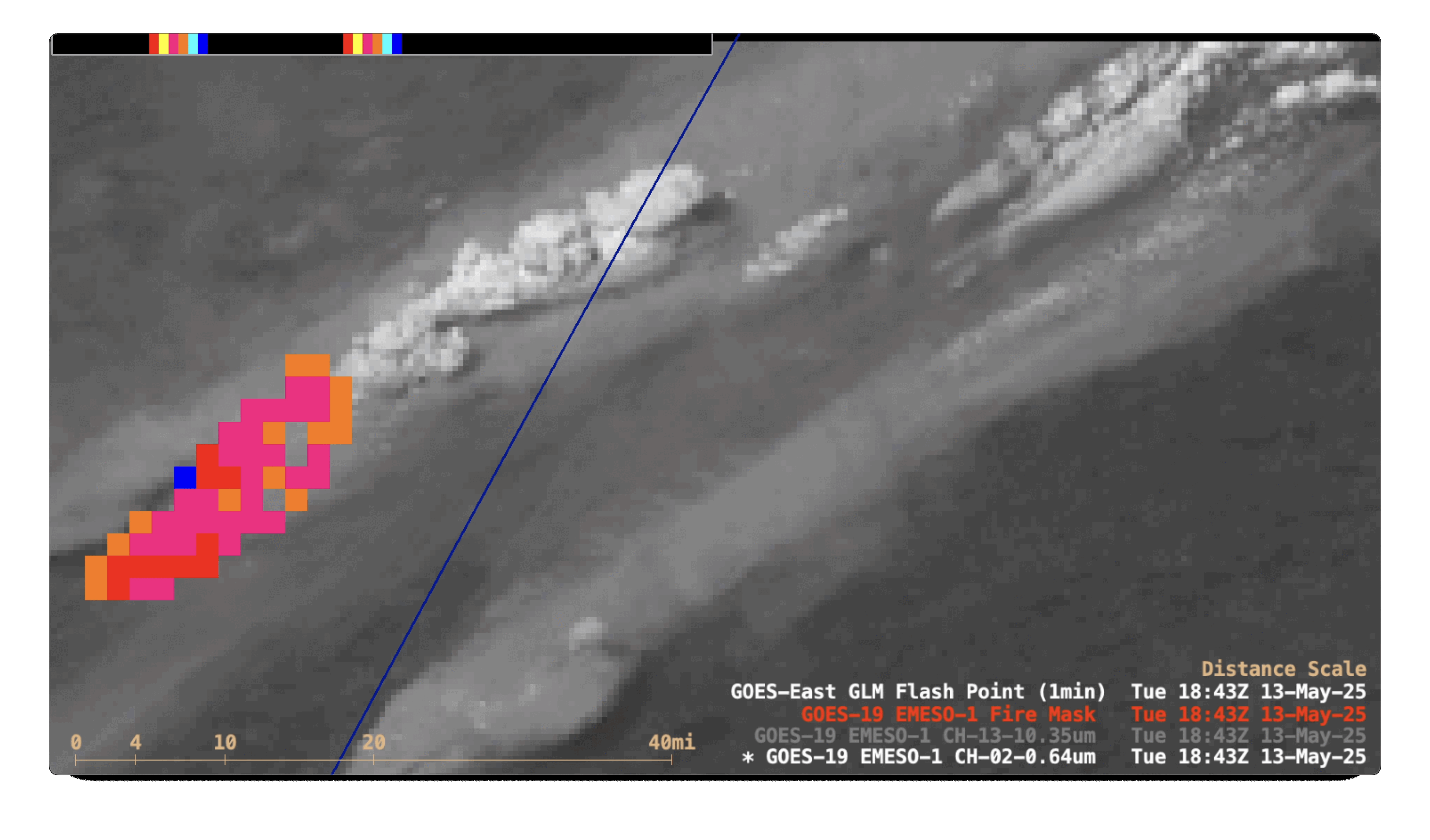
1-minute Mesoscale Domain Sector GOES-19 (GOES-East) Visible (0.64 µm) with an overlay of the FDCA Fire Mask derived product (above) showed the large thermal anomaly associated with a wildfire in the Nopiming Provincial Park (located just west of the Manitoba/Ontario border) as it made a rapid northeastward run of ~20 miles on 13 May 2025 — and also displayed the periodic bursts of pyrocumulus clouds that began shortly after 1800 UTC.
The corresponding 1-minute GOES-19 Infrared images (below) indicated that many of these pyrocumulus clouds eventually exhibited cloud-top 10.3 µm brightness temperatures of -40ºC (dark blue enhancement) or colder — a necessary condition to be classified as pyrocumulonimbus (pyroCb). This large wildfire generated a series of at least 8 pyroCb clouds from 1843 UTC on 13 May to 0007 UTC on 14 May.
1-minute GOES-19 Clean Infrared Window (10.3 µm) images with an overlay of the Fire Mask derived product, from 1501 UTC on 13 May to 0100 UTC on 14 May [click to play MP4 animation]
1-minute GOES-19 GeoColor RGB images with an overlay of Next Generation Fire System (NGFS) Fire Detection polygons (below) also showed the rapid northeastward run of the Nopiming Fire during the day. In addition, to the southwest of the large Nopiming Fire a NGFS thermal signature of the smaller Lac du Bonnet Fire was apparent — that wildfire was unfortunately responsible for 2 fatalities.
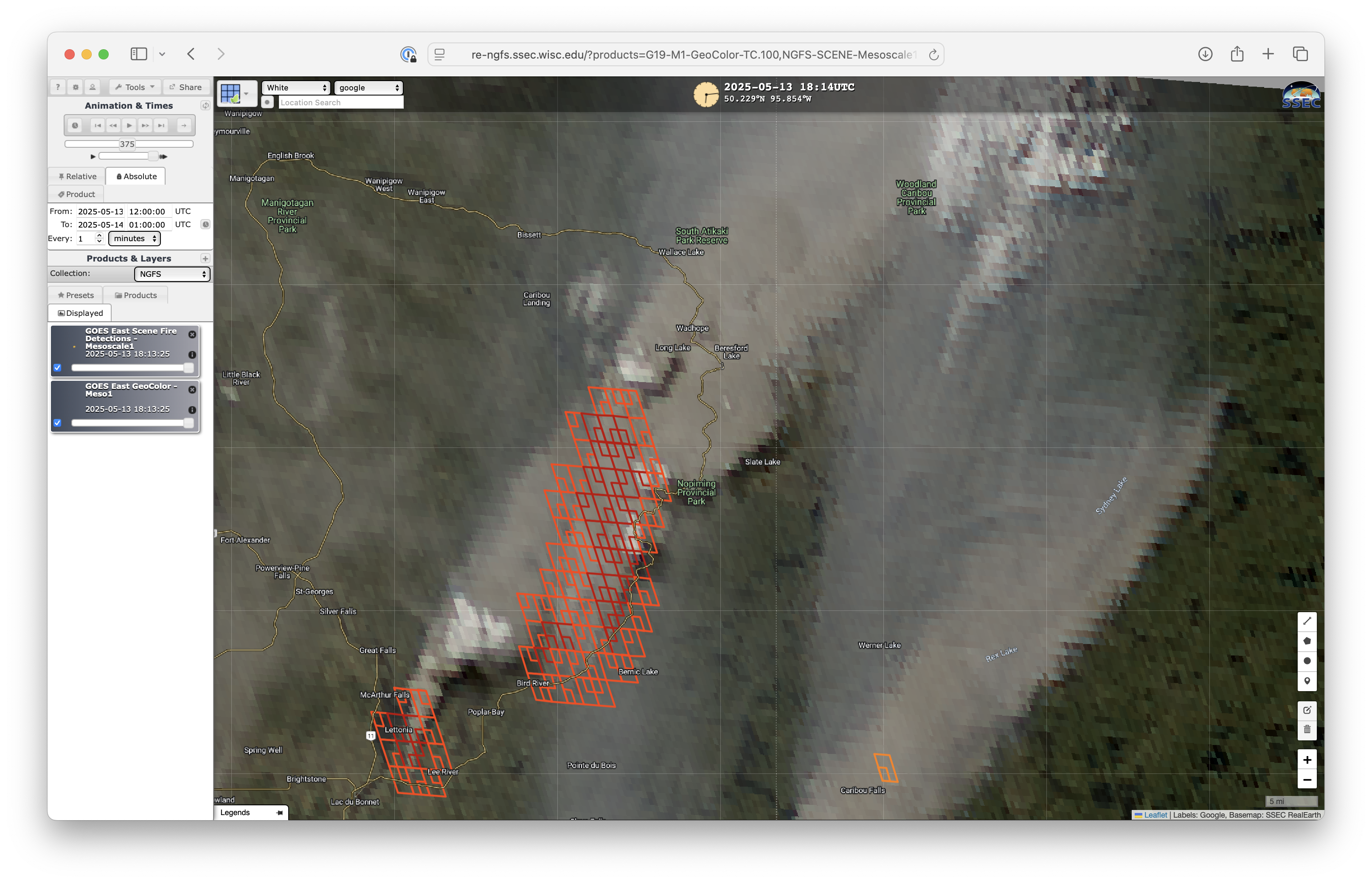
1-minute GOES-19 GeoColor RGB images with an overlay of NGFS Fire Detection polygons, from 1200 UTC on 13 May to 0100 UTC on 14 May [click to play MP4 animation]
Toggles between VIIRS True Color RGB and False Color RGB images from Suomi-NPP and NOAA-20 (as visualized using RealEarth) are shown below. Brighter-white pyrocumulus and pyroCb clouds were seen rising above the wildfire smoke in both the True Color RGB and False Color RGB images; active fires appeared as brighter shades of pink in the False Color RGB images.
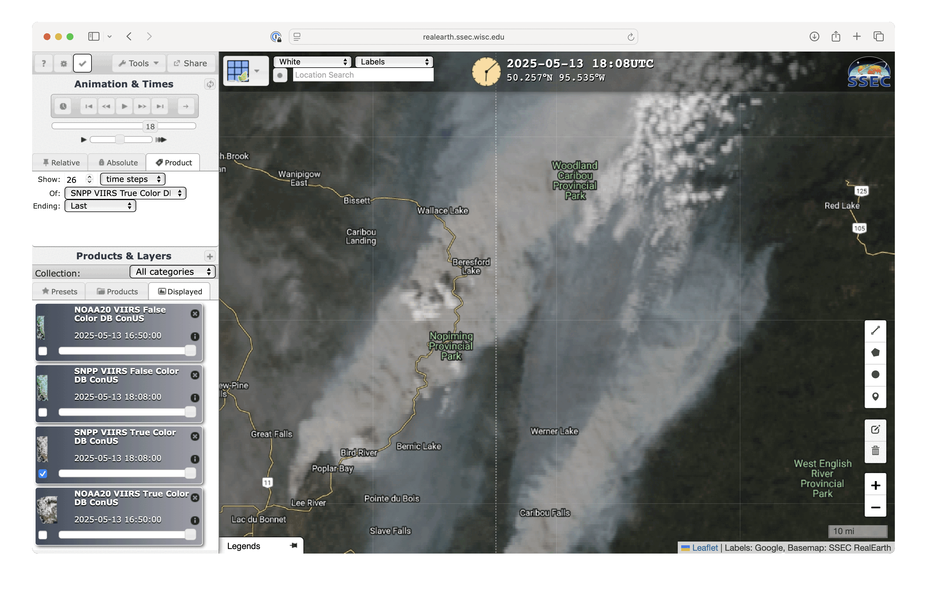
Suomi-NPP VIIRS True Color RGB and False Color RGB images valid at 1825 UTC on 13 May [click to enlarge]
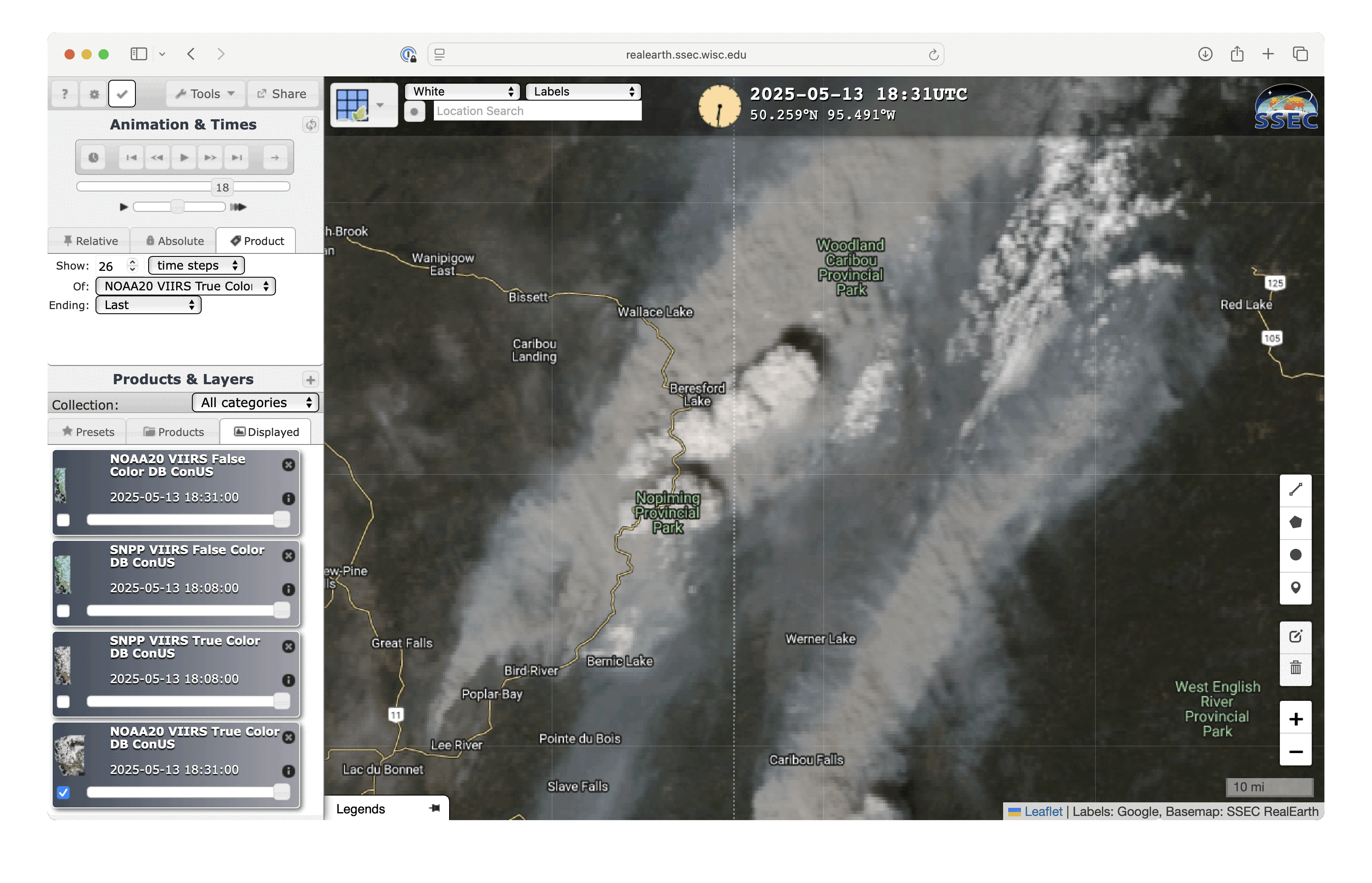
NOAA-20 VIIRS True Color RGB and False Color RGB images valid at 1847 UTC on 13 May [click to enlarge]
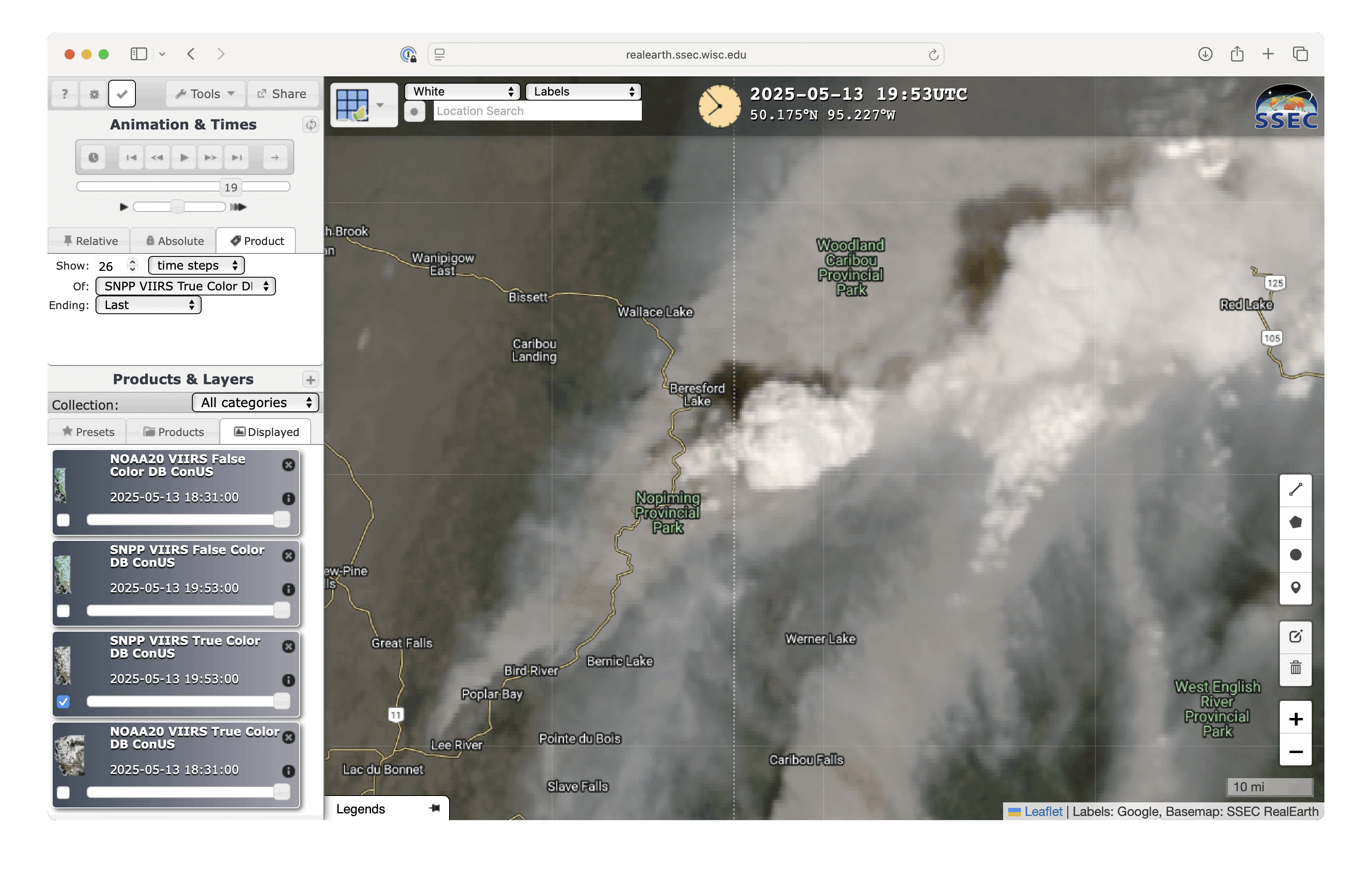
Suomi-NPP VIIRS True Color RGB and False Color RGB images valid at 2006 UTC on 13 May [click to enlarge]
A larger-scale view using 10-minute Full Disk scan GOES-19 Infrared images (below) showed several of the pyroCb clouds as they were transported eastward across Ontario — with two of the larger pyroCbs exhibiting cloud-top 10.3 µm brightness temperatures as cold as the -60s C (shades of green).
10-minute GOES-19 Clean Infrared Window (10.3 µm) images with an overlay of the Fire Mask derived product, from 1650 UTC on 13 May to 0100 UTC on 14 May [click to play MP4 animation]
———-
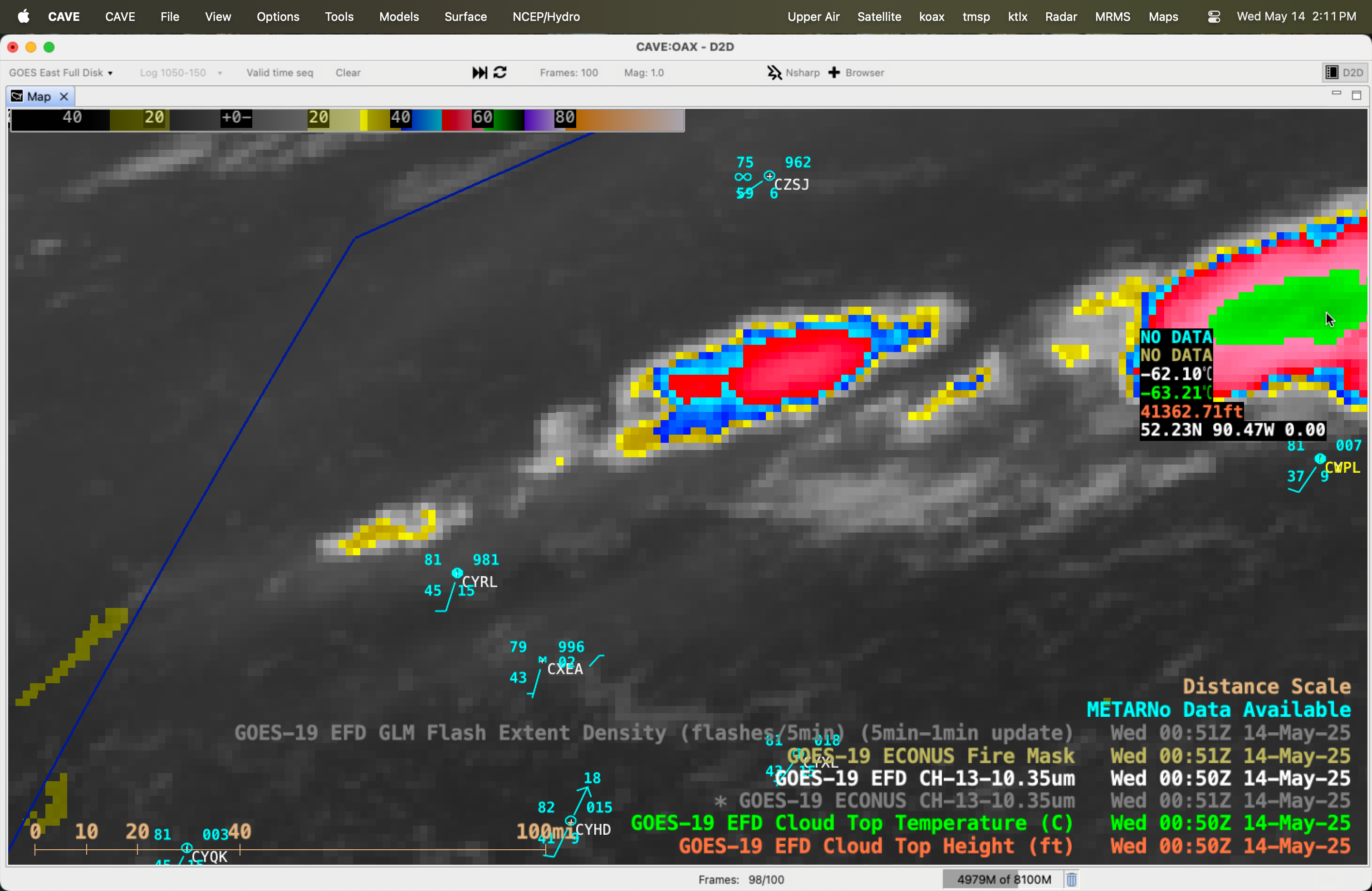
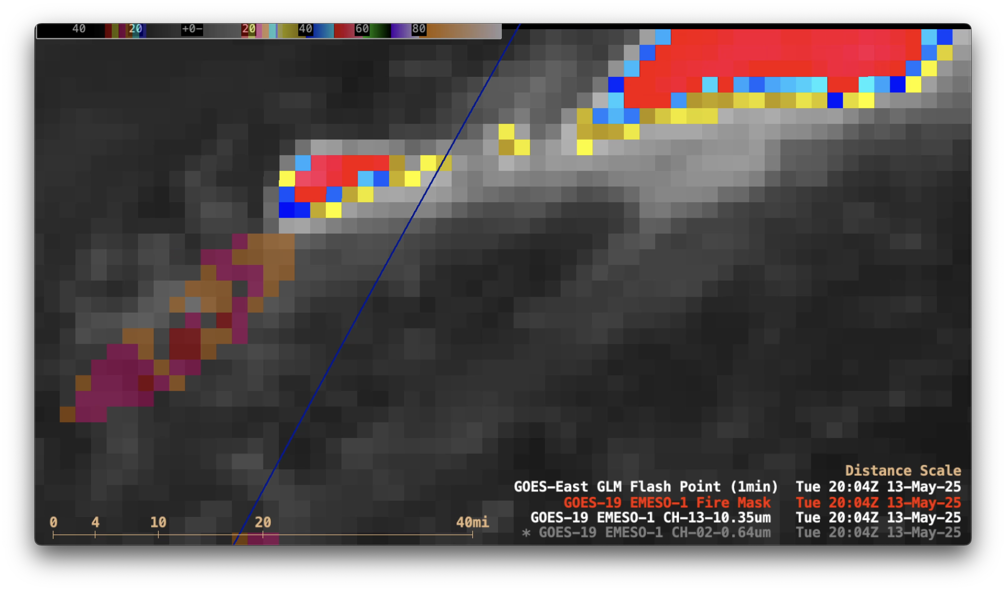
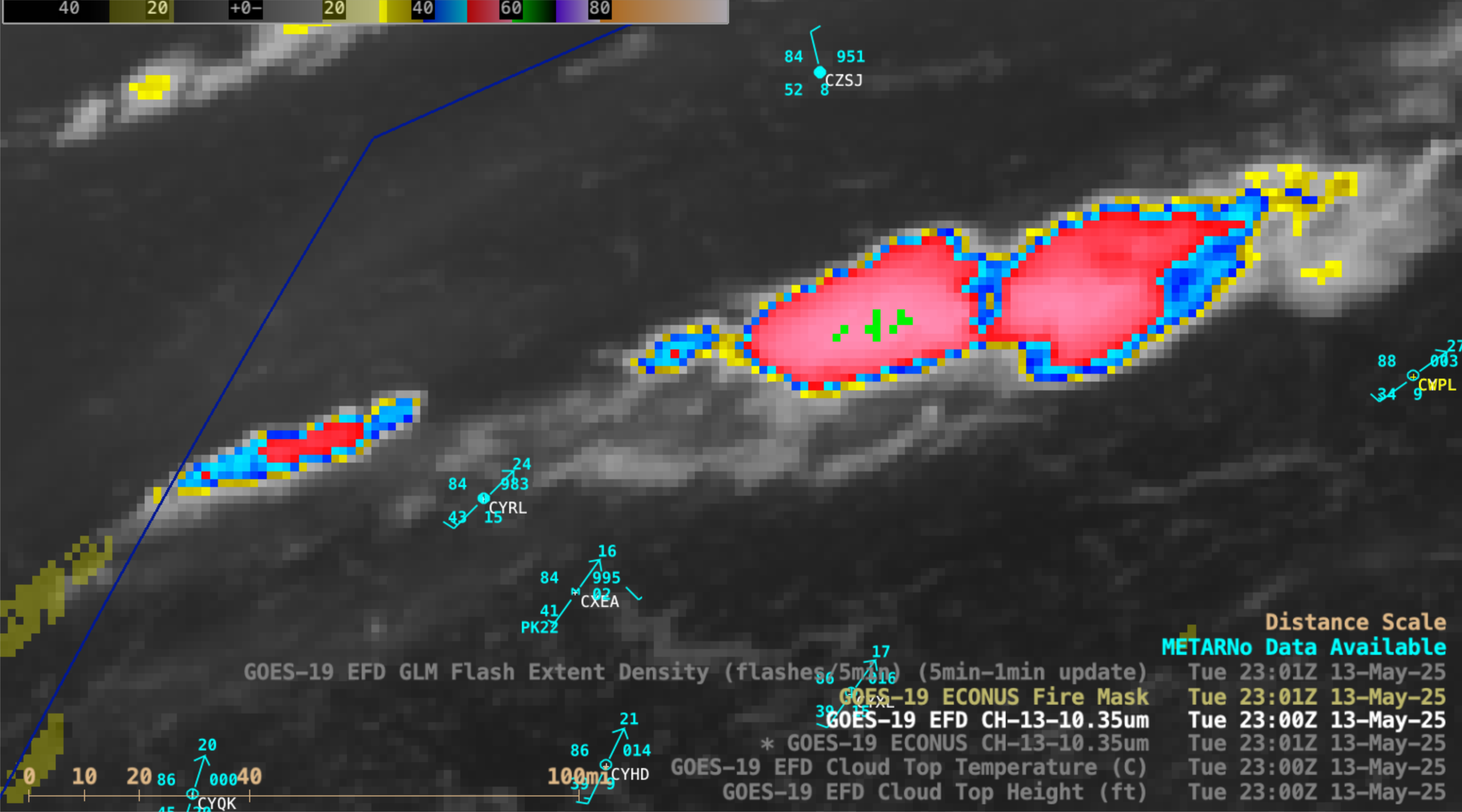
GOES-19 Clean Infrared Window image at 0050 UTC on 14 May, with cursor samples of the 10.3 µm infrared brightness temperature (white), Cloud Top Temperature derived product (green) and Cloud Top Height derived product (orange) at the coldest point of the dominant pyroCb cloud top [click to enlarge]
A cursor sample of the coldest cloud-top pixel of the large pyroCb located north of Pickle Lake, Ontario (CYPL) at 0050 UTC on 14 May (above) displayed a 10.3 µm infrared brightness temperature of -62.1ºC, along with a corresponding Cloud Top Temperature of -63.21ºC and Cloud Top Height of 41362.71 ft (12.6 km) at that pixel location.
Those values of cloud-top temperature and height appeared to be comparable to those of the tropopause on a plot of rawinsonde data from Pickle Lake at 0000 UTC on 14 May (below).
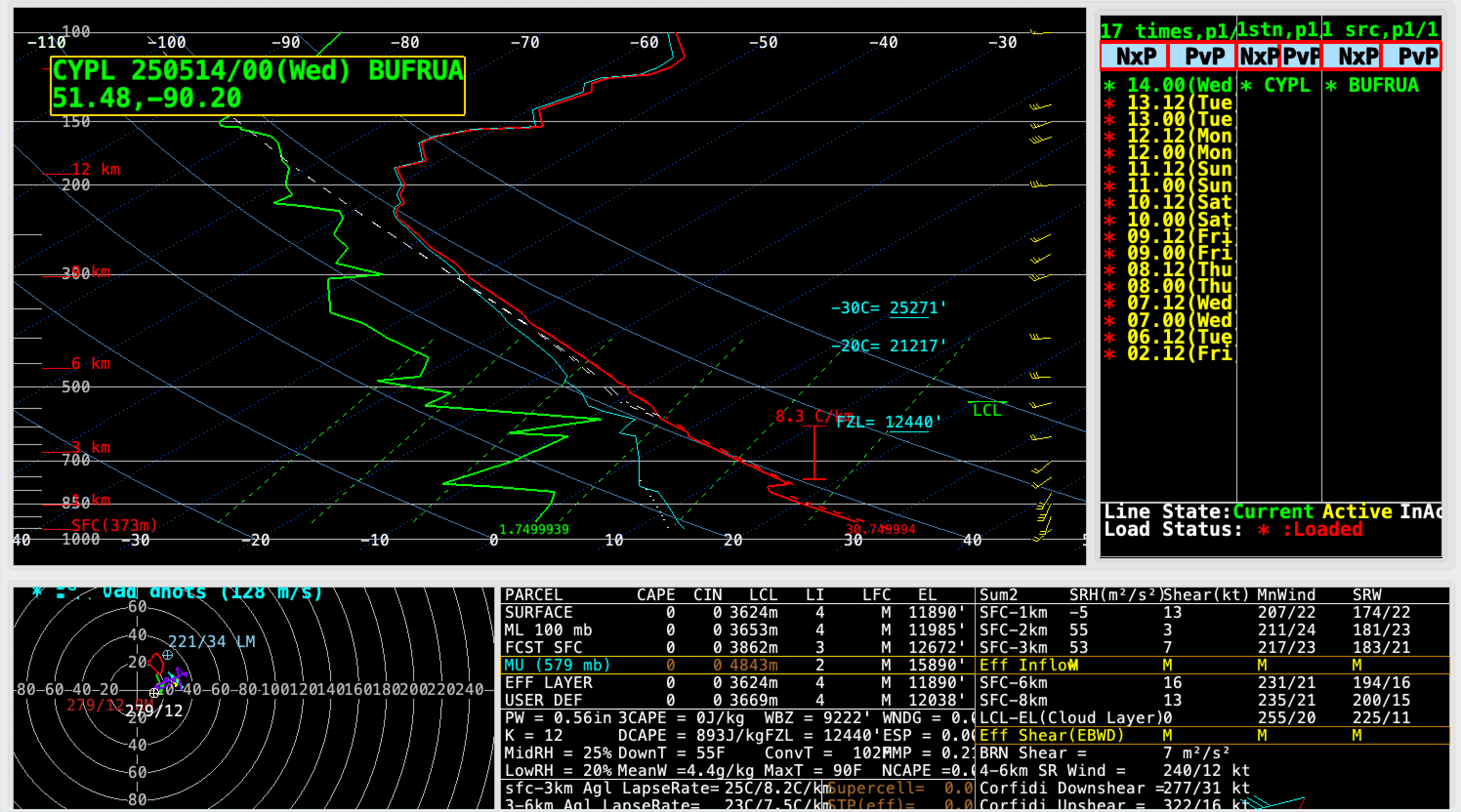
Plot of rawinsonde data from Pickle Lake, Ontario (CYPL) at 0000 UTC on 14 May [click to enlarge]
GOES-19 Infrared images with an overlay of GLM Flash Extent Density (below) revealed that there was a brief 10-minute period of lightning activity with one of the larger pyroCbs over Ontario.
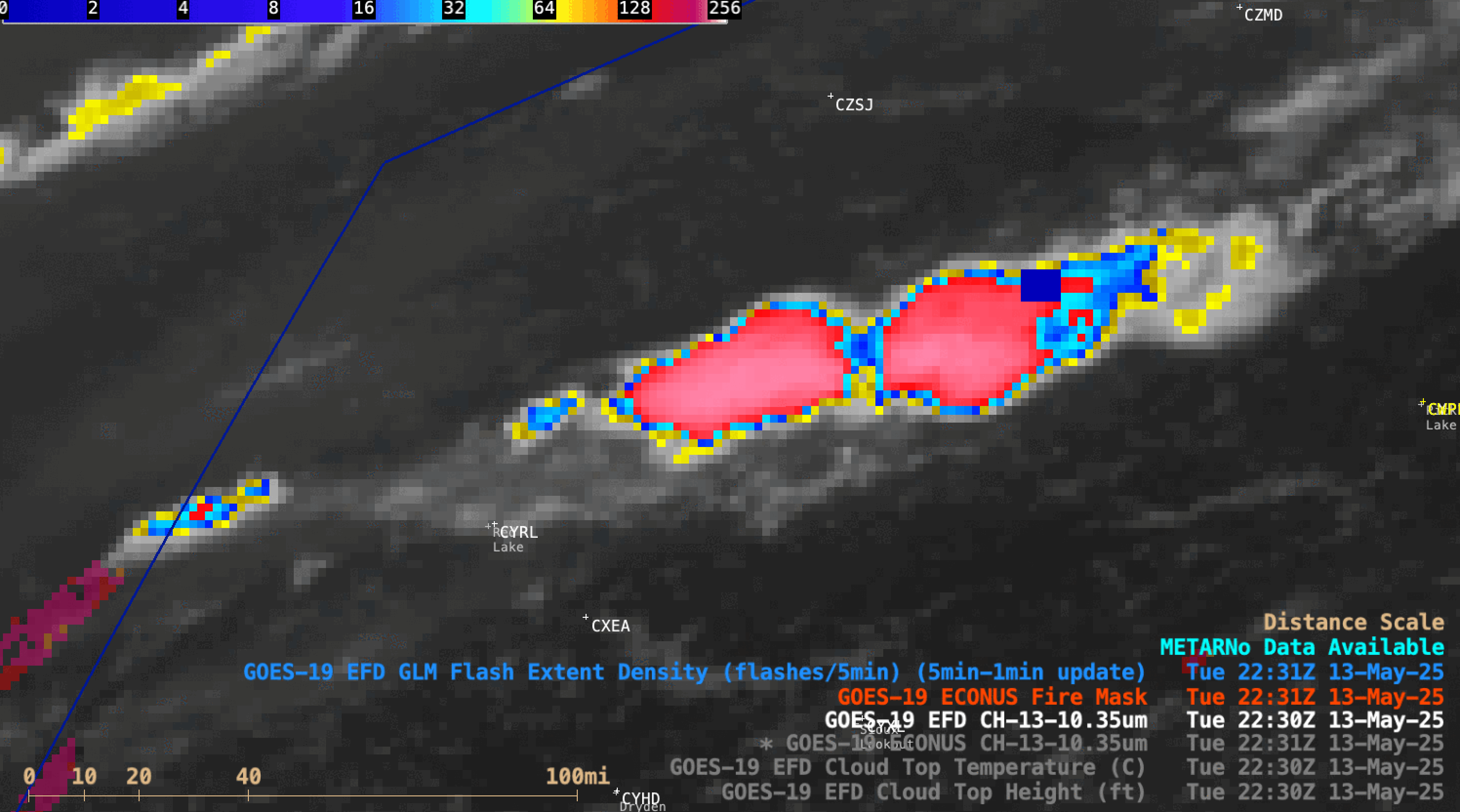
10-minute GOES-19 Clean Infrared Window (10.3 µm) images with an overlay of 5-minute GOES-19 GLM Flash Extent Density (large blue pixels) from 2030-2050 UTC on 13 May
The Nopiming Fire (along with the Ken Fire, just across the Ontario border) continued to burn aggressively throughout the subsequent nighttime hours — and the elongated nocturnal glow of those 2 wildfire footprints were very apparent in VIIRS Day/Night Band imagery from NOAA-20 and NOAA-21 (below), northeast and east of Winnipeg (CYWG).
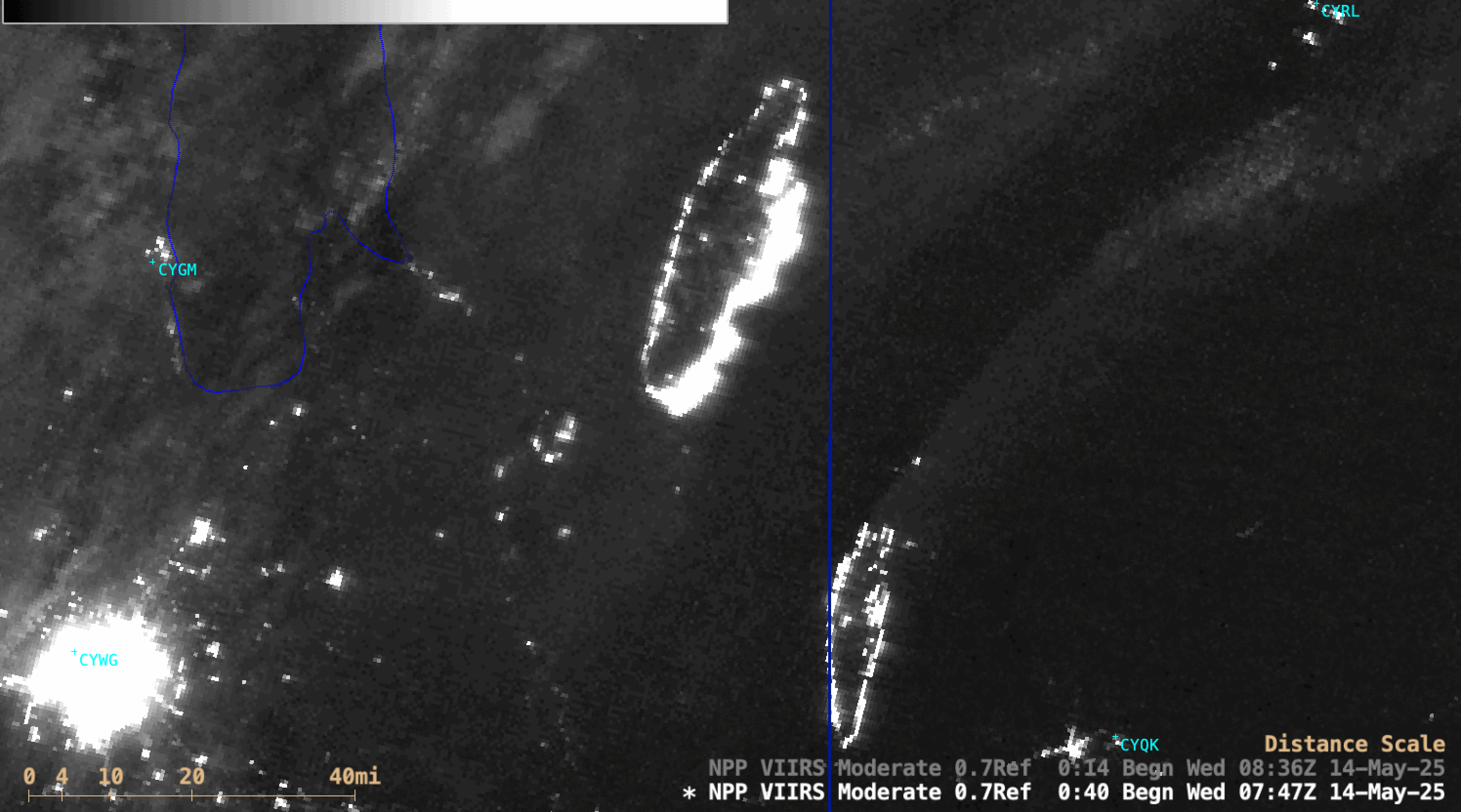
NOAA-20 and NOAA-21 (mislabeled as NPP) VIIRS Day/Night Band (0.7 µm) images on 14 May [click to enlarge]