Lake Michigan ice and lake effect clouds, viewed using 4 GOES
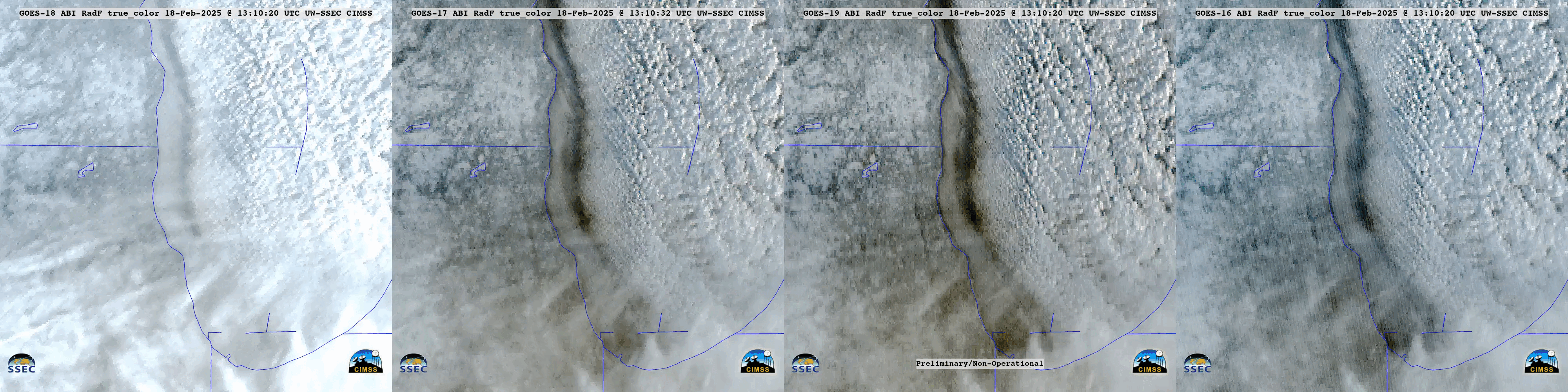
From left to right: GOES-18, GOES-17, GOES-19 and GOES-16 True Col.or RGB images, from 1310-1540 UTC on 18th February [click to play animated GIF]
The respective satellite locations over the Equator at that time were: GOES-18 (137.0 W longitude), GOES-17 (104.4 W longitude), GOES-19 (89.5 W longitude) and GOES-16 (75.2 W longitude). GOES-17 had been temporarily brought out of storage and was drifting slowly from 12th-15th February 2025, approximately 0.3 degrees of longitude in total. All GOES-17 ABI imagery during this “Longitude Test” were resampled to the nominal 105 W location (the final GOES-17 image during this test period was at 1540 UTC on 18th February). GOES-17 products were analyzed for any potential impacts that this shift in longitude might cause. The overall goal of the Longitude Test was to determine what product impacts (if any) there might be when GOES-16 (currently operational as GOES-East) is moved to 75.5 W in March 2025, ahead of GOES-19’s arrival (GOES-19 is then scheduled to become operational as GOES-East on 4th April). This also tested our ability to track a GOES-R series satellite as it moved (and still receive quality data).
GOES-16 Visible images (below) included plots of surface wind/temperature/weather. Winds were generally light, and early morning temperatures across southeast Wisconsin and northeast Illinois were around -10 F away from the lake and around -5 F along the lakeshore. Air temperatures were much warmer beneath the lake effect clouds that were moving inland across northern Indiana and western Michigan (with some sites reporting light snow).
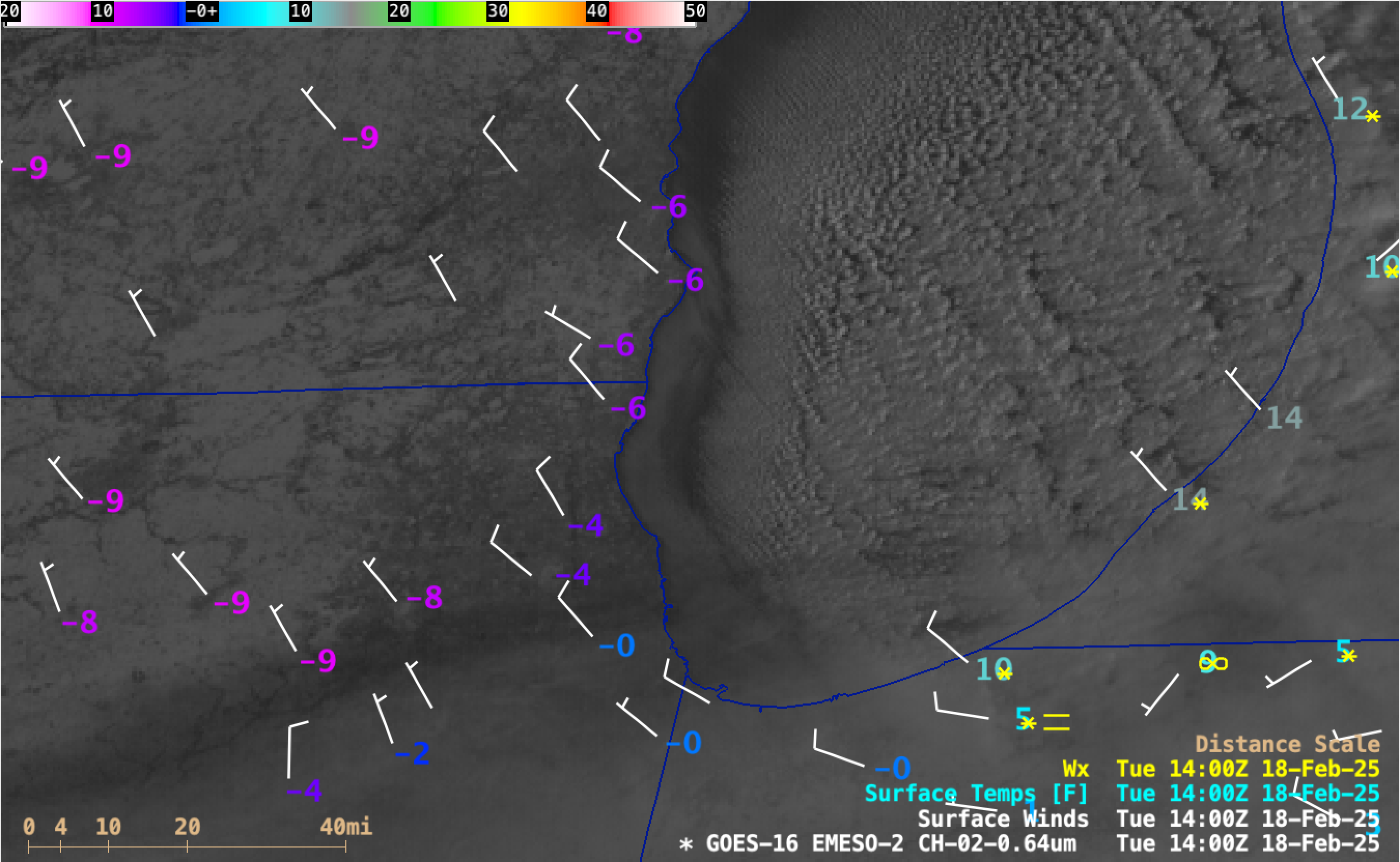
GOES-16 Red Visible (0.64 µm) images with plots of Surface Wind barbs (white), Surface Temperature (purple/blue/cyan) and Surface Weather (green), from 1301-2201 UTC on 18th February [click to play MP4 animation]
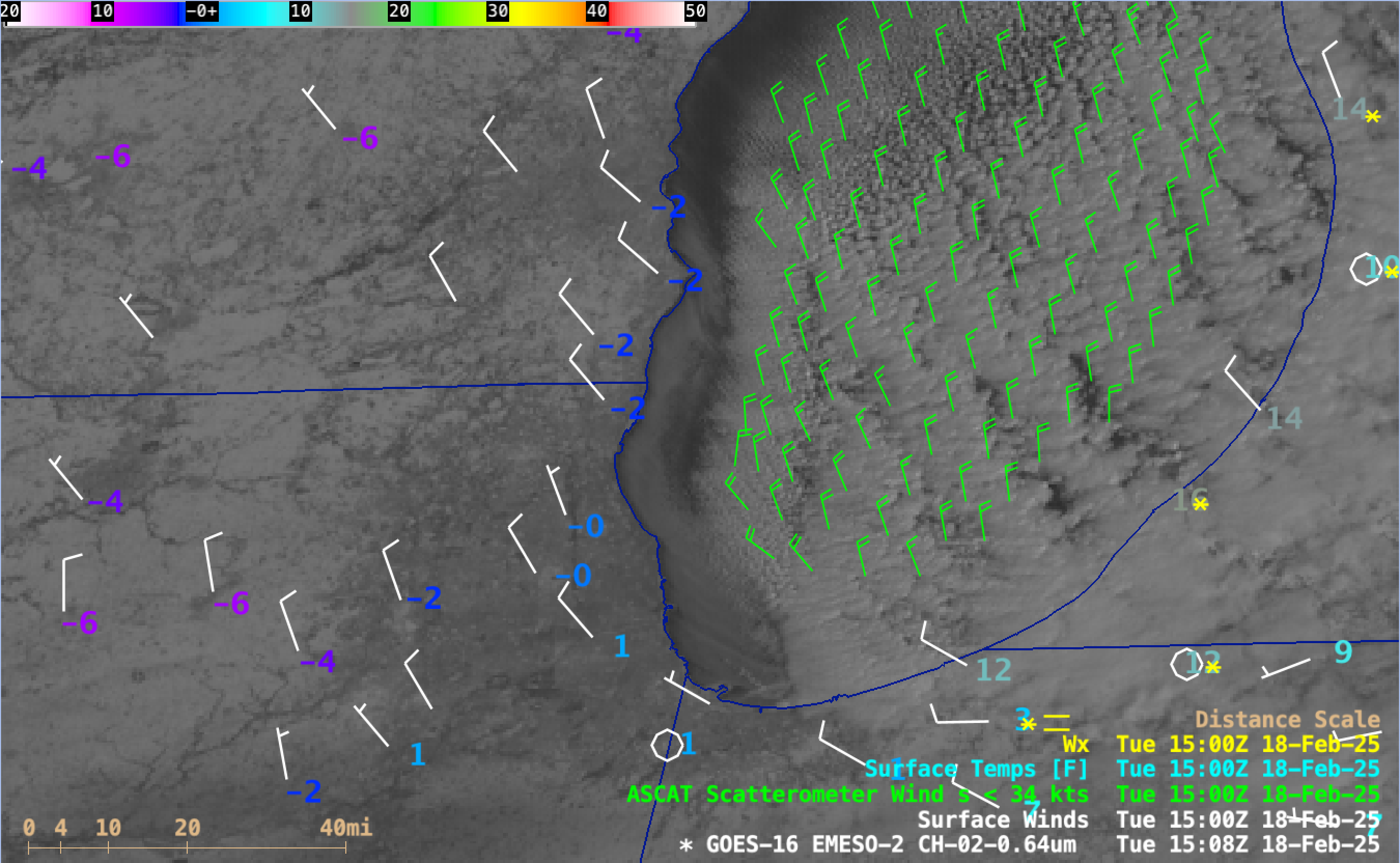
GOES-16 Red Visible (0.64 µm) image with plots of Metop ASCAT winds over Lake Michigan (green) at 1508 UTC on 18th February [click to enlarge]