Upgraded webpages for browsing LEO direct broadcast products
The University of Wisconsin-Madison Space Science and Engineering Center owns and operates a network of low-earth orbiting direct broadcast satellite antennas around the United States, and provides software support for partner institutions with similar antenna systems. Last week, a new version of the web interface hosted by each antenna’s on-site direct broadcast processing system was rolled out to improve the experience of browsing the wide array of satellite imagery and derived products available. Products displayed are automatically generated utilizing a collection of CSPP (Community Satellite Processing Package) software, including Polar2Grid, for designated fixed sectors and tropical cyclones within view of satellite overpasses from a given antenna, with a typical latency of 5 – 15 minutes after an overpass ends.

The new browser pages are available at the following locations:
- Honolulu, HI (located at Honolulu Community College): http://soest-hcc1.hcc.hawaii.edu/browser/
- Miami, FL (located at the NOAA Atlantic Oceanographic and Meteorological Laboratory): https://dbps.aoml.noaa.gov/browser
- Mayagüez, PR (located at the University of Puerto Rico at Mayagüez): http://dbps.ece.uprm.edu/browser/
- Hampton, VA (owned by Hampton University): http://dbps.cas.hamptonu.edu/browser/
National Weather Service Pacific Region users also have internal access to similar product browser sites featuring data from SSEC’s antenna located at NWS Guam and NOAA’s antenna at the Inouye Regional Center on Ford Island, Hawaii. These pages are lightweight and perform well on desktop and mobile browsers.
To use the page, you’ll first have to select a location to view. Each site has at least one static sector centered over the antenna location, and if there are tropical storms in the region, additional locations will be listed on this first screen:

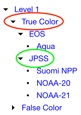
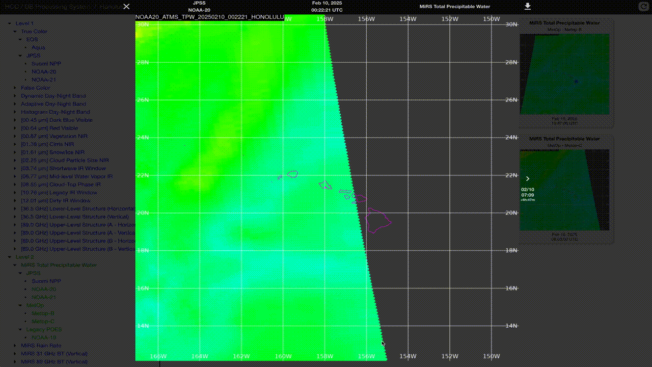
After selecting a location, you can now select which products you’d like to view on the left sidebar. Currently, a selection of Level 1 visible and infrared imagery from VIIRS, MODIS, and AVHRR, plus Level 1 microwave imagery from AMSR-2 is shown in the browser, along with Level 2 microwave products from MiRS (ATMS and AMSU/MHS). The full list is broken down first by level, then product name. By default, similar products from multiple satellite constellations are grouped together, and when possible, similar product nicknames to those used for GOES ABI are used. For example, clicking the down arrow next to True Color (red circle below) reveals that the EOS and JPSS constellations provide this product, and clicking the down arrow next to JPSS (green circle below) reveals that True Color products are available from S-NPP, NOAA-20, and NOAA-21. By default, all will be toggled on when the True Color product is loaded, but you can click any of the names to remove them from the listing if you wish.
Selecting products will open a thumbnail listing on the right side of the page with the selected images from the last week in reverse chronological order. When you click on a specific product thumbnail, it will go full screen. If you wish to download the image that you are currently viewing, there is a download button in the upper right. Also on this screen, you can use the keyboard’s arrow keys or the on-screen arrows to go backwards and forwards in time through the products that you selected. This allows you to make an impromptu animation or image toggle of your choosing, as shown below:
Future plans include rolling out a version of this site to a dedicated test processing server located on the campus of the University of Wisconsin-Madison, including additional products of interest, and making it easier to know when upcoming satellite overpasses are expected. And finally, a big thanks to SSEC software developer Geoff Yoerger for his efforts creating this new image browser functionality!