Tehuano wind event
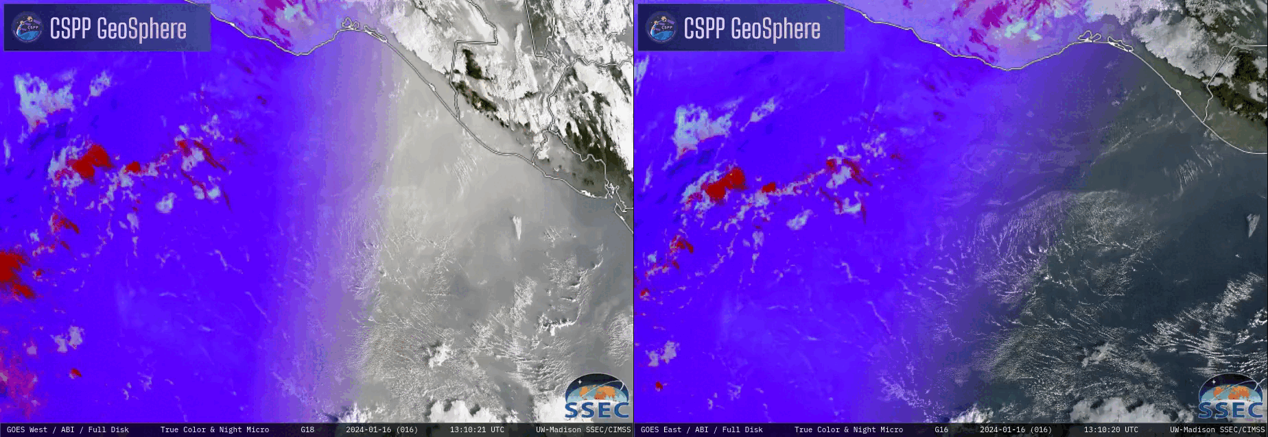
True Color RGB images from GOES-18 (left) and GOES-16 (right), from 1310-2330 UTC on 16 January and 17 January [click to play animated GIF | MP4]
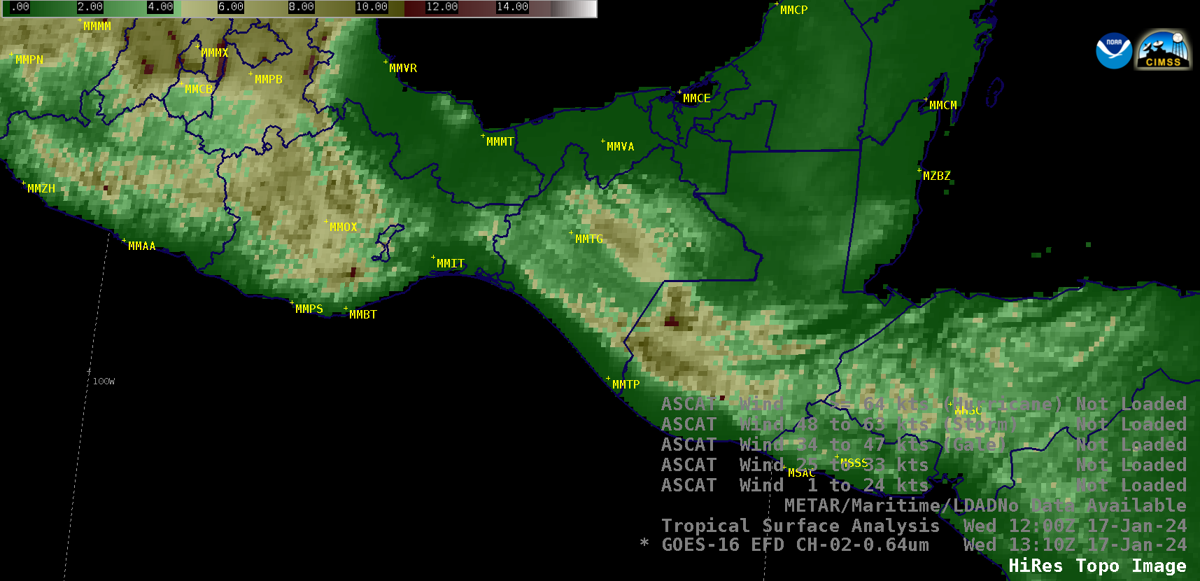
GOES-16 Visible images on 16 January (below) included surface plots, Metop ASCAT winds and surface analyses. The development of Gale Force winds was being forecast for the Gulf of Tehuantepec, as northerly winds behind an approaching arctic cold front accelerated through the Chivelas Pass (topography) before exiting the southern coast of Mexico near Ixtepec (MMIT).
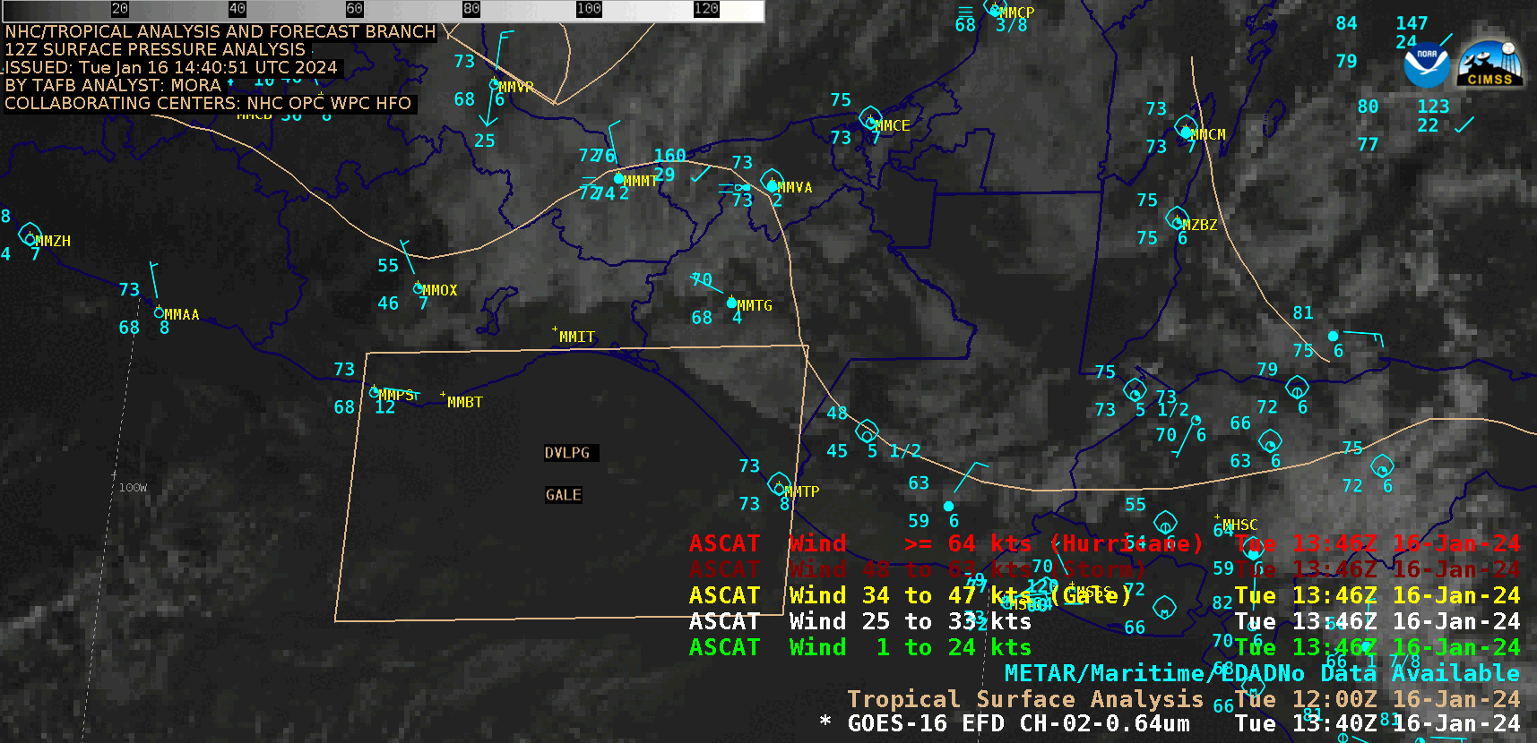
GOES-16 Visible images on 16 January, with plots of surface reports (cyan), Metop ASCAT winds (green) and surface analyses (beige) [click to play animated GIF | MP4]
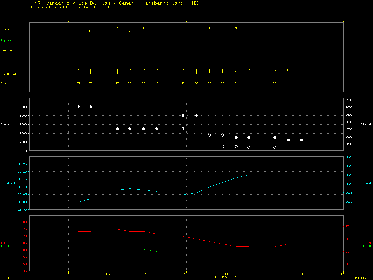
Plot of surface report data from Veracruz [click to enlarge]
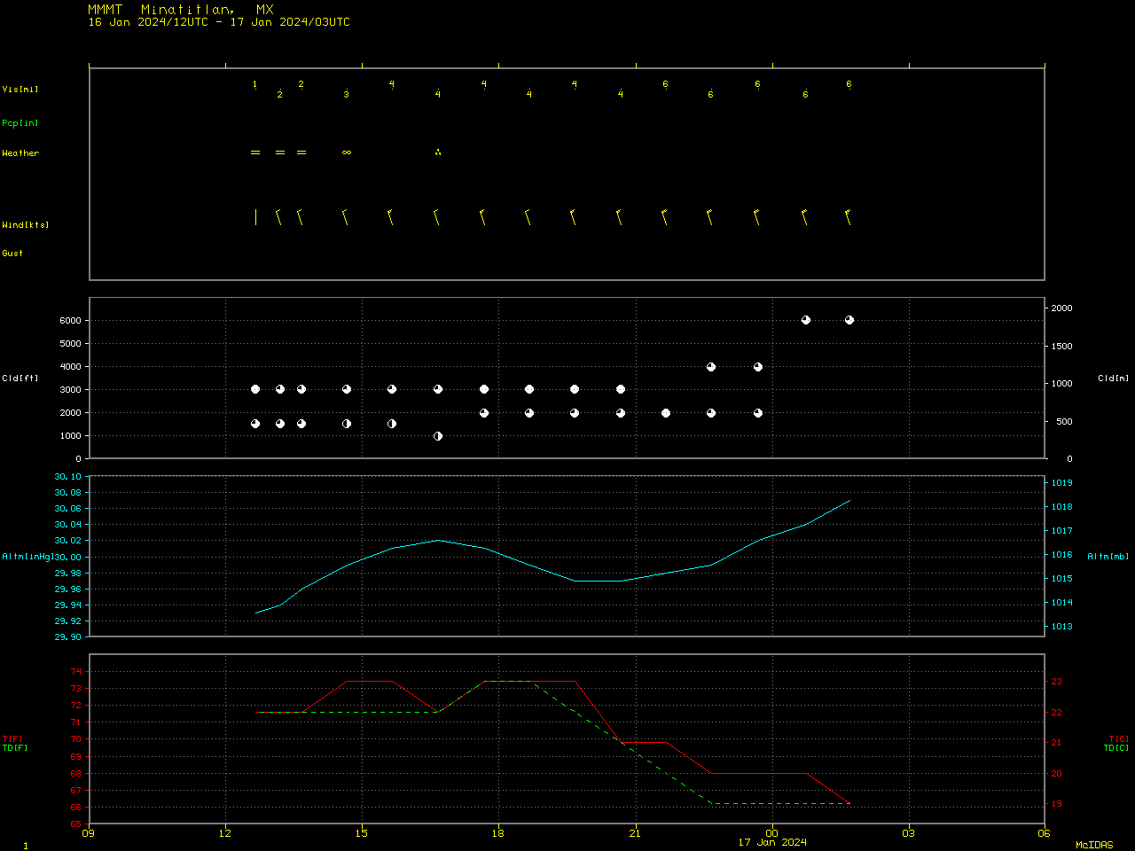
Plot of surface report data from Minatitlan [click to enlarge]
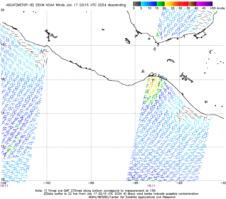
Metop-B/Metop-C ASCAT winds at 1611 UTC on 16 January, 0318 UTC on 17 January and 0412 UTC on 17 January
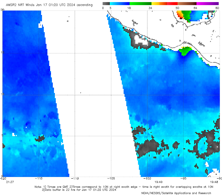
GCOM-W1 AMSR2 winds at 1949 UTC on 16 January and 0805 UTC on 17 January
Significant Wave Height values up to 11.66 ft were generated by these Gale Force winds, according to CryoSat-2 altimetry data (below).
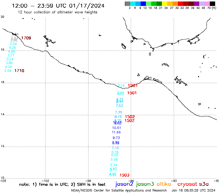
CryoSat-2 altimeter Significant Wave Heights at 1502 UTC on 17 January