Yet another East Coast winter storm
The Winter of 2009/2010 has brought a number of significant snowfall events to parts of the US East Coast — and another powerful storm affected that region on 05 February – 06 February 2010. The highest storm total snowfall reported was 40.0 inches at Colesville in Maryland. Washington Dulles International Airport received 32.4 inches of snow (their largest 2-day snowfall on record), and Baltimore-Washington International Airport received 24.8 inches of snow (their second-largest 2-day snowfall on record). So far, this is Philadelphia’s 2nd-snowiest winter on record (56.3 inches) and Washington DC’s 3rd-snowiest winter on record (44.9 inches).
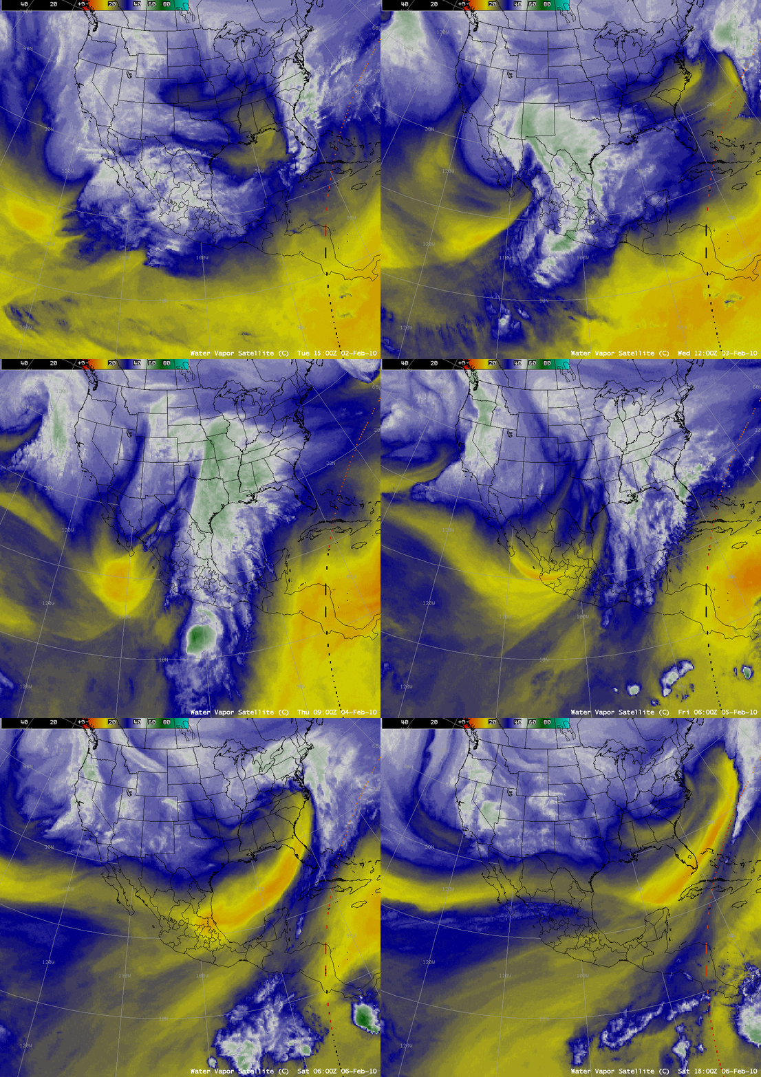
AWIPS images of 3-hourly composites of the GOES-11 and GOES-12 water vapor channel data (above) showed a strong disturbance originating over the Pacific Ocean that was progressing eastward across the southwestern US and northern Mexico during the days leading up to the storm. There was also evidence of a plume of subtropical moisture seen on the water vapor imagery.
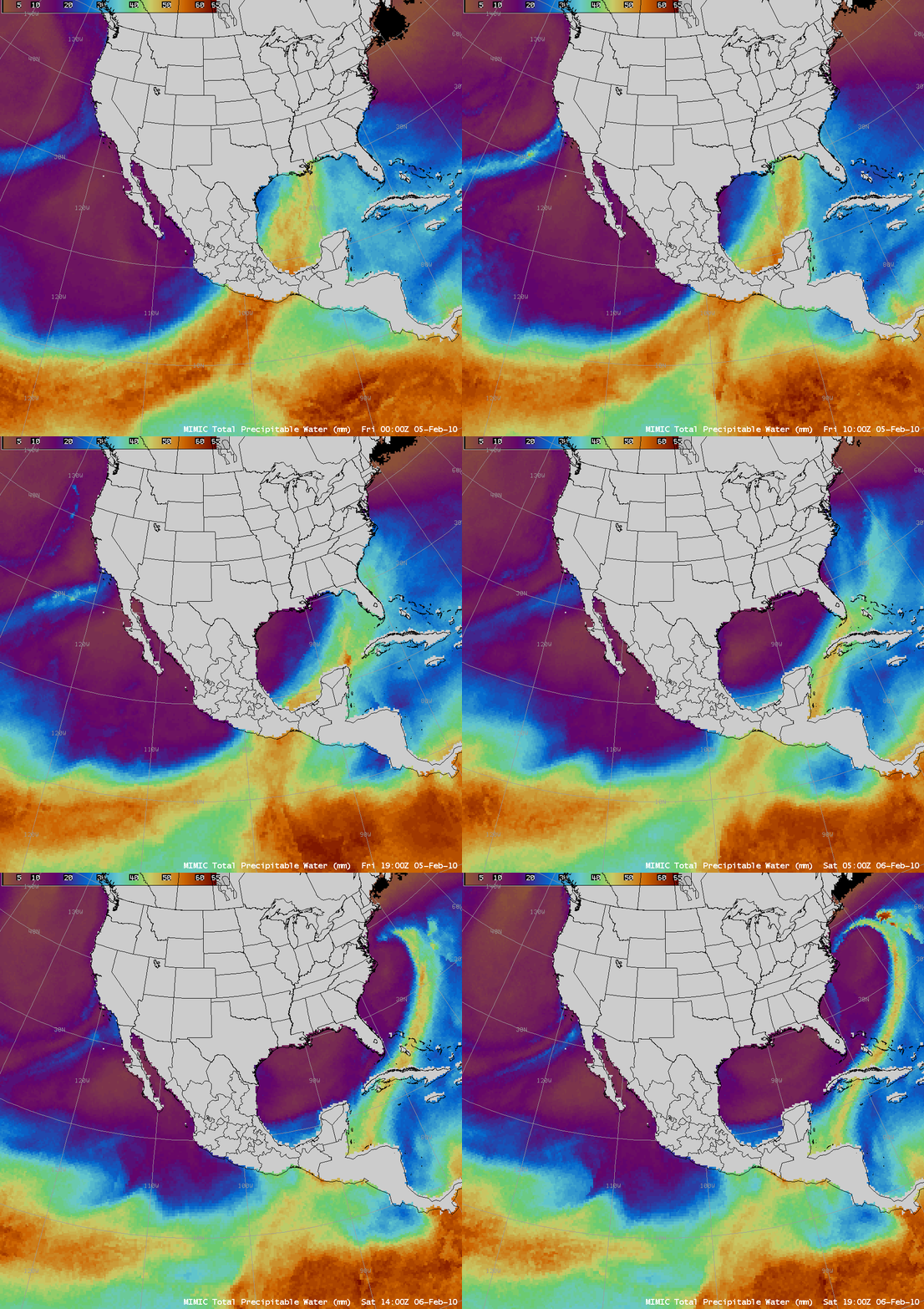
The presence of this moisture plume was confirmed on MIMIC Total Precipitable Water (TPW) images (below), which revealed a clear linkage to the rich moisture source within the Inter-Tropical Convergence Zone (ITCZ) over the eastern equatorial Pacific Ocean. MIMIC TPW values were in the 50-60 mm (2.0 – 2.4 inch) range within this moisture plume as it was being drawn northeastward across the Gulf of Mexico — and the Blended Total Precipitable Water product showed a large area of TPW values exceeding 200% of normal from the Gulf of Mexico to the mid-Atlantic states.
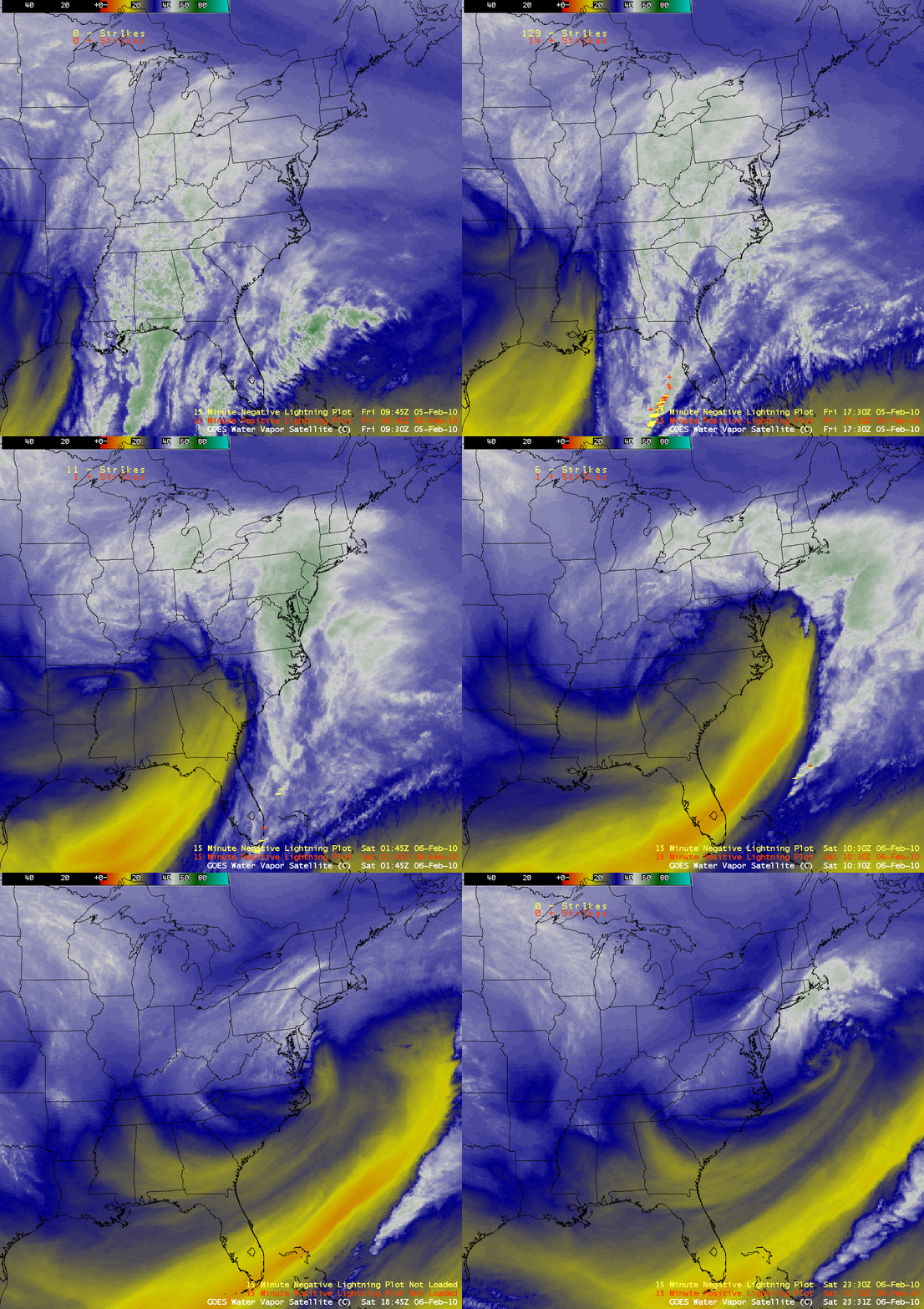
4-km resolution GOES-12 water vapor images with an overlay of cloud-to-ground lightning strikes (below) showed 3 important phases of the storm: (1) a expansive area of cold cloud tops associated with the initial round of heavy snowfall later in the day on 05 February; (2) the penetration of a broad dry slot, which helped to release convective instability along it’s leading edge that led to periods of thunder and lightning (especially during the 08-10 UTC time period), and (3) a well-defined deformation zone where additional snowfall banding developed during the final hours of the storm.
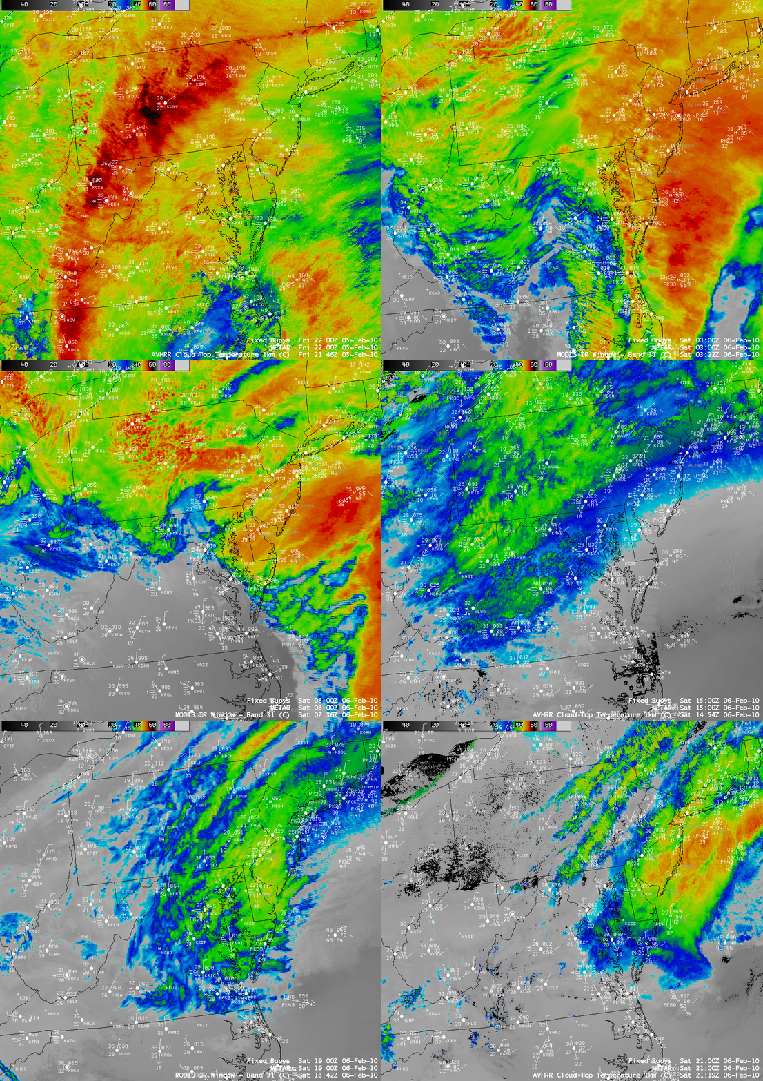
A series of 1-km resolution AVHRR Cloud Top Temperature product images and MODIS 11.0 µm IR images (below) showed greater detail of some of the banding structures during different phases of the storm.
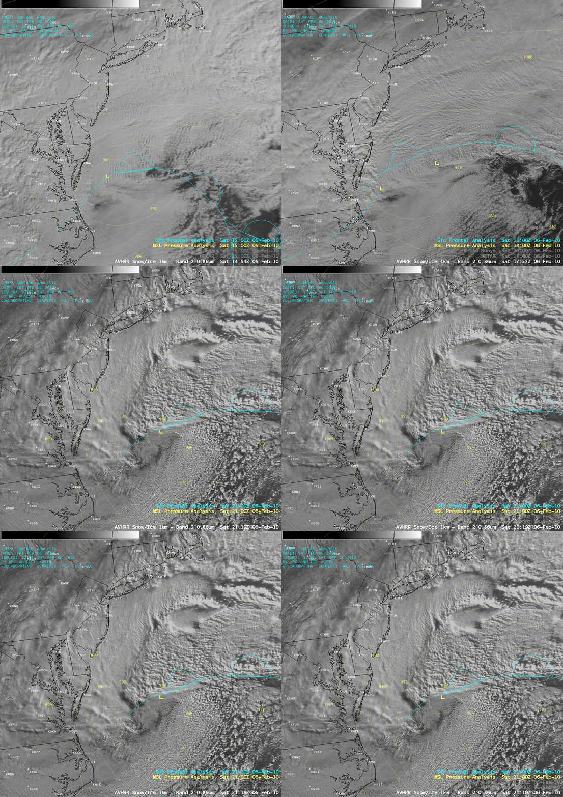
1-km resolution AVHRR visible images (below) displayed the cloud features as the surface low was rapidly deepening just offshore during the day on 06 February.
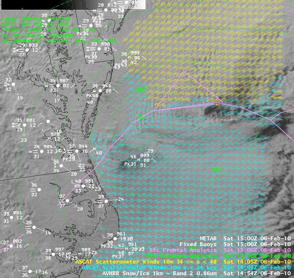
MetOp ASCAT scatterometer winds at 14:05 UTC on 06 February (below) indicated that surface winds were generally in the 30-40 knot range, which were in agreement with offshore buoys which were reporting wind gusts 31-43 knots at 15 UTC. The highest reported gust was 61 mph at Lewes, Delaware during the pre-dawn hours on 06 February.
===== 07 FEBRUARY UPDATE =====
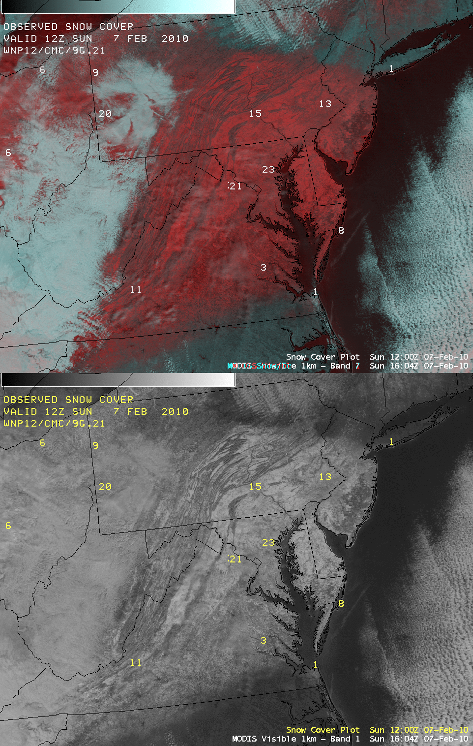
A comparison of a 1-km resolution MODIS visible channel image and a false-color Red/Green/Blue (RGB) image (below) shows the extent of the snow cover on the morning of 07 February. On the RGB image, snow appears as varying shades of red, in contrast to supercooled water droplet clouds (which appear as brighter features). Even after compaction of the heavy snowfall, there were still a number of sites reporting snow depths in excess of 30 inches that morning. Additional MODIS true color and false color imagery — at resolutions up to 250 meters — can be seen at the SSEC MODIS Today and the SSEC MODIS Direct Broadcast web sites.
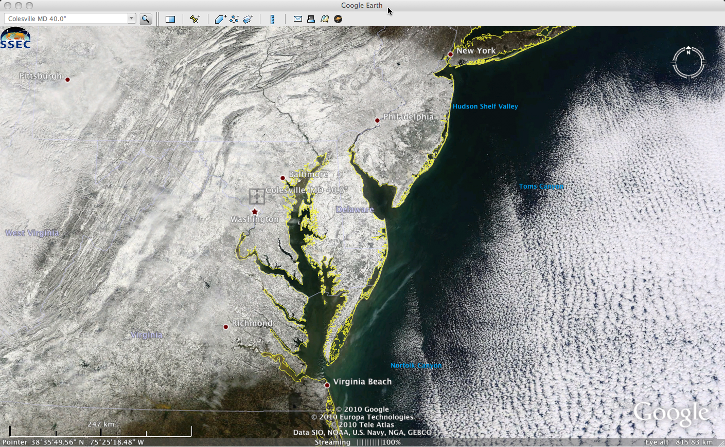
MODIS true color images from the SSEC MODIS Today site can also be displayed using Google Earth (below). The location of 40.0 inch snowfall report (at Colesville, Maryland) is also noted on the image.


