Fog across the western Great Lakes region
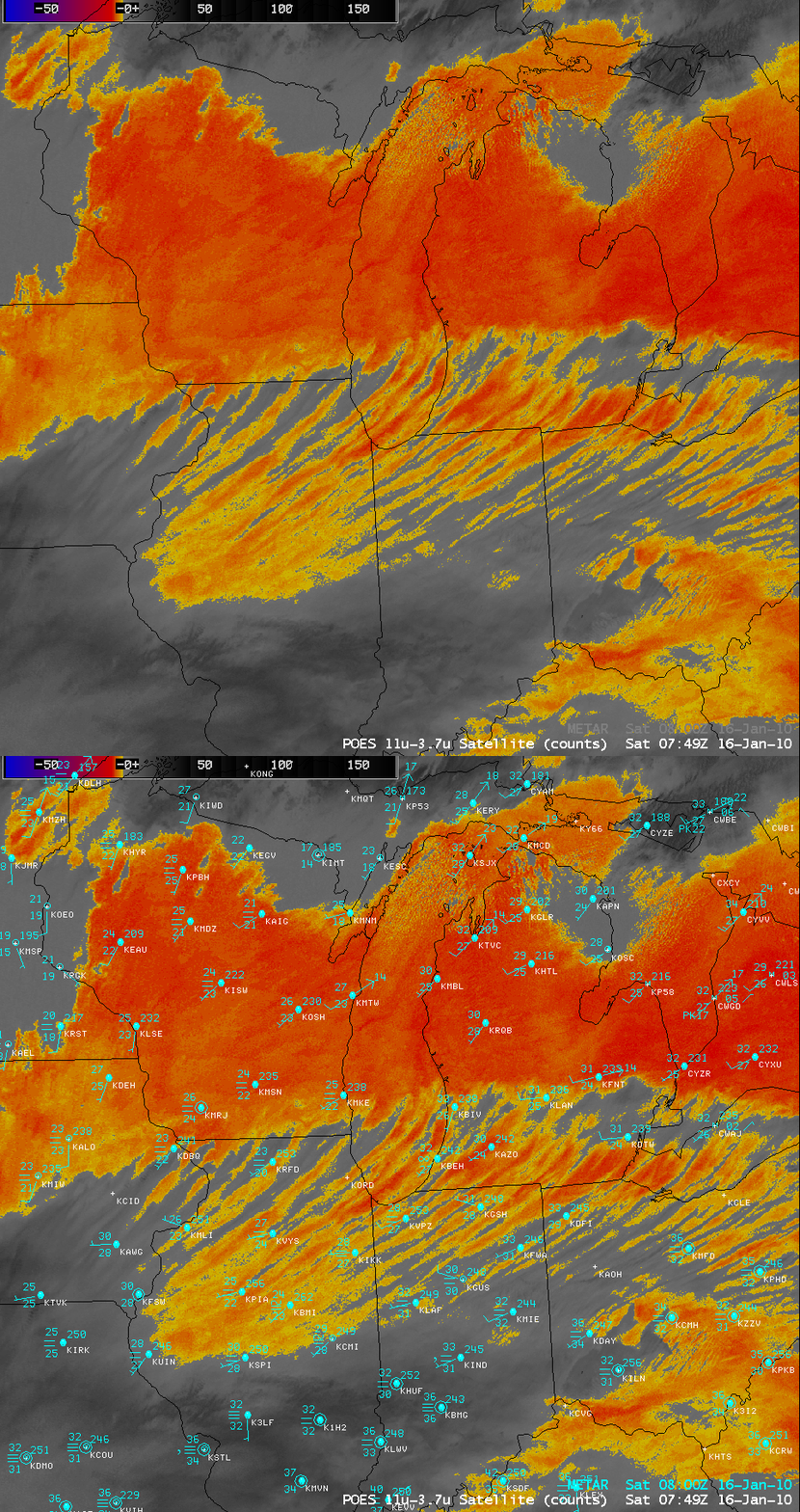
An AWIPS image of the 1-km resolution POES AVHRR 11.0-3.7 µm “fog/stratus product” (above) revealed a very interesting banded structure in the fog and stratus features (yellow to red color enhancement) that covered a large part of the western Great Lakes region at 07:49 UTC on 16 January 2010. With stagnant high pressure in place and light winds over much of the area, there was little boundary layer mixing to mitigate the formation and persistence of the low clouds that were trapped under a very strong low-level temperature inversion (Rawinsonde data: Davenport IA | Lincoln IL | Wilmington OH; NAM12 Line A-A’ west-to-east cross section).
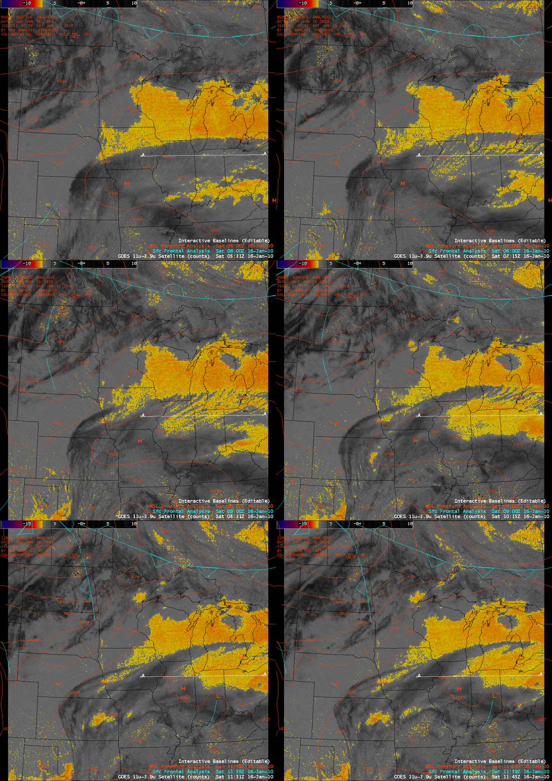
An animation of the 4-km resolution GOES-12 11.0-3.9 µm fog/stratus product (below) suggested that there might be a thin veil of high-altitude cirrus clouds (which show up as darker black features) drifting over the banded portion of the fog and stratus — the presence of overlying high clouds could have been contributing to the unusual appearance of those low cloud features on the fog/stratus product imagery.
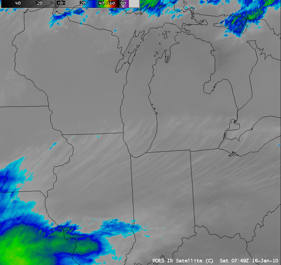
To further explore whether or not there were indeed cirrus clouds overhead that might be masking the low-altitude fog/stratus signal and creating the false appearance of banding as seen on the fog/stratus product, let’s examine a few additional satellite images. The POES AVHRR 10.8 µm IR image (below) did show some thin filaments that exhibited slightly colder IR brightness temperatures, but most were warmer than -20º C — much warmer than would be expected of typical cirrus clouds. However, with very thin cirrus features, a significant amount of thermal energy reaches the satellite IR detectors from the warmer surfaces below; this then leads to IR brightness temperatures values that are much warmer than those of the actual cirrus clouds themselves.
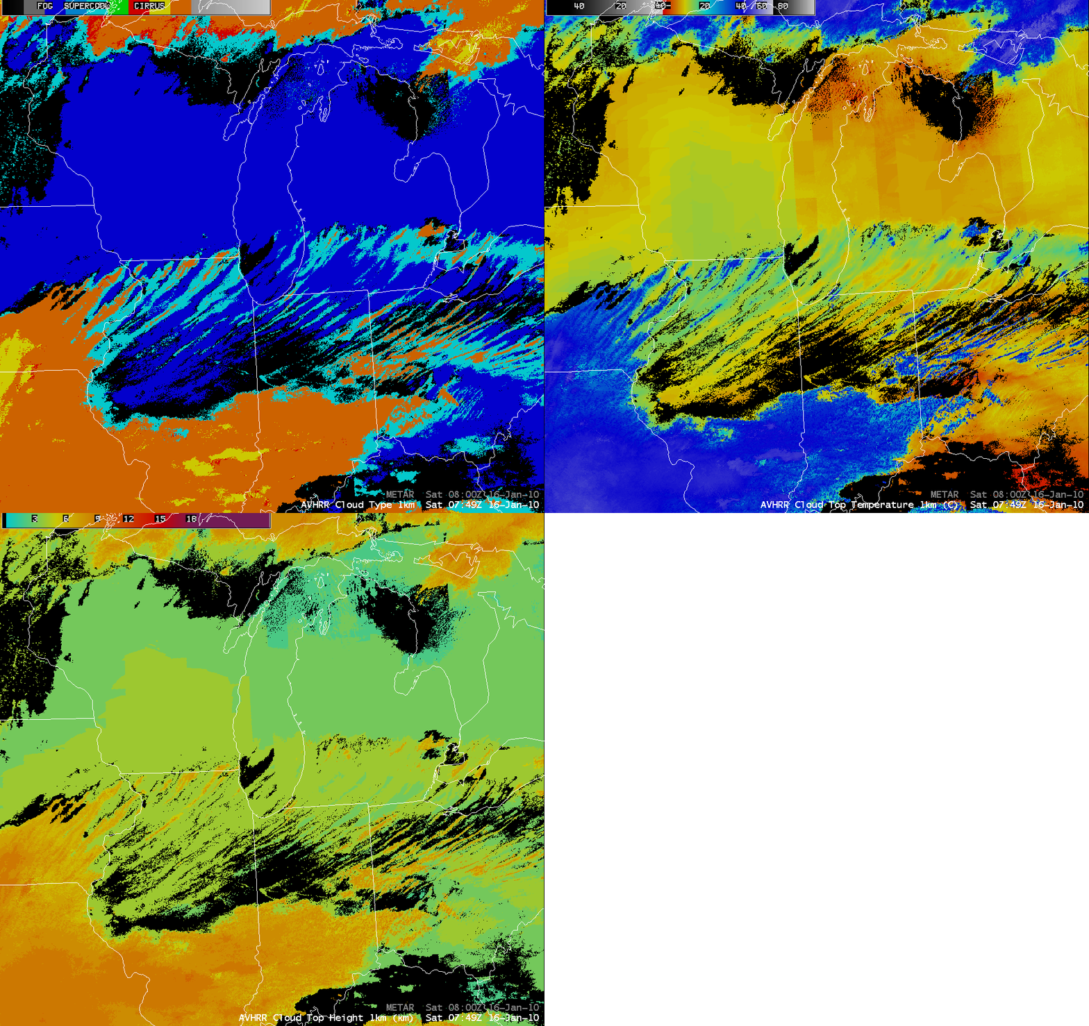
Multi-spectral POES AVHRR derived products such as Cloud Type, Cloud Top Temperature, and Cloud Top Height (below) did a better job at identifying more of the thin features as Cirrus (orange color enhancement on the Cloud Type product) — with cloud top temperatures of -30º C to -40º C and cloud top heights of 7-8 km — but some of the thinnest cirrus filaments were still flagged as supercooled water droplet clouds (cyan color enhancement on the Cloud Type product).
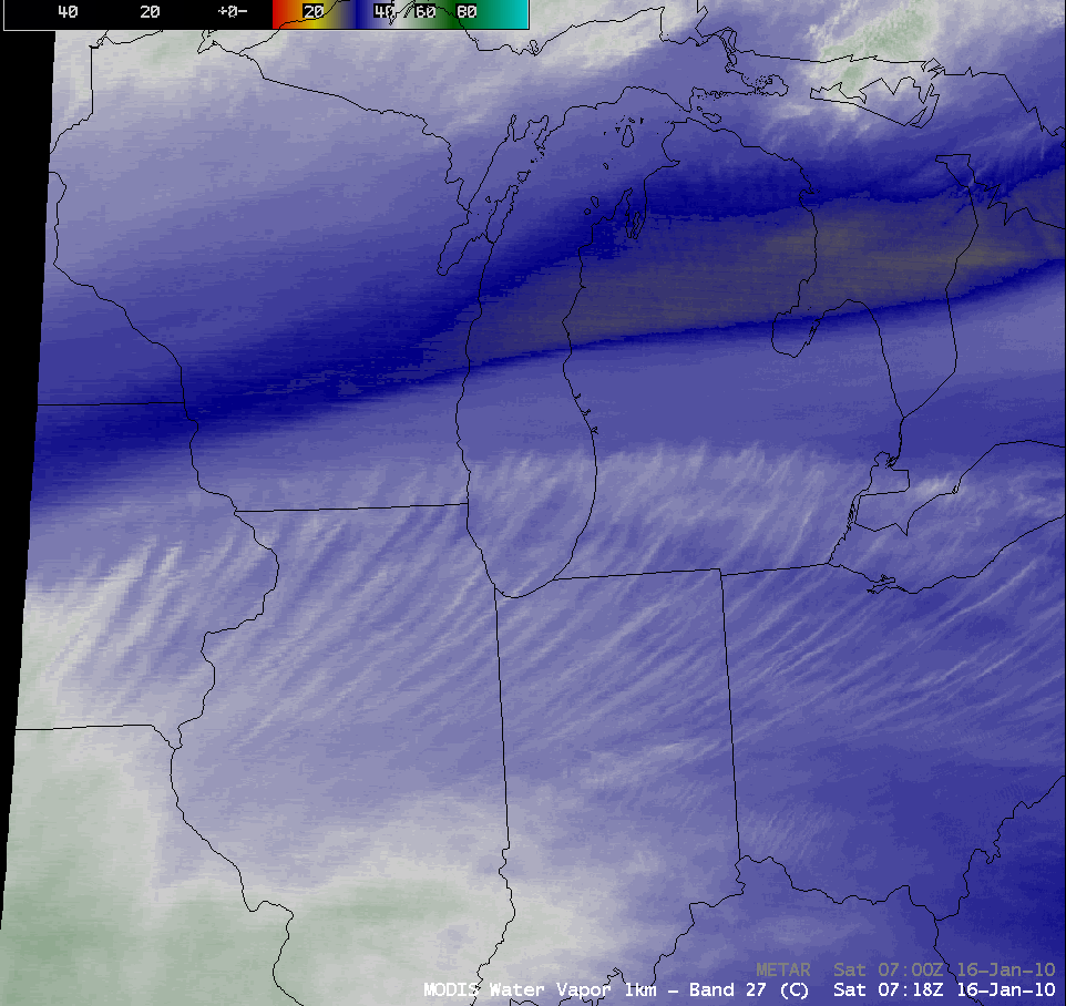
In this case, perhaps the best satellite product to confirm the presence of thin cirrus filaments aloft was the 1-km resolution MODIS 6.7 µm water vapor channel (below). Since the weighting function of such a water vapor channel normally peaks at higher altitudes in the middle troposphere, it is generally immune to the effects of warm surface radiation that can sometimes plague proper cirrus cloud classification using conventional IR imagery alone.
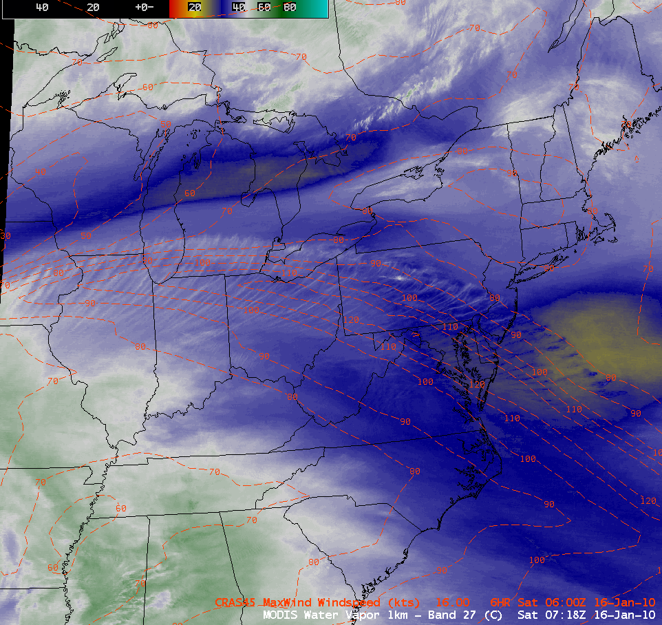
As it turns out, a broad region of high-altitude “transverse banding” had formed from the southern Great Lakes to the mid-Atlantic region — this banding was generally located along the axis of a strong (120 to 130 knot) anticyclonically-curved jet stream axis, as confirmed by an overlay of CRAS model Level of Maximum Wind isotachs (below).
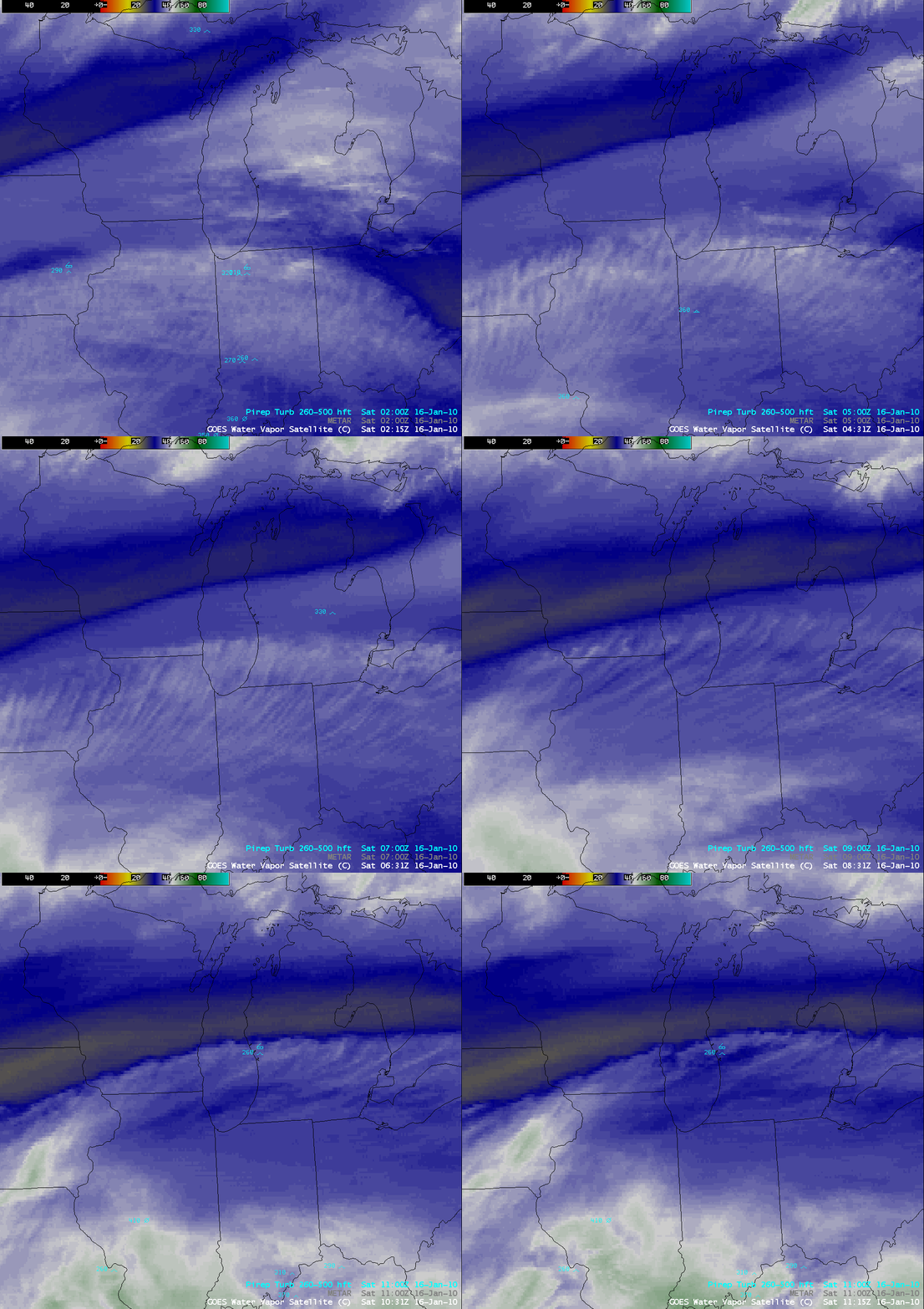
This transverse banding is a satellite signature that indicates a potential for high-altitude turbulence — and there were a few pilot reports of moderate turbulence over the area during the 02-11 UTC time period, shown overlaid on 4-km resolution GOES-12 6.5 µm water vapor images (below).


