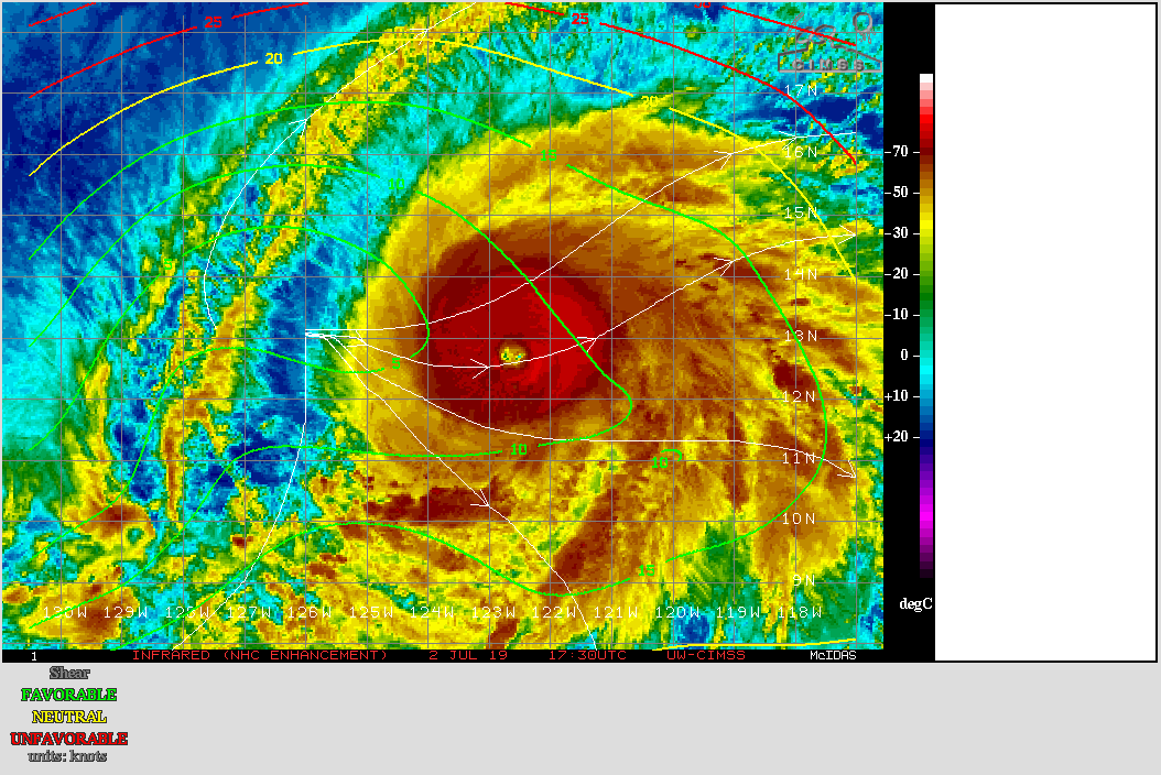
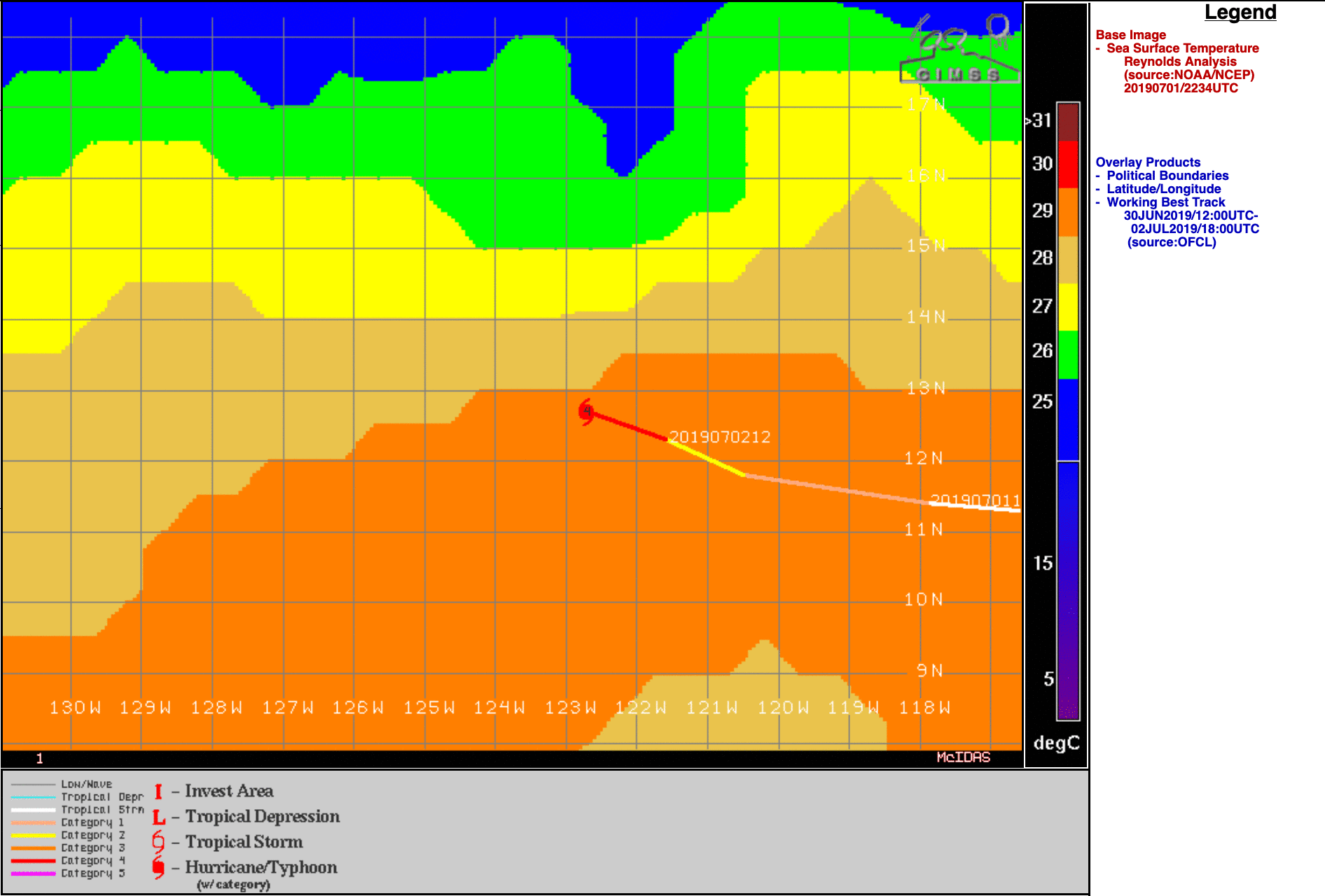
Hurricane Barbara in the East Pacific

GOES-17 “Red” Visible (0.64 µm, top) and “Clean” Infrared Window (10.3 µm, bottom) images [click to play animation | MP4]
DMSP-17 SSMIS Microwave (85 GHz) imagery from the CIMSS Tropical Cyclones site (below) showed a closed eyewall at 1448 UTC.
![DMSP-17 SSMIS Microwave (85 GHz) image [click to enlarge]](https://cimss.ssec.wisc.edu/satellite-blog/wp-content/uploads/sites/5/2019/07/190702_1448utc_dmsp17_ssmis_Barbara.png)
DMSP-17 SSMIS Microwave (85 GHz) image [click to enlarge]
GOES-17 “Red” Visible (0.64 µm) and Metop-A ASCAT winds [click to enlarge]
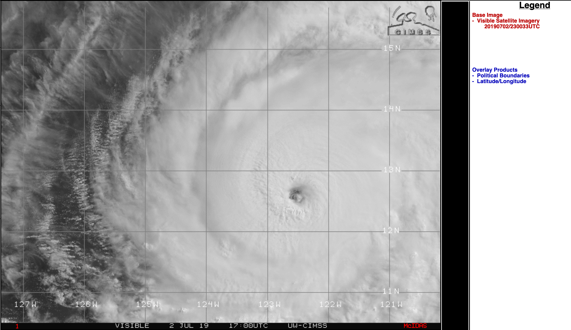
===== 03 July Update =====
![GOES-17 "Red" Visible (0.64 µm, top) and "Clean" Infrared Window (10.3 µm, bottom) images [click to play animation | MP4]](https://cimss.ssec.wisc.edu/satellite-blog/wp-content/uploads/sites/5/2019/07/190703_goes17_visible_infrared_Hurricane_Barbara_anim.gif)
GOES-17 “Red” Visible (0.64 µm, top) and “Clean” Infrared Window (10.3 µm, bottom) images [click to play animation | MP4]