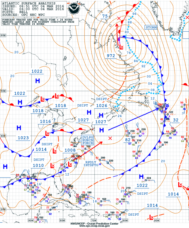
Rapidly intensifying mid-latitude cyclone off the US East Coast
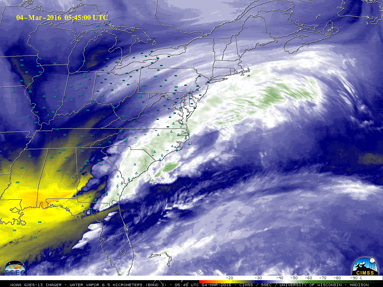
![GOES-13 Water Vapor (6.5 µm) images [click to play MP4 animation]](https://cimss.ssec.wisc.edu/satellite-blog/wp-content/uploads/sites/5/2016/03/960x1280_EASTL_B3_GOES13_WV_EAST_US_STORM_04MAR_2016064_213000_0001PANEL.GIF)
GOES-13 Water Vapor (6.5 µm) images [click to play MP4 animation]
![Aqua MODIS Water Vapor (6.7 µm), Infrared (11.0 µm), and Visible (0.65 µm) images [click to enlarge]](https://cimss.ssec.wisc.edu/satellite-blog/wp-content/uploads/sites/5/2016/03/160304_1737utc_aqua_modis_water_vapor_infrared_visible_anim.gif)
Aqua MODIS Water Vapor (6.7 µm), Infrared (11.0 µm), and Visible (0.65 um) images [click to enlarge]
![Suomi NPP VIIRS Visible (0.64 µm) and Infrared (11.45 µm) images [click to enlarge]](https://cimss.ssec.wisc.edu/satellite-blog/wp-content/uploads/sites/5/2016/03/160304_1722utc_suomi_npp_viirs_visible_infrared_anim.gif)
Suomi NPP VIIRS Visible (0.64 µm) and Infrared (11.45 µm) images [click to enlarge]
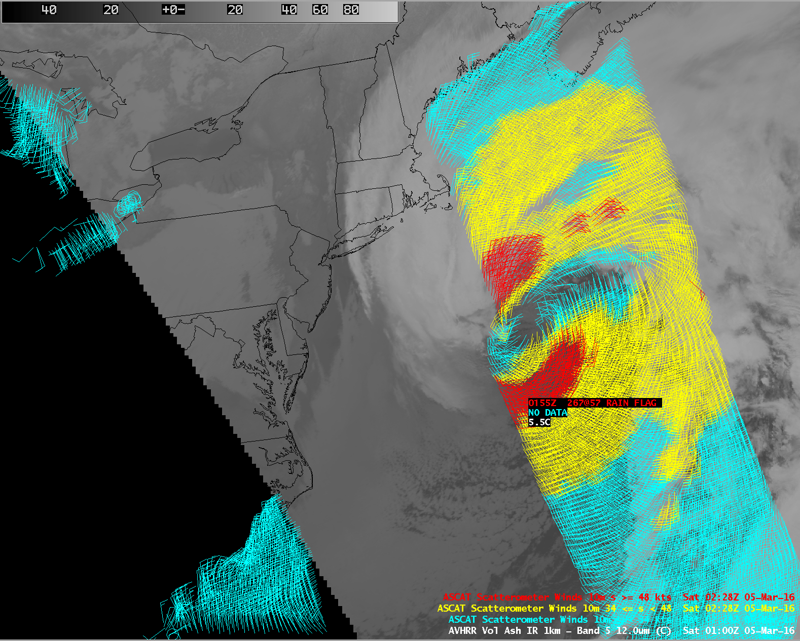
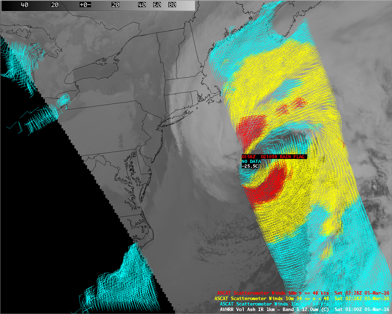
![POES AVHRR Infrared (12.0 µm) images at 1852, 2205, and 0100 UTC, with Metop ASCAT winds at 0155 UTC [click to enlarge]](https://cimss.ssec.wisc.edu/satellite-blog/wp-content/uploads/sites/5/2016/03/160304-05_poes_avhrr_infrared_ascat_anim.gif)
POES AVHRR Infrared (12.0 µm) images at 1852, 2205, and 0100 UTC, with Metop ASCAT winds at 0155 UTC [click to enlarge]
Geocolor satellite showing hurricane force low developing off SE coast over past few days & then turning NE. #GRPG pic.twitter.com/1uJmhHxfPs
— NWS OPC (@NWSOPC) March 7, 2016