Aircraft “hole punch” and “dissipation trails” over the eastern Great Lakes
GOES-13 (GOES-East ) Visible (0.63 µm) images centered over Lake Erie, Lake Ontario, and central New York state (below) showed a variety of aircraft “hole punch” and “dissipation trails” over the eastern Great Lakes on 03 March 2016.
![GOES-13 Visible (0.63 µm) images, centered over Lake Erie [click to enlarge]](https://cimss.ssec.wisc.edu/satellite-blog/wp-content/uploads/sites/5/2016/03/160303_goes13_visible_Lake_Erie_hole_punch_clouds_anim.gif)
GOES-13 Visible (0.63 µm) images, centered over Lake Erie [click to play animation]
![GOES-13 Visible (0.63 µm) images, centered over Lake Ontario [click to play animation]](https://cimss.ssec.wisc.edu/satellite-blog/wp-content/uploads/sites/5/2016/03/160303_goes13_visible_Lake_Ontario_hole_punch_clouds_anim.gif)
GOES-13 Visible (0.63 µm) images, centered over Lake Ontario [click to play animation]
![GOES-13 Visible (0.63 µm) images, centered over New York state [click to play animation]](https://cimss.ssec.wisc.edu/satellite-blog/wp-content/uploads/sites/5/2016/03/160303_goes13_visible_NY_hole_punch_clouds_anim.gif)
GOES-13 Visible (0.63 µm) images, centered over New York state [click to play animation]
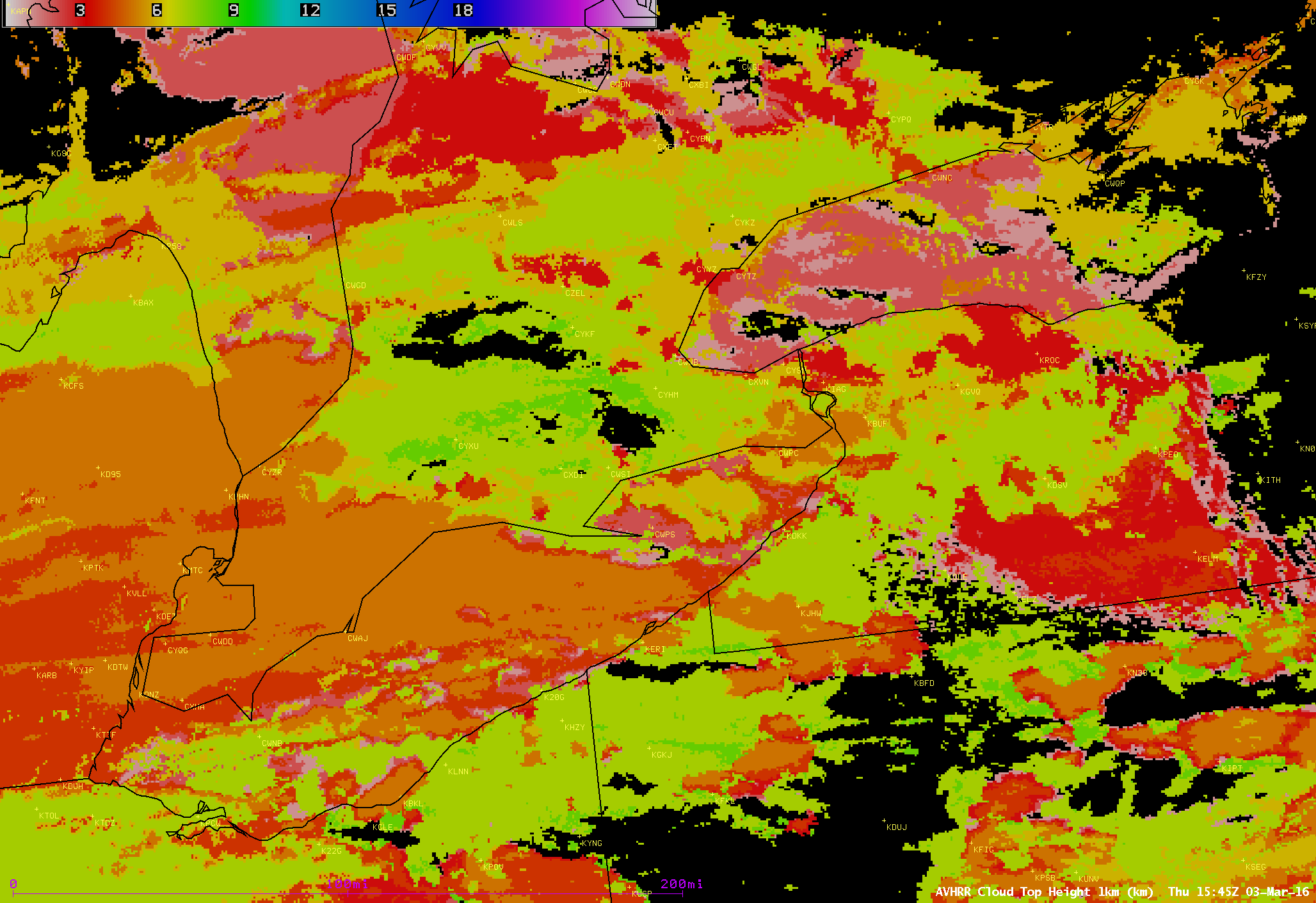
![POES AVHRR Cloud Type product at 1545 UTC [click to enlarge]](https://cimss.ssec.wisc.edu/satellite-blog/wp-content/uploads/sites/5/2016/03/AVHRR_CLD_TYPE_20160303_1545.png)
POES AVHRR Cloud Type product at 1545 UTC [click to enlarge]
![GOES-13 Visible (0.63 µm) images with pilot reports of icing [click to play animation]](https://cimss.ssec.wisc.edu/satellite-blog/wp-content/uploads/sites/5/2016/03/160303_goes13_visible_pireps_icing_anim.gif)
GOES-13 Visible (0.63 µm) images with pilot reports of icing [click to play animation]
![Terra MODIS true-color and false-color images over Lake Erie [click to enlarge]](https://cimss.ssec.wisc.edu/satellite-blog/wp-content/uploads/sites/5/2016/03/160303_1649utc_terra_modis_truecolor_falsecolor_Lake_Erie_anim.gif)
Terra MODIS true-color and false-color images over Lake Erie [click to enlarge]
#Holepunch cloud (panorama) over Broome & Chenango County from ground & ~22,000 miles above. pic.twitter.com/s0TsCMeBxR
— HowardManges (@HowardManges) March 3, 2016