Gravity waves over the Gulf of Mexico
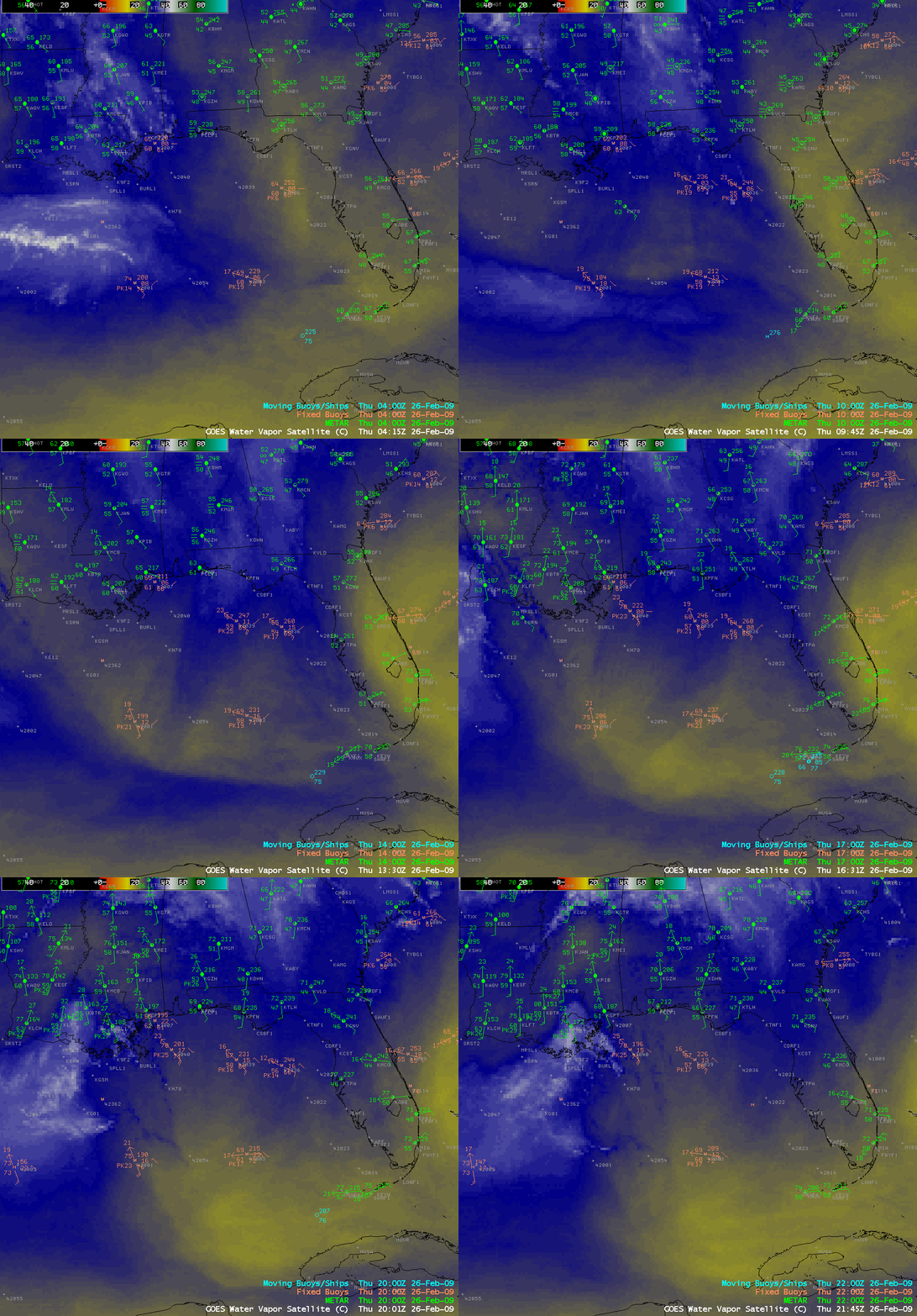
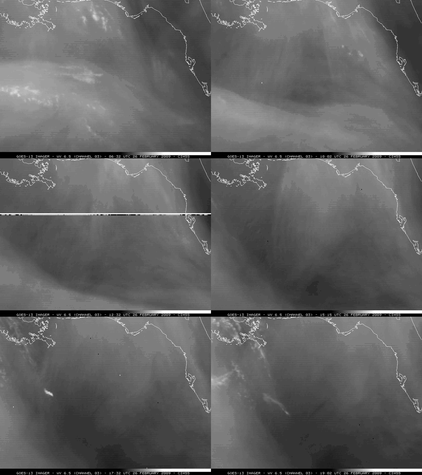
I’m usually a fan of color-enhanced water vapor imagery, but in this particular case, the low-altitude wave structure seems to show up a bit better using a simple contrast-stretched gray-scale enhancement. Utilizing the GOES-13 satellite (in orbit at 105º West longitude), we get a slightly better view of the Gulf of Mexico region (below) — and the westward-propagating gravity wave feature is plainly seen (along with a subtle train of waves behind its leading edge). In addition, we can also see that there appeared to be a second packet of low-altitude gravity waves out ahead of the aforementioned gravity wave (which was moving from southeast to northwest). Convective initiation seems to occur around the time that the primary westward-moving wave intersects the secondary northwestward-moving wave (around 17:00 UTC).
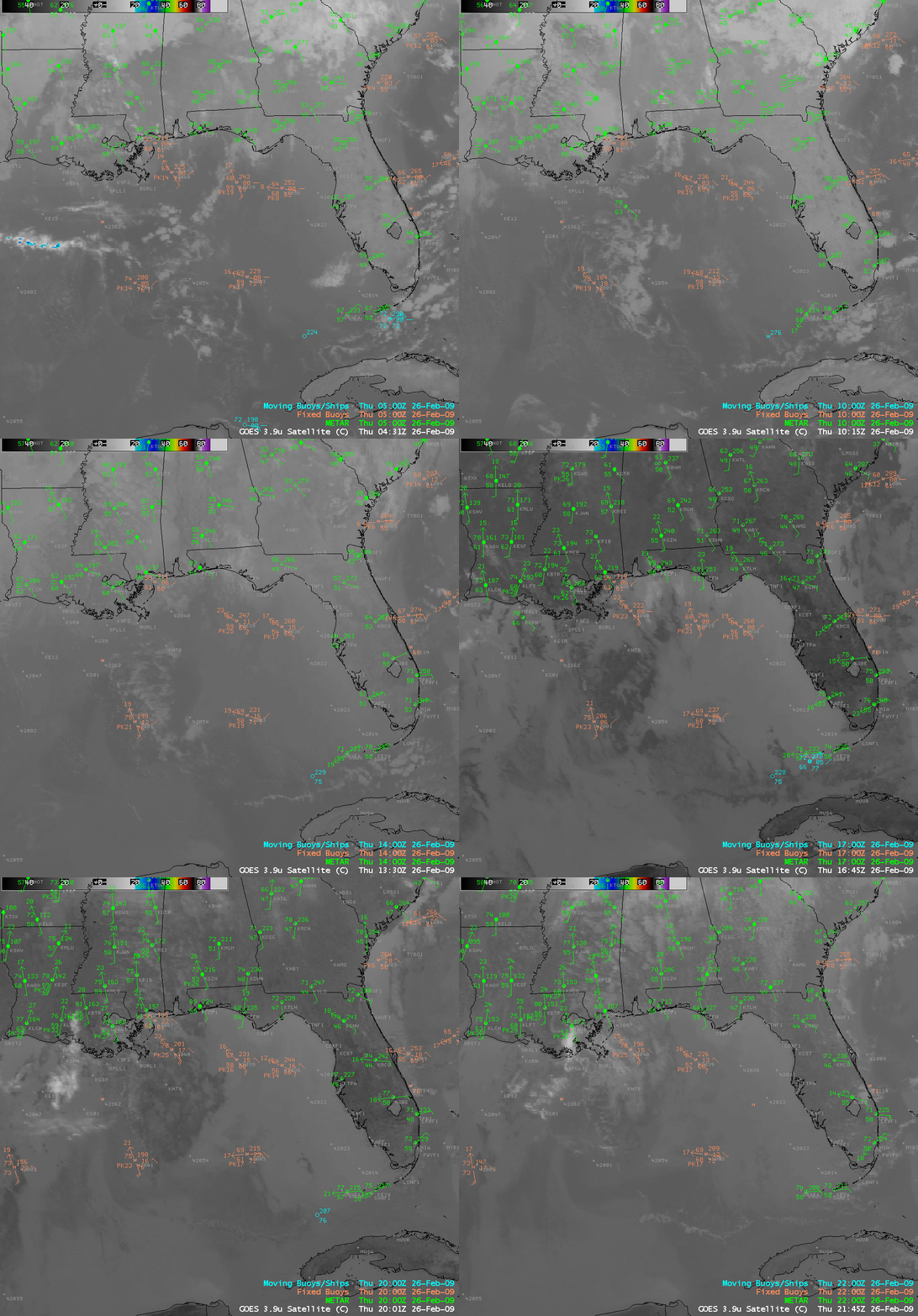
Looking at GOES-12 3.9 µm shortwave IR imagery (below), we can see that there was a deck of patchy stratocumulus cloud present over and to the east of the area of convective initiation. The appearance of those clouds changed from light gray before sunrise to darker gray after sunrise, since the 3.9 µm shortwave IR channel is sensitive to the reflection of solar radiation off the tops of the water droplet clouds. Also note how the eastern edge of the stratocumulus cloud deck appears to erode as the westward-propagating gravity wave feature moves through that area — the passage of the wave apparently acted to mix dryer air aloft downward into the marine boundary layer (a dry layer aloft near 800 hPa was seen on both the Tampa FL and New Orleans LA rawinsonde data).
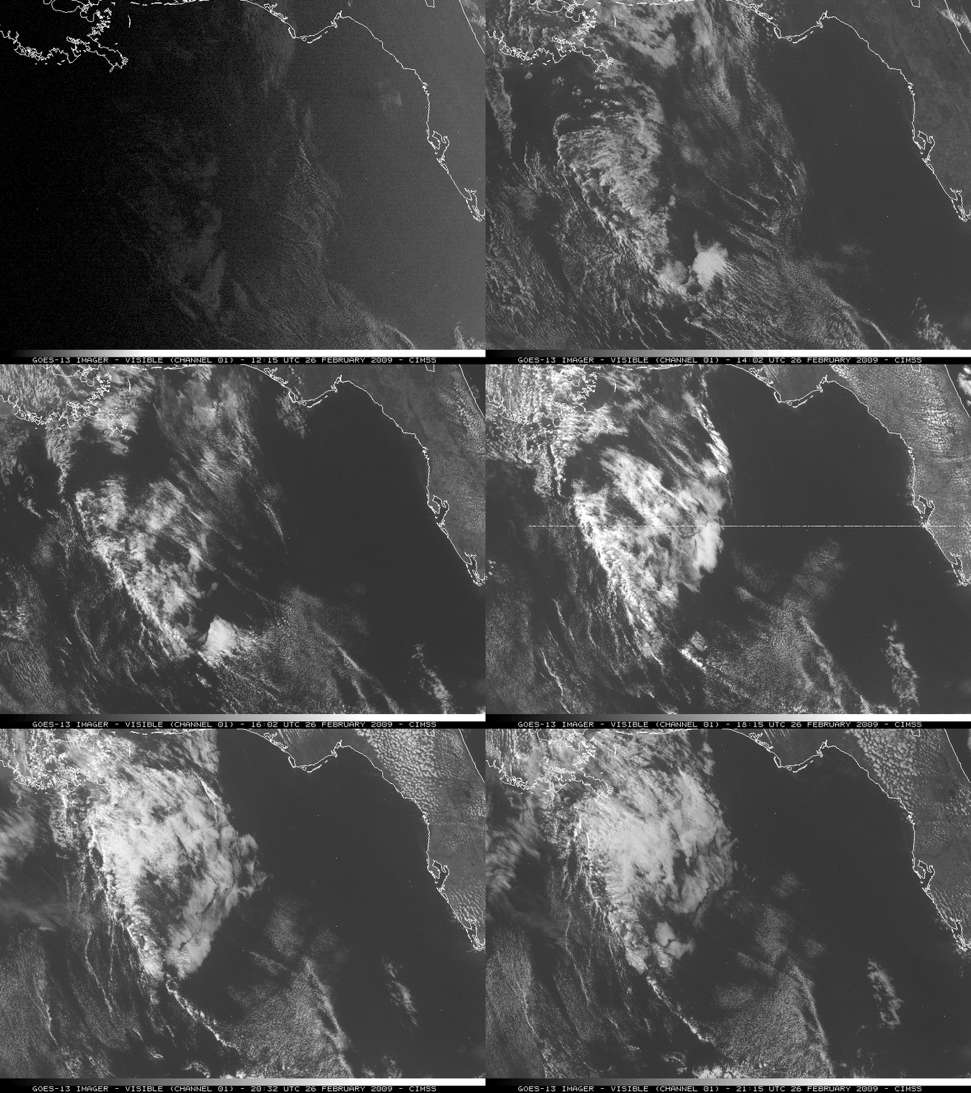
One curious feature to note on GOES-13 visible imagery (below) — which was also seen on the GOES-12 shortwave IR imagery above — was the fact that a new patch of cloudiness appeared to form in the wake of the main gravity wave feature, which exhibited a pronounced east-northeastward component of motion.
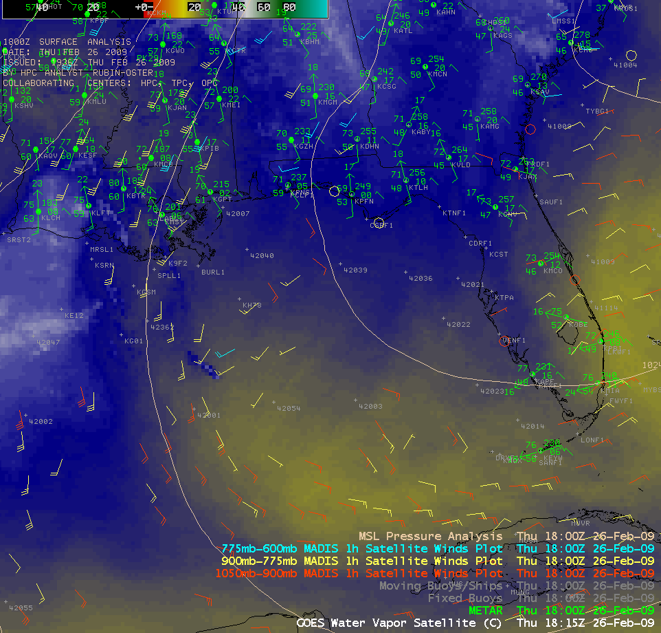
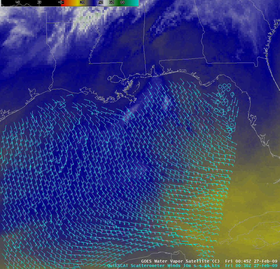
A number of satellite-derived wind targets were seen which exhibited an obvious northeasterly component: both on GOES MADIS winds around 18:00 UTC (above), and also on QuikSCAT winds several hours later as the the wave had progressed westward (below).
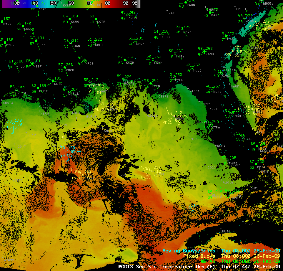
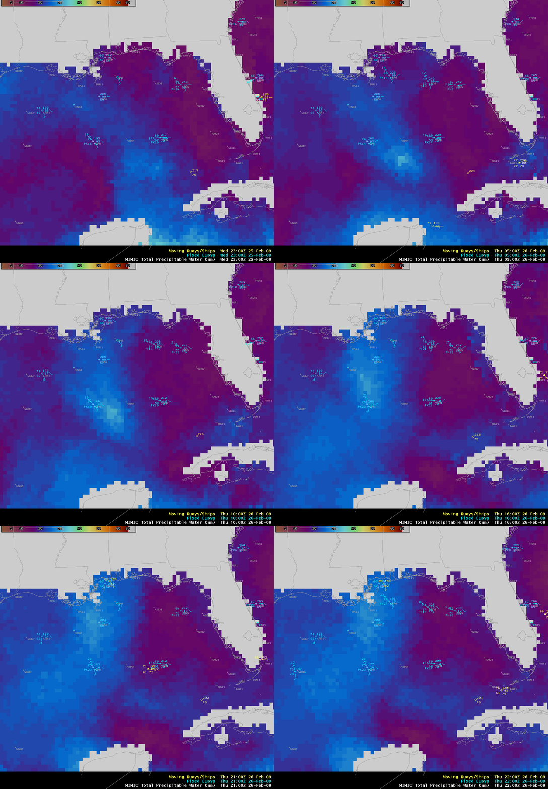
Two other items are worthy of mentioning, since they may have been a factor in the formation of the isolated convection: (1) a plume of warmer water (due to the Gulf of Mexico Loop Current) was evident on the MODIS Sea Surface Temperature product (above), and (2) the MIMIC Total Precipitable Water product (below) indicated that a plume of higher TPW was moving northwestward across the Gulf of Mexico, with the highest TPW values (greater than 30 mm, lighter blue colors) moving to the north of Buoy 42001 just prior to the time of convective initiation.


