GOES-13 outage
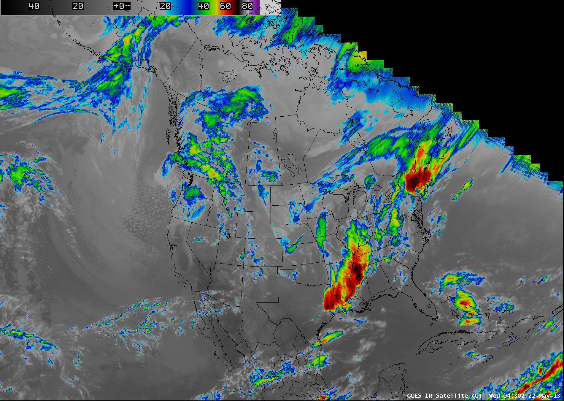
GOES-13 suffered an anomaly overnight: the satellite is no longer pointed towards the Earth for as yet unknown reasons. The anomaly started at 03:40 UTC on 22 May, and at 04:29 UTC, GOES-15 (GOES-West) began a 30-minute full disk scan schedule.
Successive images from just before the anomaly (above), at nominal times of 03:15 UTC and 03:32 UTC, are shown. There is a large navigation offset (~200 km) apparent in the right panel, which panel shows the last scanned image from GOES-13 before the major anomaly. The offset is also apparent in the image at the top of the page (Look, for example, at Cuba, or in the northwest corner of the image)
GOES-14, in standby mode at 105.5 W longitude, has been activated; the first images from GOES-14 will be available at 05:00 UTC 23 May. There are no plans now to move GOES-14 from its current position. In the meantime, GOES engineers are working on a solution to GOES-13’s problems. An update from the Environmental Satellite Processing Center (ESPC) is scheduled for around Noon eastern time (see NOAA NESDIS GOES Special Bulletins). Note that GOES-14 data will *not* be relayed via GOES-13 — so ground station users will need to reposition their antennas to receive GOES-14 direct readout data.
In addition, GOES-12 (GOES-South America) continues to give coverage from its position over 60 W. Full-disk imagery is available every three hours, and routine sampling (both Imager and Sounder) continues and is available here.
— Note to NWS AWIPS Users —
With the temporary loss of GOES-13 (GOES-East), the GOES-15 (GOES-West) satellite has been placed into Full Disk scan mode, which only provides imagery over CONUS every 30 minutes — and the quality of the imagery degrades over the eastern US (above), due to the very large view angle from GOES-15 (which is located at 135 West longitude). Parallax error is also greatly increased.
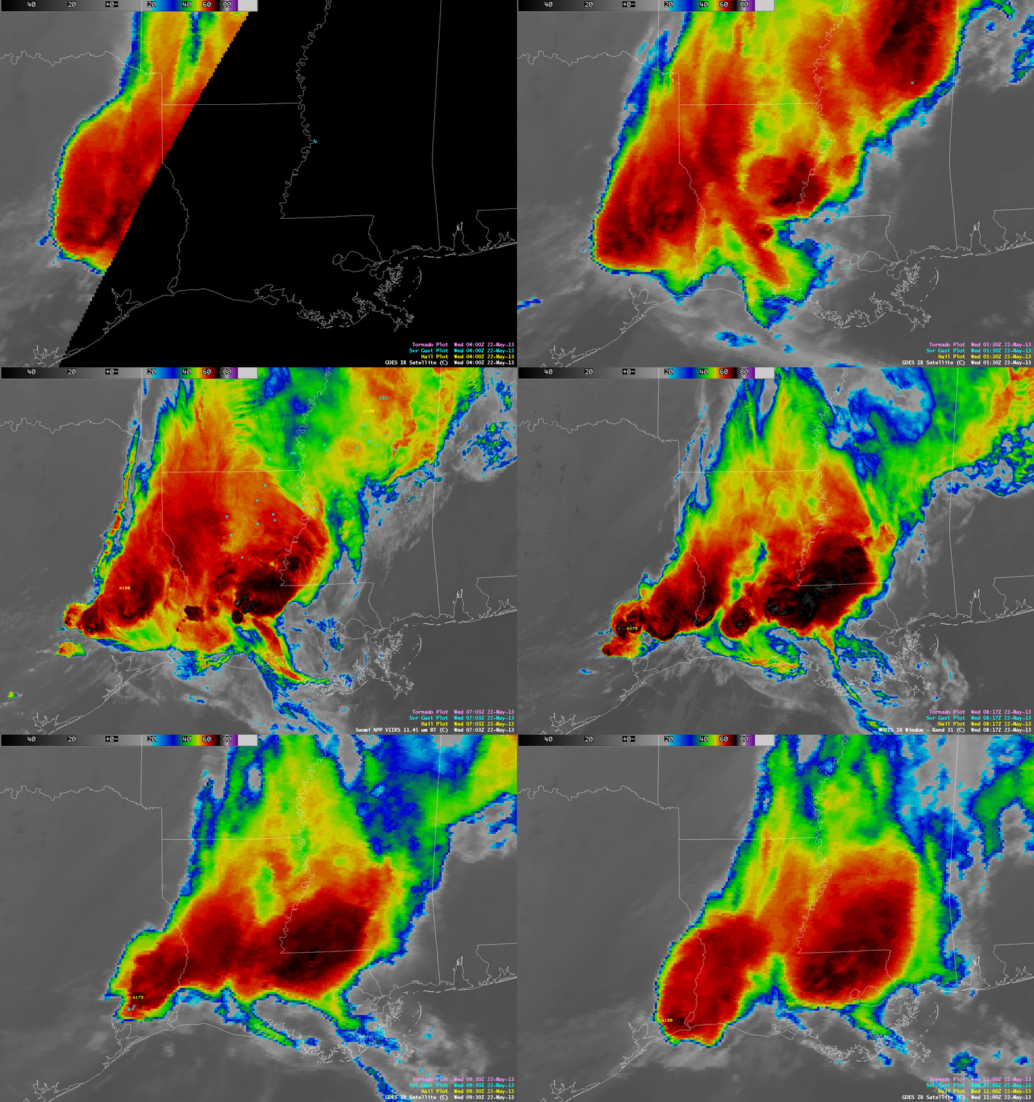
During such an outage of geostationary satellite data, imagery from polar-orbiting satellite instruments (such as Terra and Aqua MODIS, Suomi NPP VIIRS, and POES AVHRR) can be used when available to help fill in temporal data gaps, and also provide a much more detailed image in terms of spatial resolution (and with a lack of a large parallax error). The animation below covers the time period from 04:00 UTC to 11:00 UTC, showing the GOES-15 IR imagery at 30 minute intervals with the insertion of IR images from MODIS, VIIRS, and AVHRR when available. You can immediately see the value of the higher spatial resolution provided by the polar-orbiting satellite data.
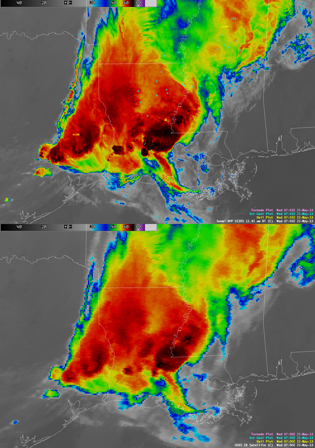
A direct comparison of GOES-15 and Suomi NPP VIIRS IR imagery around 07:00 UTC (below) again shows the better detail provided by the higher spatial resolution of VIIRS (along with a lack of parallax error) for severe thunderstorms that were producing large hail and damaging winds across parts of the lower Mississippi Valley region.
In addition, the availability of a Day/Night Band on the VIIRS instrument can provide a “visible image at night”, which can be helpful for locating important features such as convective overshooting tops and low-level cloud edges (below).
Imagery and products from AVHRR, MODIS, and VIIRS are available in AWIPS via LDM subscription.


